

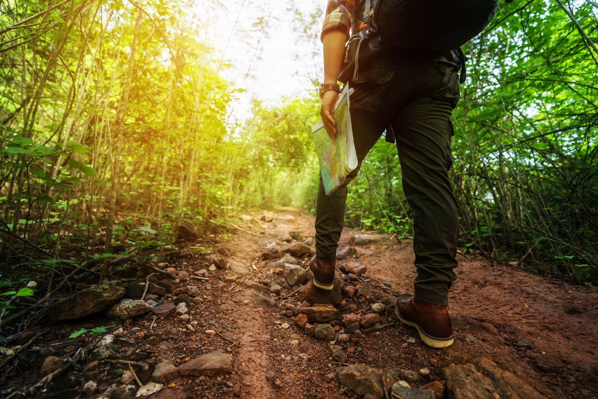
Top 10 tips for beginner walkers and hikers
May is National Walking Month, the perfect excuse to venture into the great outdoors. To mark the occasion, we caught up with Sam Knight from Ramblers Scotland, to get his top 10 tips for starting out on walks and hikes.
Get inspired
There are plenty of inspiring routes out there if you know where to find them! If you’re not sure where to start, try the OS Maps app or the Ramblers’ app. They both have loads of features, including walking routes submitted by app users. Walking guidebooks can be great for finding trails too.

Join a group
You’ll meet plenty of like-minded people in a walking group. As well as the social element, you’ll be able to practise your navigation skills in a safe environment and pick up new skills from others in the group. There are loads of groups to choose from. The Ramblers alone has more than 500 across the UK, all run by experienced walk leaders.
Keep it cheap
Walking kit can be expensive, but it doesn’t have to be. Charity shops and online auction sites are amazing for buying kit. You can also get hand me downs from others at walking groups. As you get into walking or hiking, you’ll start to learn more about what gear works for you and what you need for different routes.
Be flexible when planning
Remember to be flexible when it comes to your walk or hike. Before you set off ask yourself three questions: Do I know what the weather forecast is for the whole route? Do I have the right clothing and kit for the day? Do I have the knowledge, skills and ability to complete my planned walk? If you can answer yes to all three, then off you go. If you can’t, be open to changing your plans. E.g., look at doing a different route or walking your route another time.
Learn to navigate
Knowing how to navigate is like having superpowers! Start by learning to read a map, then bring a compass into it when you’re confident with your map reading skills. When you’re getting started, practise reading a map in an area you know, such as a local park, so you can do it safely. It’s important to learn navigation skills before you actually need them. The three questions above will help you with this. Learning to navigate is about making mistakes but in a safe environment. Try a skills course if you want extra guidance.
Use the five Ds
You can use the five Ds to help you effectively navigate from point A to point B:
- What’s the distance from point A to B?
- What’s the duration of the navigation leg?
- What direction do you need to head off in? Your compass can help with this.
- What’s the description of your navigation leg (e.g., the features you’ll see on the way)?
- What’s your destination? What will you see when you get there?
You might not need all five Ds every time, but they’re a useful planning tool. Look out for your overshoot feature too, a landmark you’ll see if you’ve gone too far on your navigation leg.

Care for the countryside
Take care of the countryside when you’re on a walk or hike. Follow the code for the country you’re in – the Scottish Outdoor Access Code, or the Countryside Code for England and Wales. Leave no trace and, if you can, leave the area looking better than when you arrived. You could even have a two-minute litter pick on your walk.
Know how to get help in an emergency
Accidents can happen to anyone, however experienced they are. That’s why it’s important you know how to get help, should you need it. Have an emergency point of contact who knows your route and can raise the alarm if you’re not back from your walk when you should be. I’d recommend registering with emergencySMS before you head out as well. This means you might be able to text the emergency services if your phone signal is too poor to make a call. OS Locate is also great to have on your phone, to help rescue teams find you in the event of an emergency. Pack items you might need in an emergency too, like warm layers, an emergency shelter, a safety whistle and spare food.
Be part of the process
Modern technology is amazing but make sure you’re part of the process when navigating using smartphone apps and GPS units. You still need map reading skills to use these tools effectively and knowing the limits of these tools is vital. A spare battery pack is a good idea too. Keep relating what’s around to your map rather than following a pre-set route without thought, so you can keep track of your progress. Always keep yourself in the process, then if you need to deviate from the pre-set route, you can plan a new route on an app/GPS or get out your map and compass.
And don’t forget to enjoy it!
Get out there and give walking a go. Navigation is fun and knowing how to navigate a walk is a skill you’ll have forever.
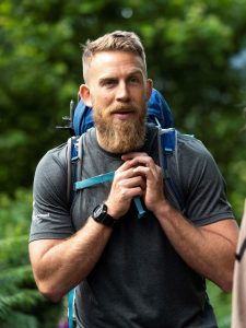
Sam Knight
Sam Knight runs Ramblers Scotland’s Out There Award, a free two-day skills course that introduces young adults to the outdoors and like-minded people. In his free time, he’s a keen walker, runner and mountain biker.
National Walking Month
National Walking Month is an annual event organised by charity Living Streets. This year, they’re asking people to #Try20 and spend 20 minutes walking every day this May. Find out more on their website or follow the campaign on social media using #Try20, #NationalWalkingMonth and #WalkThisMay.
Dennis Maps is one of the leading map printers in the world, producing more than two million maps and charts every year. We offer comprehensive pre-press services, large format print solutions using both large format litho printing and large format digital print technologies, plus specialised map folding and map finishing techniques.

Sustainability gathers pace at Dennis Maps
Sustainability
Sustainability has always been at the heart of our business, influencing all that we do. Recently, our journey to go green has gathered pace, with several exciting developments.
Counting down to net zero
Our commitment to reaching net zero is our most important journey of all. “Our journey to reaching net zero is such a transformative change for the company. It touches every aspect of our business,” says Steve Burry, MD of Dennis Maps. “It’s an evolution, not a quick step change, but we’re really pleased with our progress.” Over several months, we’ve calculated our CO2 emissions, a complex process but an essential one. We’ve delved into every aspect of our operations to come up with an accurate picture of our emissions, so we know which areas of the business to improve. For example, we looked at emissions for our map paper and cover boards and took steps to make them carbon balanced. Their emissions are now offset through Climate Partner and a programme with the World Land Trust. Of course, we’re working to reduce our emissions too, and offsetting what we can’t remove.
Making our materials greener
![]() We use FSC© certified paper and card for all our products. It’s a global scheme that supports customers and consumers to purchase products from forests that are managed sustainably. We endeavour to be environmentally friendly with the printing inks we use too. Our paper products are printed with vegetable-based inks, which are much better for people and planet than traditional inks. Vegetable-based inks are sourced from sustainably farmed plants, lowering air pollution, and cutting the amount of CO2 in the atmosphere. They’re also easier to remove from paper during the recycling process. When it comes to our printing presses, we’re making headway too. We’ve started using an alternative fount solution which contains 50% less neat alcohol, greatly reducing carbon emissions.
We use FSC© certified paper and card for all our products. It’s a global scheme that supports customers and consumers to purchase products from forests that are managed sustainably. We endeavour to be environmentally friendly with the printing inks we use too. Our paper products are printed with vegetable-based inks, which are much better for people and planet than traditional inks. Vegetable-based inks are sourced from sustainably farmed plants, lowering air pollution, and cutting the amount of CO2 in the atmosphere. They’re also easier to remove from paper during the recycling process. When it comes to our printing presses, we’re making headway too. We’ve started using an alternative fount solution which contains 50% less neat alcohol, greatly reducing carbon emissions.
A tree-mendous charity
Did you know that all our operations benefit the Heart of England Forest Charity? We’re co-owned by the Felix Dennis estate, the legacy of an ambitious entrepreneur. Felix Dennis had a dream to create a woodland in the heart of England and began to realise this ambition in the 1990s. What began as a small, wooded area now stretches from the Vale of Evesham to the Forest of Arden. An impressive two million trees have been planted so far, and the Forest is still growing. These new woodlands are part of a mosaic of Forest habitats, including grassland, mature and ancient woodland, farmland, heathland and wetland, spread over 7,000 acres. It’s a stunning, tranquil space that benefits wildlife, the environment and people. If you’re ever in Warwickshire or Worcestershire, it’s worth a visit!

Raising the standard
At Dennis Maps, we’ve committed to a range of accreditations that support us to raise our environmental standards. In 2015, we were awarded the ISO 14001 Environmental Management Standard. It’s an internationally recognised framework that supports us to be environmentally responsible. Last year, we also became a Partner Member of Two Sides, a global not-for-profit that promotes using paper and print more sustainably. We’ve signed up to its Mission and Principles, an agreement to reduce our environmental impact.
A lightbulb moment
We’ve completely replaced our factory lighting with efficient LED bulbs to save electricity. In addition, we’ve installed power factor correction and advanced harmonic filtration systems, which maintain the efficiency and performance of our electricity supply. And that’s not all. We hope to fit solar panels on our factory roof, which could generate about 30% of our electricity. Watch this space.
What do we do with waste?
We’re always looking at ways to segregate our waste streams as much as possible, to reduce the amount of material that heads to landfill. For example, we’ve created seven categories for our paper and card waste stream, with individual bins for each category. This waste is recycled, and Kimberly-Clark then uses it to create a range of products. Much of the non-recyclable waste is transported to a specialist centre, where it’s treated and exposed to high temperatures. Energy created by the process is captured, converted into electricity and sent to the National Grid.
Recycling at Dennis Maps
At Dennis Maps we recycle whenever and wherever we can. We send waste toner from our digital printers to our equipment suppliers for this purpose. Face masks and protective gloves are recycled through TerraCycle’s Zero Waste Boxes. We also opt for recyclable packaging, using paper tape and cardboard to package our products. And we don’t stop there. We aim to make our products recyclable whenever possible. Our waterproof and weatherproof maps are long lasting, but they can eventually be recycled too.
A team effort
Of course, we couldn’t go green without support across the business. Everyone at Dennis Maps is encouraged to offer ideas about how we might improve our processes further. “Sustainability is an embedded part in the culture of the company. Our whole journey is a team effort, not something that can be achieved by any individual acting alone,” says Steve. It’s just as important that our customers and suppliers are on board as well. One customer has already achieved net zero, and we’re driven to meet the sustainability standards of our clients. We’re always in discussions with our suppliers to see if their new products can help us on our environmental journey too.
On a roll
Our employees live locally, close to our factory in Frome, Somerset, and we encourage them to cycle or walk to work if possible. We support them to do this through the Cycle to Work Scheme, a government programme which helps people purchase a bike and accessories tax free.
Looking to the future
We’ve got plenty of planet-friendly plans in the pipeline. We’re evaluating if it’s viable to install solar panels on our factory roof, and if we can replace our heating system with a more energy efficient one as well. “We want to do things differently and are committed to investing the time and resources into creating change,” says Steve. Keep an eye on our blog for further updates!
Dennis Maps is one of the leading map printers in the world, producing more than two million maps and charts every year. We offer comprehensive pre-press services, large format print solutions using both large format litho printing and large format digital print technologies, plus specialised map folding and map finishing techniques.

Five incredible spots to stargaze
Few views are more stunning than a star-lit sky. You can see the wonders of the night sky wherever you are, but for the clearest views find a spot with low levels of light pollution. Luckily, there are plenty of places in the UK that boast wonderfully dark skies, perfect for astronomy. We’ve rounded up five incredible locations to get you started. Read on to find tips for beginner astronomers too!
Isle of Coll, Argyll and Bute, Scotland
Coll is one of only a handful of Dark Sky Islands worldwide and one of only two in Scotland (the other being North Ronaldsay). With its Atlantic isolation and small population, it boasts incredibly dark skies. “Coll delivers on all counts. Great people, fantastic food, incredible nature and inky black skies,” says James Green, who helps run stargazing events, Coll & The Cosmos, on the island. Those living on the Hebridean island are committed to keeping their skies pristine, with no streetlights installed there. Visit Coll notes that you’ll see millions of stars, the Milky Way, and possibly the elusive Aurora Borealis (Northern Lights) in autumn, winter and spring. Come summer you might spot somewhat rare night shining clouds. These illuminated wisps form high up in the atmosphere and appear, like magic, around sunrise and sunset.
Map out your astronomy adventure
Exmoor National Park International Dark Sky Reserve, Somerset and North Devon, England
Exmoor is the oldest International Dark Sky Reserve in Europe, with its starry skies awarded the accolade over a decade ago. The achievement may be longstanding, but the Park is always looking to the future and ways to enhance astrotourism in the area. It’s now home to an exciting Dark Sky Discovery Trail that opened last year. This gentle two-mile path follows open moorland and offers incredible 360-degree views of the heavens. The trail even has glow-in-the-dark markers to guide you. “Exmoor’s dark night skies are an incredible treasure, and this new trail is another way that people can get outside and explore the amazing sights they have to offer,” says Astronomer Will Gater. Why not borrow a telescope to see the Park’s incredible sights too? They can be hired at three National Park Centres for an even clearer view of the cosmos.
Plan your visit with an Ordnance Survey (OS) map
Brecon Beacons International Dark Sky Reserve, Carmarthenshire, Powys, Monmouthshire, Rhondda and Merthyr Tydfil, Wales
It’s been called “a secluded utopia for stargazing” by the International Dark-Sky Association, and they’re not wrong. The rural site was named an International Dark Sky Reserve in 2012 – the first in Wales. According to the official website, it’s an excellent place to view the constellations and to marvel at the Milky Way. You may even see a meteor shower! Have a listen to these podcasts to discover what you might encounter in different months of the year. Visit Wales recommends the Usk Reservoir Dark Sky Discovery Site for stargazing, as it’s dark, quiet and you can venture onto the dam for a memorable viewing spot. Why not sleep under the stars too? There are plenty of places to stay in the Brecon Beacons with views up to its starry skies.
Find spots to stargaze with OS maps
Northumberland International Dark Sky Park, Northumberland, England
You’re sure to have an out of this world experience on a visit to this northern star. It’s famed for being Europe’s largest Gold Tier Dark Sky Park, the highest accolade for the quality of an area’s starry skies. Head to the Park’s Kielder Observatory for a guided astronomical adventure, with many events to choose from. “The Milky Way is easily visible on dark nights, and we can observe galaxies and star clusters,” says Finn Burridge, Astronomer and Science Communicator at the Observatory. “Often, we can spot the ghosts of recently dead stars or the veils of creation we call nebula, where new stars are in the process of formation,” he adds. There are plenty of other stargazing sites dotted across the Park too, with lots to see wherever you go.
Discover the area with OS maps
Galloway International Dark Sky Park, Dumfries and Galloway, Scotland

By day it’s known for its forest trails, wealth of wildlife and mountain views. By night it’s famed for its stunning celestial shows. In 2009, it was named the first Dark Sky Park in the UK, and it holds acclaimed Gold Tier accreditation. Head to one of the Park’s three visitor centres – Kirroughtree, Clatteringshaws or Glentrool – where you can look out across the dark sky. Each centre has information panels to help you understand the wonders of the universe. According to Forestry and Land Scotland, more than 7,000 planets and stars can be observed with the naked eye, and the Milky Way can usually be seen curving across the sky.
Top tips for beginner astronomers

Finn Burridge, Astronomer and Science Communicator at Kielder Observatory, shares some useful advice for beginner astronomers.
- Most objects you’re going to be observing in the beginning won't require a huge telescope. Even a set of decent binoculars will reveal more of the sky than you could imagine. I recommend Celestron Skymasters.
- Don’t be put off by urban lights. Dark skies yield the best stargazing experience but many objects in the sky are bright enough to be seen from towns and cities. The moon, the planets and the bright constellations will be visible from almost anywhere.
- If you have one, take a red torch stargazing to protect your ‘dark-adapted vision’. We’ve got a chemical called Rhodopsin in our eyes that’s very light sensitive. When our eyes are exposed to white lights (like torch lights) the Rhodopsin is temporarily removed, making it harder to see in the dark.
- Keep your phone screen on night mode too. A bright screen will remove all the Rhodopsin in your eyes even with just a quick look!
- Make sure you are going to a safe location to stargaze. Either go with another person or let someone know where you are going.
- Use an App like Stellarium or SkyGuide to help you learn about the night sky and assist you with finding objects while out.
Date for your diary
International Dark Sky Week takes place from 22nd-30th April this year. It’s a prompt to discover the sky where you are and find out more about the dark sky movement – a campaign to reduce light pollution for the benefit of all. Keep up to date with events by following #IDSW2022 and #DarkSkyWeek on social media.
Dennis Maps is one of the leading map printers in the world, producing more than two million maps and charts every year. We offer comprehensive pre-press services, large format print solutions using both large format litho printing and large format digital print technologies, plus specialised map folding and map finishing techniques.

The London National Park City Map
The new edition of the London National Park City map is hot off our presses, showing the capital as you’ve never seen it before. It portrays London as a city of nature, with the great outdoors taking centre stage.

A world first
The large format, folded map celebrates and supports London’s National Park City status. Impressively, the capital became the first National Park City in the world in 2019. It’s about improving life in London for locals and visitors, connecting them with nature. These cities work to be greener, wilder and healthier for everyone – a worthy movement to get behind.
The capital goes green (and blue)
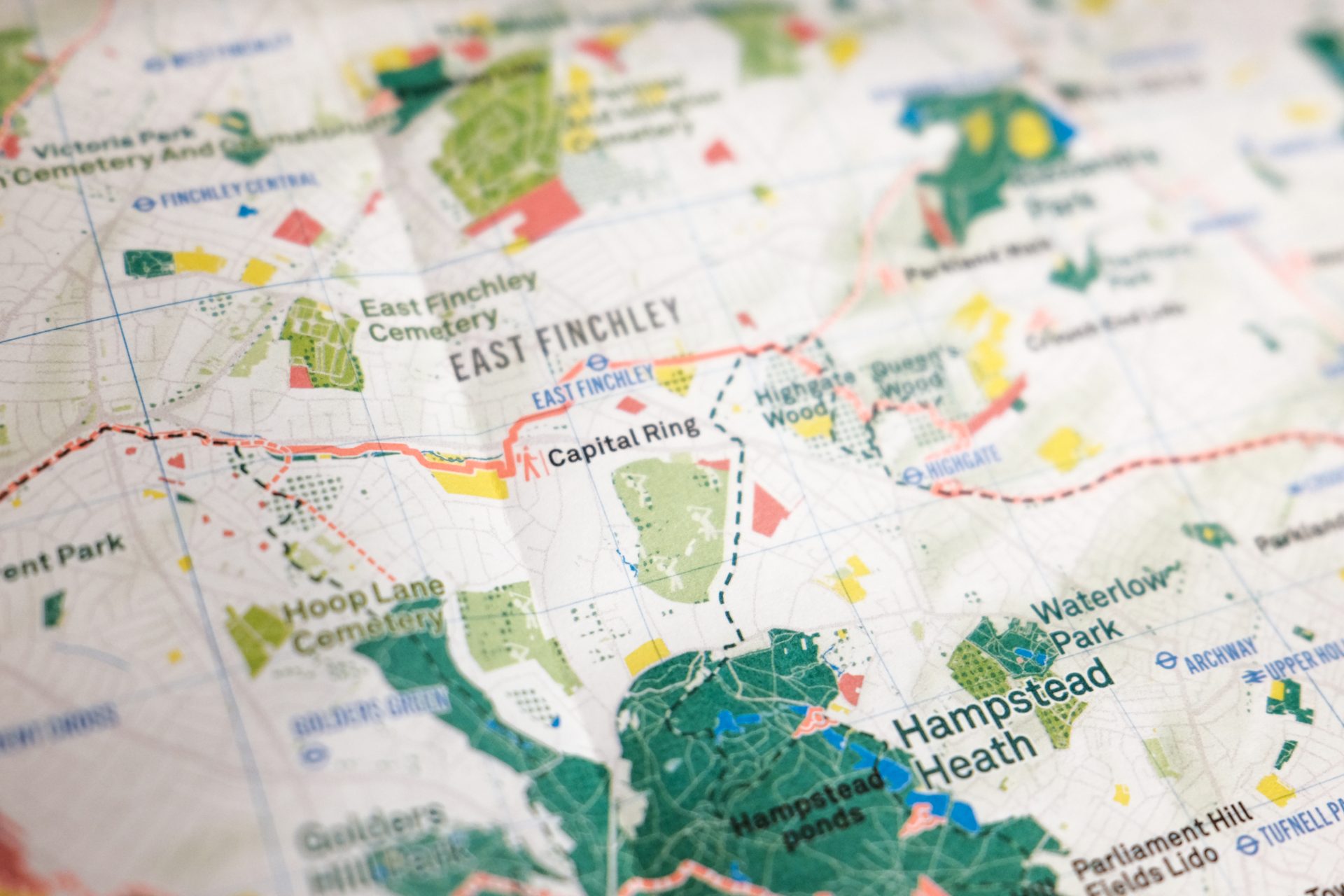
The unique map, from our customer Urban Good, covers Greater London and beyond. Gone are the usual buildings and street names you expect to see on a map, replaced with London’s glorious green and blue spaces. “It subverts the normal logic to prioritise buildings and roads on a map and instead removes them wholesale,” says Charlie Peel, the map’s designer. “You’re left with open space, which in this context is the main attraction.”
Inside the map you’ll find the capital’s greenery, including parks, woodland and nature reserves. Blue spaces are highlighted too, with rivers, canals, wetlands and lakes prominently displayed. Look out for symbols showing where you can enjoy outdoor pursuits. Think sailing, climbing peaks or even pitching a tent. Nature reserves and Areas of Outstanding National Beauty are also plotted, so you can find London’s most stunning spots.


A colourful new edition
This is the first major reprint of the London National Park City map since its 2017 release. The new edition is a complete redraw, with exciting updates on previous versions. “The third edition is a redraw from scratch, using different software and new data,” says Charlie. “It’s the most comprehensive map we’ve made yet.” The third edition is printed as a single-sided map. You can take it out when you explore, use it to plan adventures from the comfort of your home, or even display it on a wall, for a unique addition to your decor. Expect to see cleaner, clearer labels, bolder colours and more epic walks as well.
Getting from A to B
Handily, the map features public transport hubs, such as rail, overground, and tube stations. Urban Good has added six new walks to the edition too, developed with the Ramblers and other walking and green space charities. Now there are 14 incredible walks to choose from. From the London LOOP to the Colne Valley Way, you’ll find cross cutting routes starting from the centre, as well as classic ring routes. Which one will you pick first?


Explore more urban nature
You can get your London National Park City map for £9.99 with free postage. And don’t forget to check out the other maps in the series too! The London National Park City map is part of a selection of Urban Nature maps, which also includes Newcastle, Edinburgh, Glasgow and Edinburgh.
Dennis Maps is one of the leading map printers in the world, producing more than two million maps and charts every year. We offer comprehensive pre-press services, large format print solutions using both large format litho printing and large format digital print technologies, plus specialised map folding and map finishing techniques.

Top 10 eco-friendly gifts for Valentine’s Day
With Valentine’s Day approaching, it’s time to find the perfect present for your loved one. We’ve rounded-up the top 10 eco-friendly gifts to show your love for them – and the planet.
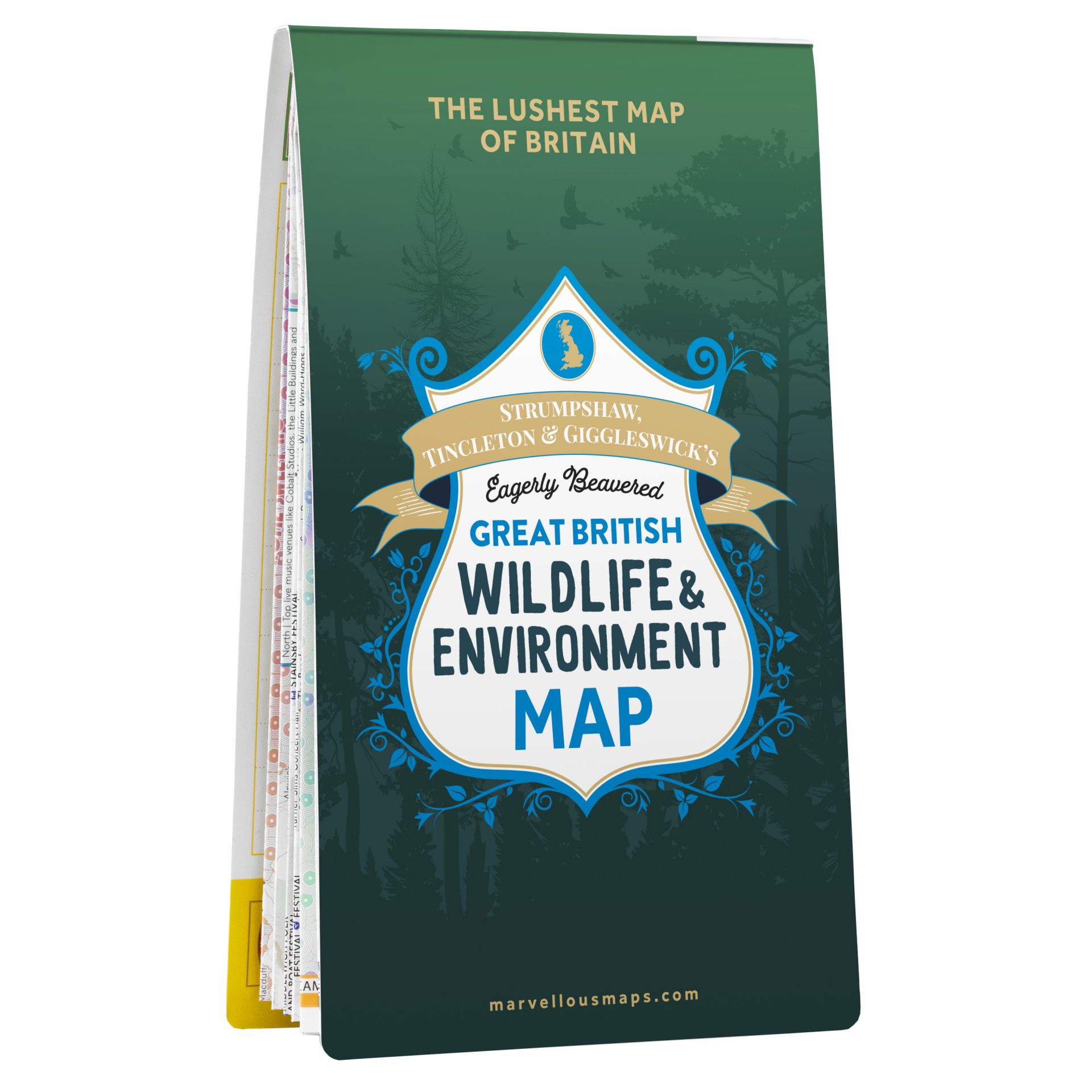
Marvellous Maps Great British Wildlife & Environment Map

The latest release from Marvellous Maps is a wonderful celebration of Britain’s habitats and wildlife – as well as a call to protect them. The Eagerly Beavered Great British Wildlife & Environment Map is bursting with over 1,500 wildlife habitats, conservation projects, eco events and green days out. It even includes an epic journey around Britain’s top 50 wildlife and environment spots, perfect for a romantic road trip. Maps start from £14.99.
Ocelot chocolate bars
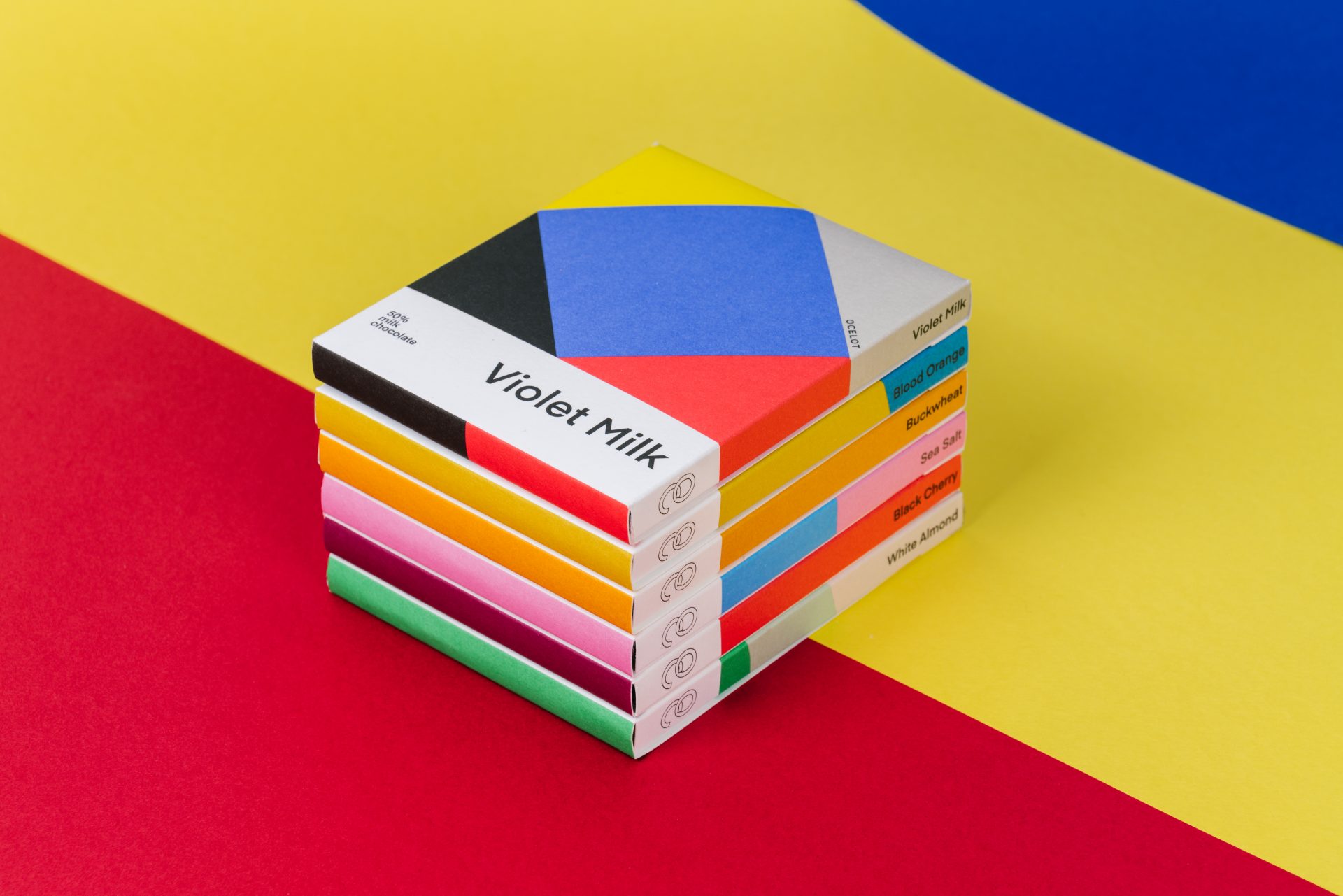


No Valentine’s Day is complete without chocolate! For chocolate with heart, check out Ocelot. All its products are handmade, organic and come in plastic-free packaging. Chocolate bars are available in a range of mouth-watering flavours, from blood orange to black cherry. Too hard to pick your favourite? Then go for the chocolate library, a collection of eight delicious bars. Chocolate bars are £5.50, and the chocolate library is £40.
BloomPost seed bombs


Like chocolates, flowers are an essential part of Valentine’s Day. This year, send the person who brightens your world some colourful seed bombs – so they can watch their flowers grow and grow. They can scatter them in their garden and collect beautiful blooms for years to come. Each box has nine seed bombs with wildflower seeds, including mallow, poppy and cornflower. The seed bombs cost £14.95 and come as a letterbox gift, posted directly to your loved one.
Urban Nature Maps


Our customer Urban Good offers a range of maps that show urban areas as cities of nature. Their green and blue spaces – woodlands, parks, nature reserves, playing fields, coastlines and rivers – are brought to the forefront, making these maps something quite unique. Urban Nature Maps will make you see cities differently to how you have before, as places to enjoy nature and to protect it. Why not use one to plan a romantic walk on Valentine’s Day? Prices start from £9.99.
Tag a tree


Surprise someone with a tree-mendous gift this Valentine’s Day. The Heart of England Forest – which Dennis Maps supports – lets you tag a tree with a personalised message, for £35. You’ll also get a certificate, location reference and map to find your tree. Alternatively, you can dedicate a tree (£12) or plant a tree (£150). If you choose the latter, your loved one will get to visit the forest and plant their tree, a pretty special experience. Whichever option you choose, you’ll help maintain the forest for generations to come.
Inner tube earrings


These inner tube earrings make the prettiest present. They’re lovingly handmade in Priormade’s workshop, crafted from bicycle inner tubes that would otherwise be disposed of. The lightweight earrings are designed to look like feathers. Several colours are available, including gold, silver and blue. Each pair comes presented in a recycled gift box, along with the tale of how their inner tube popped. Earrings start from £18.
Sustrans regional cycle maps


Is your loved one a keen cyclist? Then gift them a regional cycle map from Sustrans, a Dennis Maps customer. The maps can be used to explore the National Cycle Network and local routes by bike. They’re available for all regions of the UK, so you can choose one that covers a local area, or somewhere they want to explore further afield. Handily, the maps are made from recyclable Polyart, which is tear and water-resistant too. And the best bit? Everything you buy from Sustrans supports the charity to make walking and cycling easier for everyone. Printed maps cost £7.99.
Refill X Chilly’s Bottle
These iconic blue bottles make a great gift for outdoor types. The Refill X Chilly’s Bottle (£20) is a collaboration between Chilly’s and environmental organisation City to Sea. It’s both stylish and practical, keeping water icy cool for up to 24 hours and drinks hot for up to 12 hours. You can even get your bottle engraved. Chilly’s gives City to Sea £10 for each bottle sold. The money is used to support the organisation’s planet protecting campaigns, so everyone’s a winner.
Personalised vegan leather luggage tags


Why not treat your loved one to a vegan leather luggage tag for your next romantic adventure? They’re made from ethically sourced vegan leather and will add a splash of colour to bags and suitcases. Each luggage tag contains a card you can write personal information on, tucked away in a safe interior card slot. The luggage tags come in four colours and can be personalised with clear or metallic gold embossing. Get one for £16.
Harvey Maps present and Gift Bag Wrap

Get Valentine’s Day all wrapped up with Harvey Maps eco-friendly gift bag. It’s reusable, comes with recyclable tissue paper and only costs £4.99. You can add a personalised gift tag too. Now to choose what to put inside the bag… Luckily, Harvey Maps has a range of gifts to pick from, including mazzles, playing cards and maps, perfect for the adventurous at heart.
Dennis Maps is one of the leading map printers in the world, producing more than two million maps and charts every year. We offer comprehensive pre-press services, large format print solutions using both large format litho printing and large format digital print technologies, plus specialised map folding and map finishing techniques.

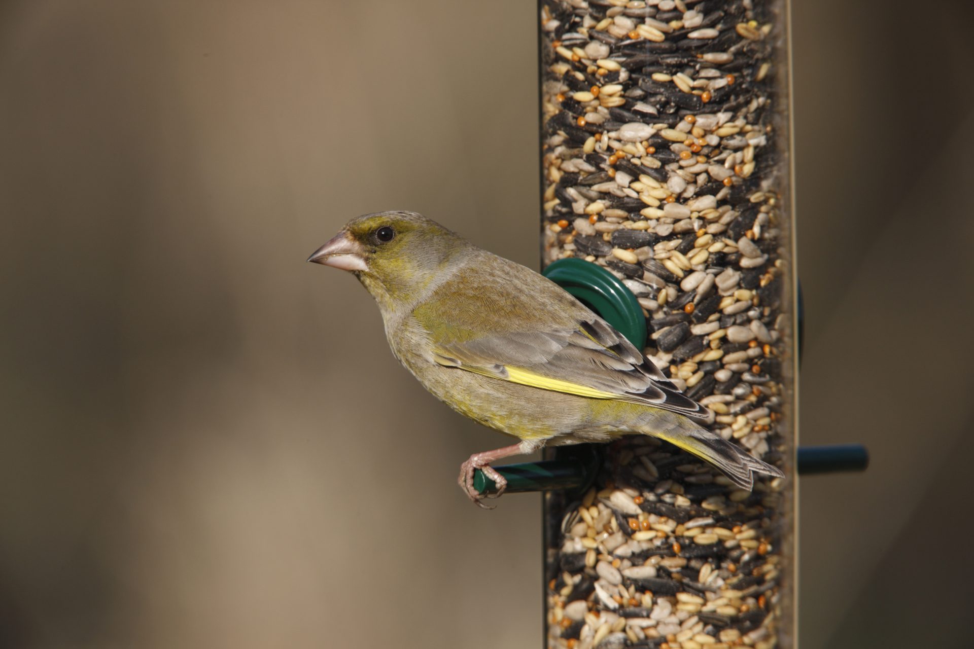
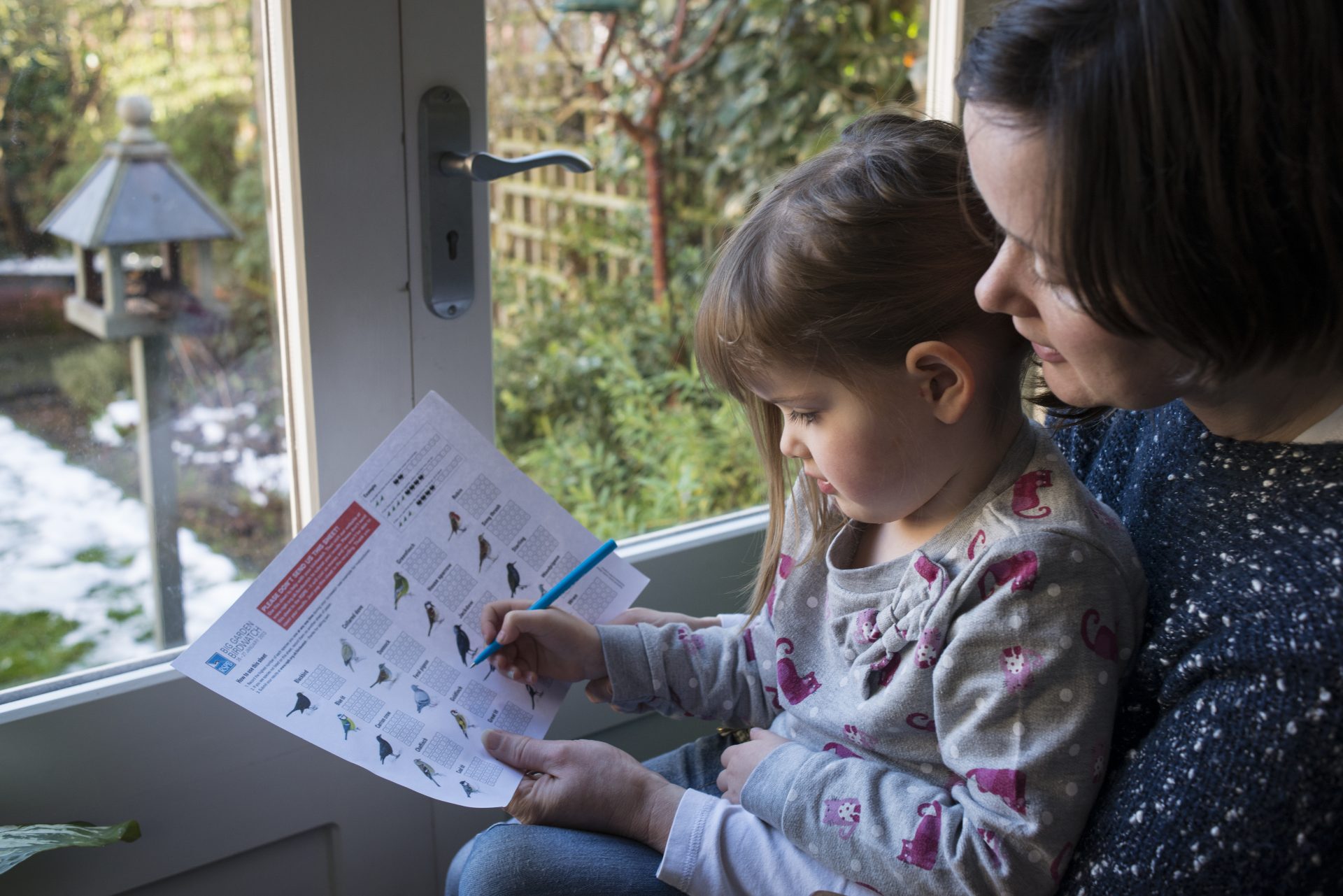
Binoculars at the ready – it’s time for the Big Garden Birdwatch
The world’s largest garden wildlife survey is taking place this month and you’re invited along! Join hundreds of thousands of people as they flock to a great cause – recording how the UK’s birds are faring.
![]()
Be wowed by wildlife
The RSPB’s Big Garden Birdwatch is back for its 43rd year, from Friday 28th until Sunday 30th January. It’s a great opportunity to be wowed by local wildlife, and to help birds too. “By taking part in the Birdwatch, you are helping to build an annual snapshot of how our birdlife is doing across the UK,” says Beccy Speight, the RSPB’s Chief Executive.
How to take part
You can take part for free, whether you’re an ardent ornithologist or beginner birdwatcher. Getting involved is simple. Register on the charity’s website, where you can download your free Big Garden Birdwatch digital guide, containing everything you need for your Birdwatch. In it you’ll find handy tips for identifying birds and their calls, expert advice on wildlife, and even a discount for the RSPB shop as a thank you. Registration closes at the end of 30th January, so act swift-ly! During the weekend, count the birds you see land over an hour period. This can be from your garden or yard, balcony or at a local park. Don’t forget to submit your results afterwards.


An astonishing insight
Over the years, more than 150 million birds have been recorded, providing an astonishing insight into how UK birds are doing. Last year, over a million people took part – the biggest Birdwatch yet. “We were blown away by the enthusiasm with which people took part in the Birdwatch in 2021,” says Speight. An incredible 17 million birds were recorded last year. The house sparrow kept its crown as the UK’s most spotted bird – 2.6 million of them were sighted. Blue tits and starlings joined sparrows in the top three. Goldfinches, robins and jackdaws also made the list of the top 20 spotted birds.
Give nature a helping hand
Unfortunately, many of the birds on the list have dropped in number since the Birdwatch began. Starling numbers have fallen by 83% and house sparrows by 58%. But there’s hope for the future. “We know that nature is in crisis but together, we can take action to solve the problems facing nature,” says Speight. So, what are you waiting for? It’s time to get your binoculars out!
Dennis Maps is one of the leading map printers in the world, producing more than two million maps and charts every year. We offer comprehensive pre-press services, large format print solutions using both large format litho printing and large format digital print technologies, plus specialised map folding and map finishing techniques.

Go green with the Great British Wildlife & Environment Map
The latest release from Marvellous Maps has barely left our printing presses and it’s already winning admirers. The Eagerly Beavered Great British Wildlife & Environment Map has been named Stanfords’ Map of the Month – a well-deserved accolade! The 10th offering from the famed Marvellous Maps series is a celebration of Britain’s wildlife and habitats – and a call to conserve them. It really packs an environmental punch, with over 1,500 conservation projects, wildlife habitats, green days out and eco events to discover.
What’s inside?
Open it to find a stunning, illustrated map featuring Britain’s top 50 wildlife and environment locations. It’s packed with an array of wildlife havens, including wetlands, grasslands, woodlands, uplands and coasts. You’ll spot all the info you need on the wildest flora and fauna to look out for across our isles, from seals in Scilly to orcas in Orkney. The map’s designed to inspire you, to explore, adore and help restore Britain’s species and their habitats.
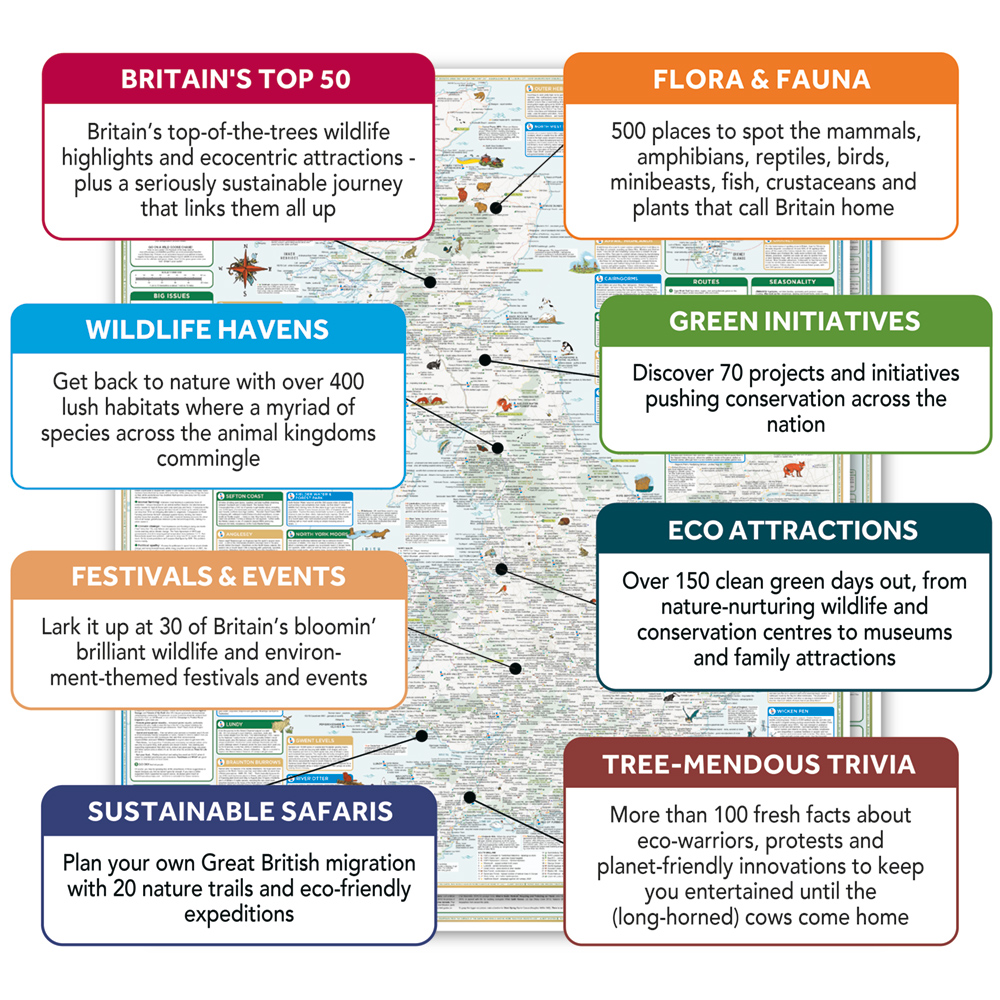


How you can help
The map tackles the big environmental issues we face – from plastic pollution to climate change – head on. It’s not all doom and gloom though! You’ll find plenty of cracking suggestions for how you can help, from peaceful protest to supporting key charities. Plus, it features plenty of positive environmental stories to make you smile.
A totally wild trip
Flip the map over and you’ll find another highlight – the ultimate journey around Britain’s top 50 wildlife and environment destinations. It’s a chance to beaver your way around Britain, with a suggested route taking in the wildest sights our isles have to offer. You can tick them off as you go, with useful tick boxes next to each location. You’ll find out the most eco-friendly ways of getting to these lusted-after locations too.
Tick them off your bucket list
Look out for another map on the back as well, featuring the top 20 things to see in your lifetime. Here you’ll find unique wildlife and the best spots to find them. Get up early in Argyll to see busy beavers or eavesdrop on natterjack toads in Norfolk. The map features a guide to common wildlife too, with some not-commonly-known facts to wow your friends with. Did you know that a group of hedgehogs is called a prickle? Or that bats are more closely related to us than mice? Well now you do!
The main event(s)
A Marvellous Map wouldn’t be complete without its list of festival and events, and this is the wildest one we’ve seen yet. Have a peruse at what’s going on throughout the year, from World Wildlife Day to the Brecon Beacons’ Green Man Festival. It’s a curated list of 30 events to help you be inspired and delighted by the natural world.


Looking for more?
Look closely at the edge of the map and you’ll find wise words on the environment from famous figures like W. H. Auden and Winston Churchill. “Long live the weeds and the wilderness yet,” said Gerard Manley Hopkins and we couldn’t agree more. If all that’s given you plenty to ponder, there’s a section for notes on both sides of the map. And that’s not all. The Great British Wildlife & Environment Map is filled with loads of extra information and inspiration to guide you on your environmental journey. Look out for its guide to totally wild books, TV shows, films, websites and podcasts.
The Great British Wildlife & Environment Map is available in three formats – folded, flat and framed. Which one will you choose?
Dennis Maps is one of the leading map printers in the world, producing more than two million maps and charts every year. We offer comprehensive pre-press services, large format print solutions using both large format litho printing and large format digital print technologies, plus specialised map folding and map finishing techniques.

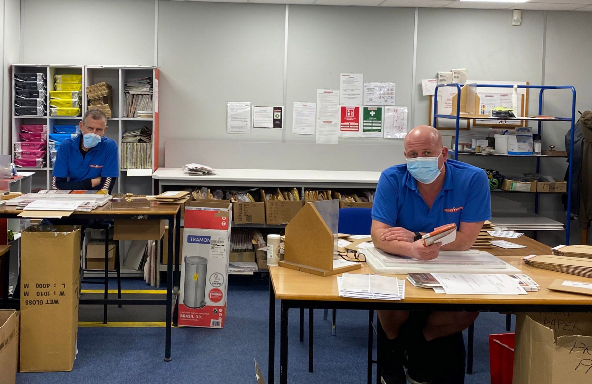
A day in the life of Christian Coates, a CTP Operator at Dennis Maps
Christian Coates is a CTP (Computer to Plate) Operator at Dennis Maps and has worked for the business since it began. He’s kept busy in his role in the pre-press department and helping other departments across the business. And he’s just as busy outside of work too: cycling, swimming, and working as a Sports Performance Coach – phew!
6.15am
My alarm goes off at 6.15am every morning. I’m good to go as soon as I get up. I wouldn’t say I’m a morning or an evening person; I’m an everything person. I seem to have energy throughout the day. I shower and get dressed. On a morning I always make a cup of tea (milk and no sugar).
Before I leave, I grab my bag, which I packed with my work uniform and lunch the night before. Then I’m out the door. I cycle to work – around a mile – on my road bike. I’m a keen cyclist and have three bikes but this is my go-to one.
7am
I arrive at work for 7am. I recently changed my hours to 7am-3pm Monday to Thursday and 6am-11.30am on a Friday, to spend more time with my family, as a Sports Performance Coach and on my hobbies.
7.15am
At this time of year I spend two days a week as a CTP Operator in pre-press and three days helping other departments across Dennis Maps. As a CTP Operator I check digital versions of maps prior to printing, making sure everything is as it should be. For example, I’ll make sure the dates for maps and their covers are the same and that the orientation of the maps is correct
Today I’m helping other parts of the business though, so I check which department I’m in. I’m helping out the Custom Made department, where they make Ordnance Survey Custom Made maps. Christmas is their busiest time. There’s a been a boom in these maps in the last two years, with people taking staycations and trying to find out more about their local area. We print about 600 Custom Made maps a day now, so it’s busy!
7.20am
I get to Custom Made. Map covers are printed separately to maps, on a Ricoh digital printer. Then they’re laminated, die cut and brought to us in the Custom Made department. Three or four of us work there at the moment. We fold the maps using a semi-automatic folding machine. Then we match maps with their covers and package them ready to be posted. It’s a nice department to work in with a really good team atmosphere.
8am
I have a quick breakfast about an hour into the day – a banana and cereal. Then it’s back to work preparing the maps. There is a pop quiz playing on the radio this morning while we work on the maps. Today I beat my manager in the quiz.
11am
I stop for coffee and a bite to eat. I’ve got a chicken salad wrap I made at home, with cheese and onion crisps. I get back to folding more maps and matching them with their covers. Then it’s time to sort the post ready for the postman to collect. We have a discussion over who’s doing it and decide that a colleague Tom is doing this today.
2pm
Most people finish at 2pm but I work for another hour, getting a head start on the next day’s maps. I get them folded using the semi-automatic folding machine, ready to have the covers added the next morning.
3pm
I change back into my own clothes and I’m ready to go. I cycle the quickest route to work on a morning, but I often take the longer route home if the weather is nice. It’s a scenic 4-5 miles out into the countryside, round a lake on the edge of town, and back home. At my house I jump in the car to collect my twin boys from school. My eldest son is a bit older, so he makes his own way home.
4pm
When we get back, I go into my office, get on my time trial bike and do some training with Zwift. I train on Zwift every other day. It’s a virtual world for runners, cyclists and triathletes where you can train indoors. Today I go on a 15-mile cycle ride round France! Afterwards, my wife Beth makes the children dinner, then we all watch some TV together.
6pm
I also run a business as a Sports Performance Coach, training athletes for different events. This evening I’m coaching The Bath Amphibians, a triathlon club, at Bath Uni’s Sports Training Village. I’m a swimmer myself and particularly love open water swimming.


7.30pm
I arrive home and have dinner, halloumi and salad. We all tend to eat separately in the week but together on weekends. Then I make my lunch for tomorrow and pack my bag for work.
8.15pm
The children go to bed and I catch up with my wife. We chat with some background TV on – First Dates, which is always amusing!
10pm
It’s bedtime after a busy day.

Top 10 Christmas gifts to inspire adventure
Looking for the perfect gift for an adventurous loved one? Check out our round up of the top 10 Christmas presents to inspire adventure. From colour-in backpacks to Custom Made maps, we’ve found gifts that are sure to wow them.
Colour-in kit bag / backpack
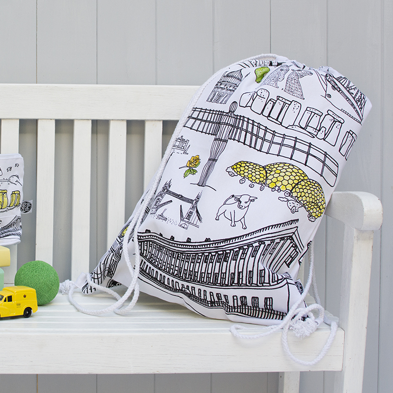

If there’s one thing better than a backpack, it’s a backpack you can colour in! Our customer Eggnogg offers a variety of quirky, colour-in products but this is one of our favourites. The unique gift features some of the UK’s most famous landmarks, like Stonehenge, the Angel of the North and Tower Bridge. Little ones will love colouring the backpack in and packing it for an adventure. Bag it for £15.
The MAZZLE


“The ultimate jigsaw for map lovers” is a clever combination of a map and a jigsaw puzzle. Mazzles are created by our customer Harvey Maps and feature iconic British mountains. Think Skye Cuillin, Snowdon, and The Munros. They cost £24.95 each and come with 1000 pieces – challenging enough to keep them entertained for hours. You can also include a pocket magnifier (£2), so they can view their mazzle in even more stunning detail.
ST&G’s Joyously Busy Great British Adventure Map
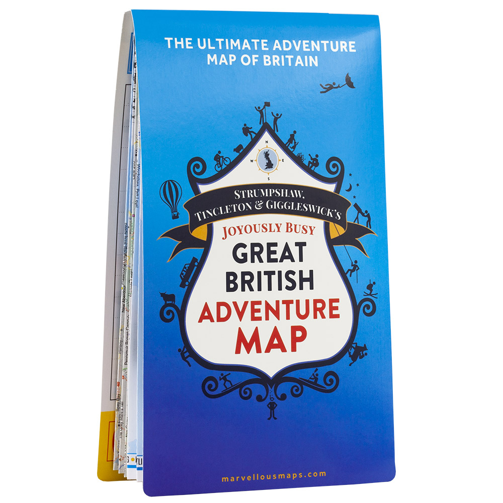
This quirky map was made for those with a love of adventure. The full-colour map is packed with 2,500 must-see landmarks, including mountains, islands and beaches. The map even features over 100 adventurous events to add to your calendar. You’ll also find a route for the ultimate road trip around Britain’s most adventurous spots. Pick up the map from our lovely customer Strumpshaw, Tincleton & Giggleswick for £14.99, or get 20% off two or more maps using the code DROPANDGIMME20.
The Ordnance Survey Kids’ Adventure Book

The Ordnance Survey Kids’ Adventure Book is the perfect present for mini adventurers. Created by Ordnance Survey (OS) experts, it teaches the reader skills they need for a real-life expedition. They’ll find out how to read a map, use a compass and get advice on the best places to visit. There’s even a section with map challenges to test their new-found knowledge. Pick it up from OS, a Dennis Maps customer, for £12.99.
Wild Munro Soy Wax Candle

Get the adventurer in your life a scent-sational gift this Christmas. Adventures are multi-sensory, with scents evoking memories of our best experiences – or dreams of adventures to come. They’ll be transported to the wild Munros every time they light this Gold Moss candle. It’s got a delicious fruity aroma of apple, pear and dewberry, with floral notes; designed to connect them to the wild Scottish mountains. Pick it up for £15.95.
Playing cards


These playing cards would make a great stocking filler or Secret Santa present. They come in different designs, featuring maps of adventurous UK locations. Choose from iconic spots, like Hadrian’s Wall Path, the Peak District and Glen Coe. They’re fun to play with and educational too! Get a single pack of cards for £9.95 or a double pack for £17 if you’re feeling extra generous.
Custom Made Maps

Looking for something totally personalised? Then look no further than an OS Custom Made map. You can centre your map anywhere in Great Britain, like your loved one’s home, favourite holiday spot, or where they got engaged. Choose from an OS Landranger or OS Explorer map and have it folded, flat, displayed in a frame or on canvas. With so many options, you can create a map that’s completely unique. Prices start from £6.99 for paper maps and £79.99 for canvas and framed maps.
Personalised enamel camping mug


This enamel mug is a wonderful addition to someone’s camping trip. They can enjoy a delicious hot drink as they sit round the campfire, reminiscing about their adventures. It even features the phrase “Let the adventure begin”, the perfect motto if they live for exciting escapades. And the best part? You can personalise it with a loved one’s name, for that extra-special touch. The mug is available for £12.95 and there’s the option to include a gift box too.
Off road truck adventure multi tool tin
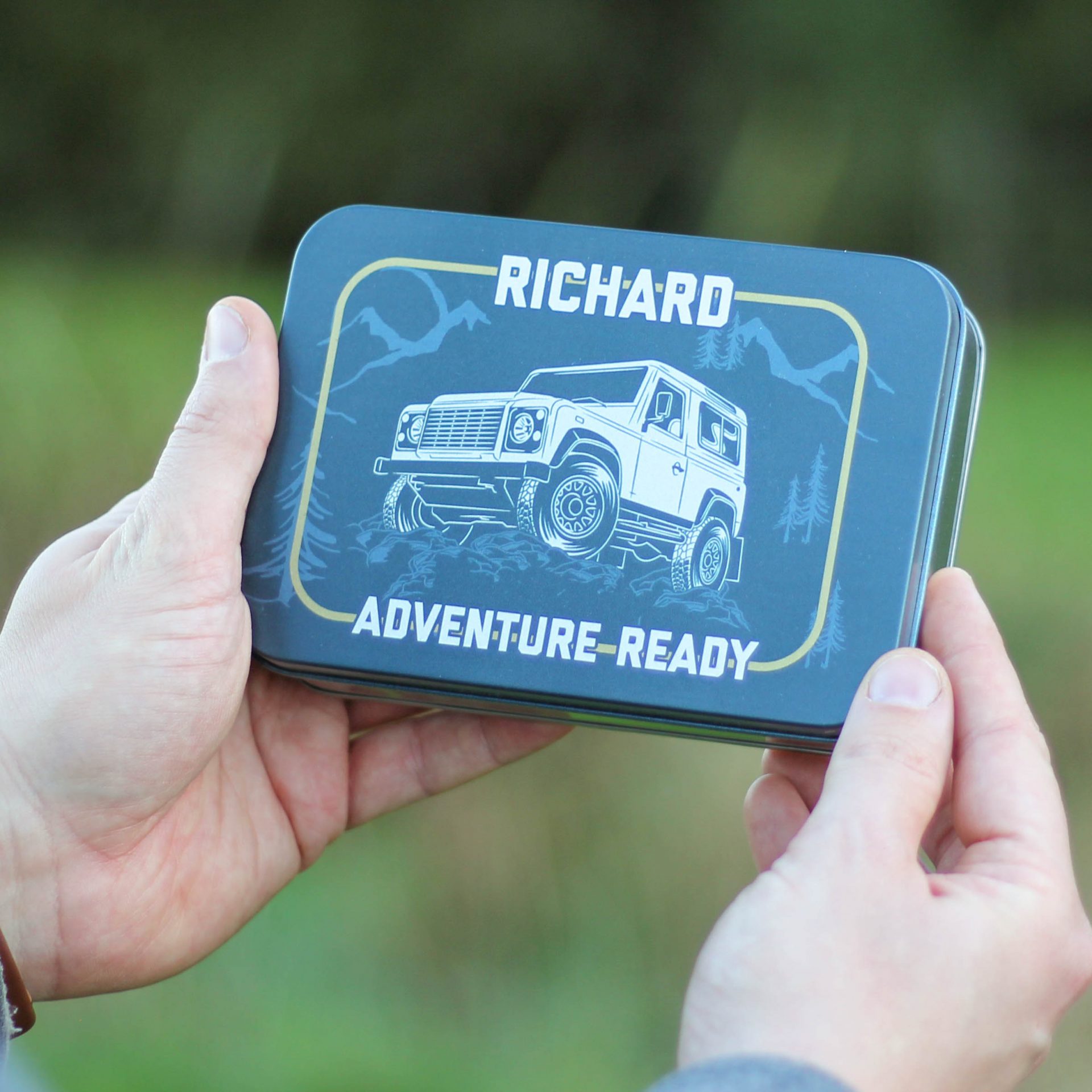
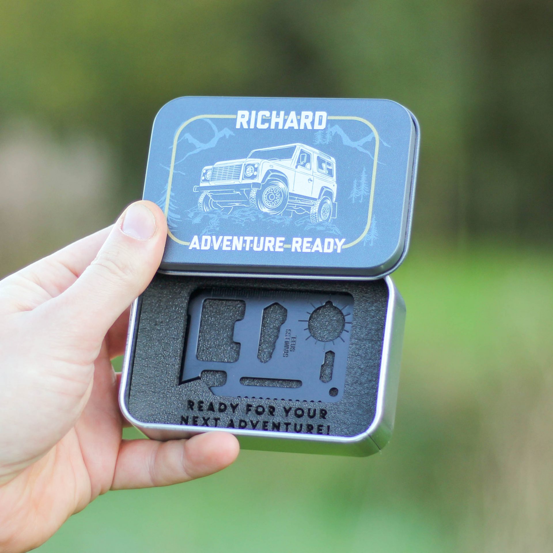
Here’s a gift that’s both stylish and practical. It’s a pocket-sized tool in a small tin, that can be taken out and about. And it includes several handy gadgets – a can opener, bottle opener, ruler, screwdriver, wrench, wring wrench, two position wrench, keyring hole and saw. You can even add a name and message to the front and a message on the inside too. This one has an off road truck design, but there are loads of designs to choose from. Prices start from a reasonable £12.95.
The London National Park City Map


Urban Good CIC produces unique city maps that celebrate open spaces and the natural world. The London National Park City Map (Third Edition) is the organisation’s latest release and is printed by Dennis Maps. The map features epic walks in the capital, with symbols to show where you can climb, pitch a tent, swim outdoors and go sailing. The social enterprise also produces nature maps of Edinburgh, Glasgow, Newcastle and Amsterdam. Prices start from £9.99 with free delivery.
Dennis Maps is one of the leading map printers in the world, producing more than two million maps and charts every year. We offer comprehensive pre-press services, custom made maps, large format print solutions using both large format litho printing and large format digital print technologies, plus specialised map folding and map finishing techniques.
Treat someone to a Custom Made map this Christmas
Custom Map Printing
With Christmas fast approaching, you’ll be looking for the perfect presents for loved ones. Why not choose something completely unique, with an Ordnance Survey (OS) Custom Made map? The personalised gifts are available in many formats, with OS custom map printing recently releasing even more styles, sizes and scales. “Now the customer has an even wider range of choice, whether they’re after a practical navigational aid or a special gift,” says Roger Gilson, Operations Director at Dennis Maps.
Designed by you
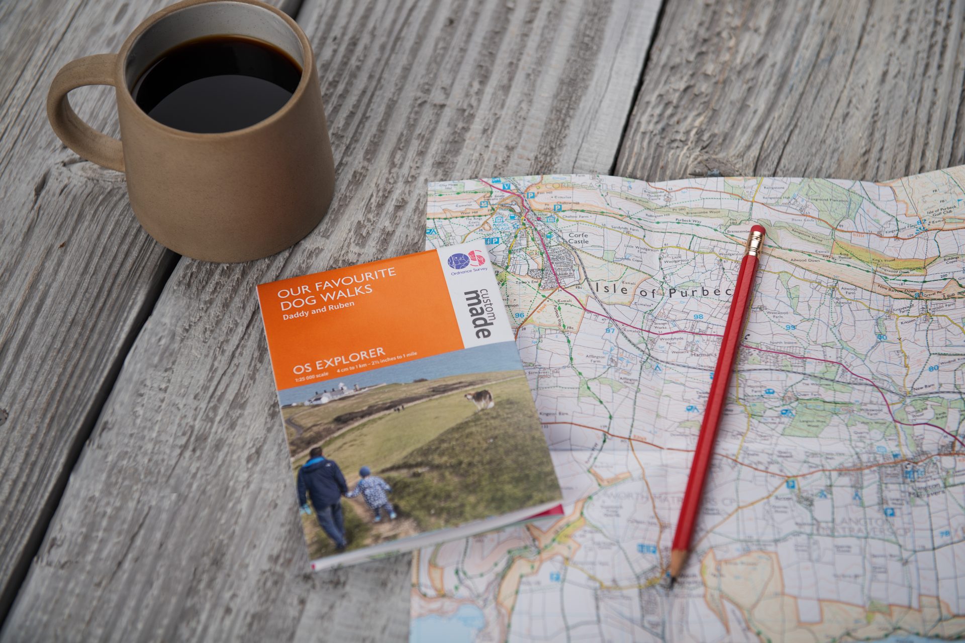
There are endless possibilities for designing your map! You can choose any location in Great Britain to centre your map on, like a favourite holiday spot, your home or where you got married. It could even be where you go with your pet dog for their favourite walk. If you pick a folded map, you can be extra creative and choose a title and picture for the cover. Upload a shot of a special memory or choose a picture from OS’s image library.
What will you choose?
Maps are available in the iconic OS Explorer and OS Landranger formats. The 1:25 000 OS Explorer maps are more detailed, making them perfect for shorter outdoor pursuits like hiking, running and climbing. Due to customer demand, OS has recently released an even larger scale 1:10 000 OS Explorer option too. These make a striking display piece. OS Landranger maps cover a large area but display less detail, so are ideal for longer adventures. They have a 1:50 000 scale.
If you pick a paper map, you can have it flat or folded. Folded is the ideal option for when you’re in the great outdoors, flat is perfect for planning exciting adventures from home. OS offers a traditional large folded map, plus a new small folded map (in A3). The A3 maps feature an introduction to map reading – perfect for a beginner. Then there are OS’s framed paper maps, a lovely keepsake. They’re available in a new small (A3 plus mount and frame) and medium (A2 plus mount and frame) size, plus a large format. You can also opt for a large canvas map, with the option to have this framed too. OS now offer additional frame styles and colours to go with your chosen map. Pick from an oak effect frame or a black one to match your décor.

Exceptional quality at affordable prices
All OS Custom Made maps are extremely good quality yet reasonably priced. Paper maps start from £6.99, framed and canvas maps from £79.99. The maps are printed at Dennis Maps’ Frome factory, using state-of-the-art equipment, so you can be confident they’ll last for many years to come. Flat and folded maps are both printed on the same high-quality materials that the OS map series is printed on. A company in Wiltshire uses specialist framing techniques to hand assemble the mounted and framed products.
Speedy delivery
All the maps are made to your exact requirements, but delivery is still speedy. We have a courier service that will deliver your map to your door within 48 hours of dispatch. We also offer a standard Royal Mail delivery option, that will deliver your map within 2-5 working days. Framed and canvas maps are both assembled locally and take a bit longer but will still arrive within 10-12 working days. Keep an eye on the OS website for cut off dates for Christmas delivery.
How to create your Custom Made map
You can make your map in a few easy steps on the OS website. Choose your map material, if you want it framed, map type (Explorer or Landranger), size and location. You can also choose a title and photo for your map if it’s folded. And you’re done! Now you can sit back and relax with one more present ticked off the list.