
IMIA Mapping Leaders Forum
This month, Steve Burry, Managing Director of Dennis Maps, headed to the US for an international mapping event. He attended the International Map Industry Association (IMIA) Mapping Leaders Forum in Denver, Colorado, with other leading figures from the industry. We catch up with Steve to find out what made the event so special.
Can you tell us more about the IMIA Mapping Leaders Forum?
The IMIA Mapping Leaders Forum is an annual conference that connects leaders, experts and innovators in the global mapping industry. It’s a two-day event and a golden opportunity to explore trends, new technology and challenges in mapping and geospatial technology. The Forum offers panel discussions, presentations and plenty of moments to network.
Why did you decide to attend the event?
I attended for the first time in June 2023 and for the second time this month. I originally heard good things about it from a colleague in the British Cartographic Society, who’d been in 2022, and one of our clients also recommended I attend. I thought I’d go and see what it was all about!

Who else attended this year?
There were predominantly US-based delegates but there were some representatives from elsewhere, including Canada, the UK and Austria.
The event was held in Denver, Colorado. What did you think of the city?
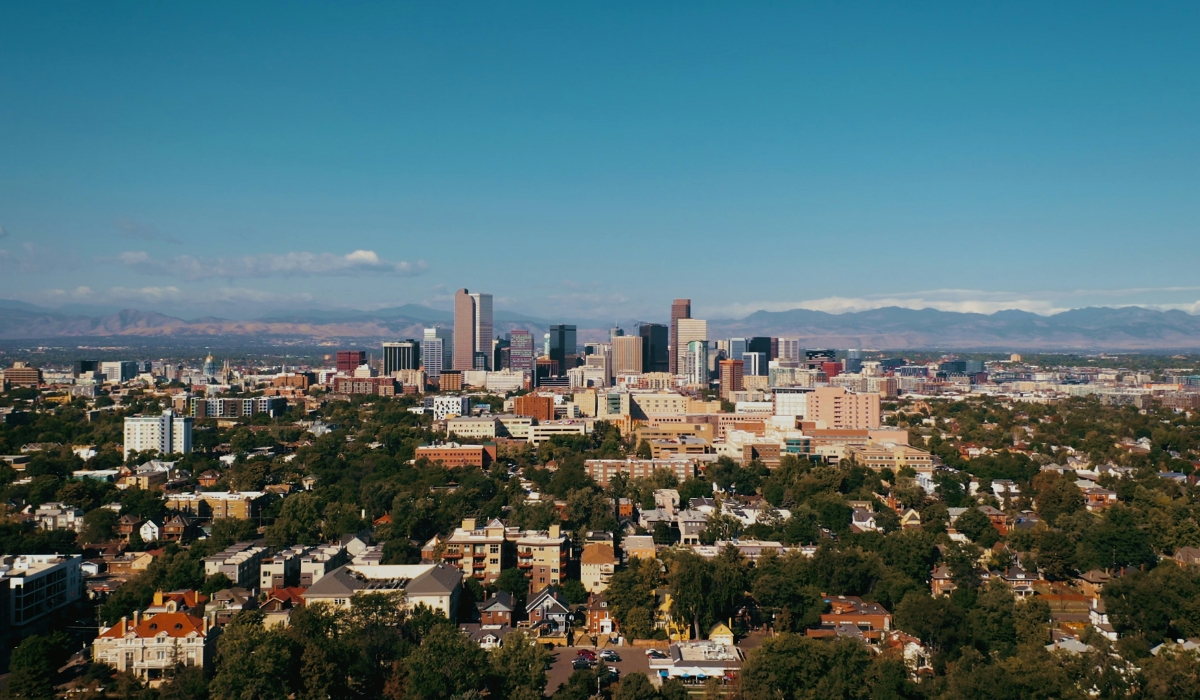
Denver is pretty impressive. It’s at a fairly high altitude and is called the ‘Mile High City’. The backdrop is the Rocky Mountains, and you can see the snow-capped peaks from the city, even in June, which is spectacular.
How did Dennis Maps contribute to the Mapping Leaders Forum?
We were a sponsor, I presented, and I did a lunchtime speech. The speech was a three-minute introduction to Dennis Maps – what we do and how we do it. I also covered our thoughts around the future of printed maps, and our place in relation to that. Later, I gave a presentation about how we’ve successfully built trust in our brand using our marketing channels, such as our website and social media accounts. I discussed how we’ve gone from having no real marketing presence to developing an effective marketing strategy.
What was the response to your speech and presentation?
My lunchtime speech was well received. It also made me familiar with the room and podium for my presentation later that day. The presentation went well too. Afterwards, a number of people said how much they enjoyed it. I included two bits of audience participation to keep everyone involved, so no one zoned out!
Did the event help promote Dennis Maps to the international mapping industry?
I think we’re certainly perceived as a major supporter of IMIA now, even though we’re relatively new to the space. Having the opportunity to present – it was my first year presenting there – also made people aware of Dennis Maps.

If you could describe the IMIA Mapping Leaders Forum in three words, what would they be?
Engaging, knowledgeable and positive.
What was your favourite part of the Forum?
It was having such a knowledgeable group of people from quite a diverse collection of organisations all coming together in one space, to share their understanding and experiences of the business of maps. There was a lot of positive energy in the room, and I had some really good discussions with a lot of different people. It was great that the event brought together companies and individuals who wouldn’t otherwise meet.
Are you planning to represent Dennis Maps at any more industry events?
There are a few other IMIA events coming up this year that we’re involved with too. I’ll be attending the IMIA Map Industry Summit in Toronto, Canada this August. It’ll be interesting to learn more about the Canadian map business. There’ll also be an IMIA presence at the Frankfurt Book Fair, the largest trade fair for books in the world. Dennis Maps is going to be one of IMIA’s co-exhibitors at the event. I always enjoy attending industry events. They’re a fantastic opportunity for conversation, knowledge sharing and connection.
Dennis Maps is one of the leading map printers in the world, producing more than two million maps and charts every year. We offer comprehensive pre-press services, large format print solutions using both large format litho printing and large format digital print technologies, plus specialised map folding and map finishing techniques.
Discover far-flung destinations with Ocean Explorer maps
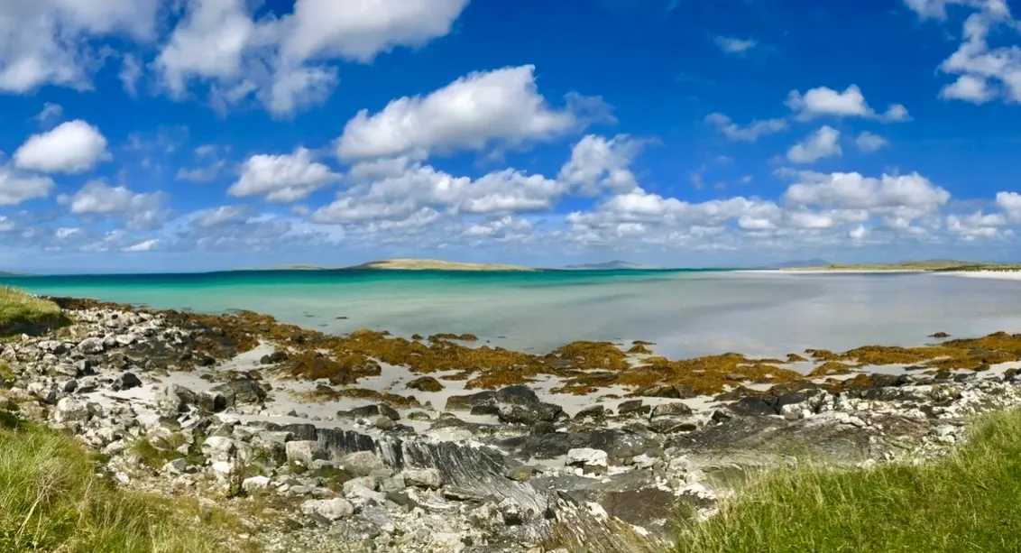
Far-flung destinations like Antarctica, the Galapagos Islands and Greenland are brought vividly to life by Ocean Explorer maps. The maps are pictorial guides and visually stunning souvenirs for passengers on expedition cruises, or anyone with a taste for adventure. Fiona Morrison, Owner of Ocean Explorer, a customer of Dennis Maps, shares more.
 Tell us how Ocean Explorer began…
My Stepfather, Nigel Sitwell, started the company in 1999. Nigel was the most amazing explorer! He was one of the early itinerary designers for adventure travel, creating incredible experiences across the globe. Among his many achievements, he was the Editor of BBC Wildlife magazine, had a stint in Canada flying planes, and was Chairman of the Galapagos Conservation Trust. Nigel had a passion for travel and was an Expedition Leader on cruises to the Antarctic. He took over 20 trips there and at least 40 to the Galapagos Islands too. Nigel saw that passengers on adventure cruises wanted information about where they were visiting and what they’d see along the way. He Created Ocean Explorer to meet this need and share his passion and knowledge.
Why was travel so important to Nigel?
Travel was absolutely in his DNA. He was at his happiest when seeing all that our amazing world had to offer.
Sustainable travel was important to Nigel too. Can you tell us more?
He was a passionate conservationist. While promoting tourism he’d always talk about sustainable tourism, before this was even popular. Tourism in the Galapagos Islands is tightly monitored, and he was an early advocate for that.
 What do you think makes Ocean Explorer maps so unique?
Our collection of maps covers areas that expedition cruises visit – from Alaska to the Antarctic. They’re not intended for navigation but are filled with vivid photography and fascinating content. Inside them you’ll find biographies of explorers who visited the area, historical timelines, plus information on native people, the flora and fauna. They’re something tangible you can use on an adventure cruise and a souvenir you can take home too.
How did you come to take over the business?
In 2013 I started working with Nigel to help him out, as his health was beginning to impact his work. He taught me how his passion worked, and he trusted me to continue the relationships he had built with his customers. It has been an honour to continue his work since he sadly died in 2017.
What do you enjoy most about running Ocean Explorer?
It’s the contact with our customers and the relationships you create. They’re a pleasure to do business with.
Have you come across any challenges while creating Ocean Explorer maps?
Brexit has been challenging because we export a lot of our maps to the European Union, so they now have to go through customs. This means there are extra hoops to jump through and extra costs. I’m eternally grateful that our European customers have stuck with us.

Do you have a personal favourite map from the Ocean Explorer collection?
I can’t say I have a personal favourite – it’s like asking which is your favourite child! The first map was the Antarctic Explorer and it’s our best seller. It’s a wonderful map. I get a lot of cruise ship passengers reaching out saying how they’ve enjoyed the map and asking about our other products.
Are there plans for any new maps in the pipeline?
There are no immediate plans to create new maps. Right now, the focus is more on keeping Nigel’s passion, knowledge and expertise alive. We make sure his maps are current and accurate. We’ve just reprinted the newest 2024 version of the Galapagos Explorer map and we’ve added the latest area that the Galapagos Tourist Board has approved for tourists. It also includes information about the Galapagos Conservation Trust, in recognition of Nigel’s time with them and the important work they do.
What does Ocean Explorer mean to you?
I consider myself extremely lucky that Nigel was in my life and that he trusted me to continue his work. My hope is that I can keep sharing his passion, and ensure his expertise is available for other people.
To purchase an Ocean Explorer map, as a single item or a bulk order, please email fiona@oceanexplorer.co.uk. More information about the maps can be found on the Ocean Explorer website.
Dennis Maps is one of the leading map printers in the world, producing more than two million maps and charts every year. We offer comprehensive pre-press services, large format print solutions using both large format litho printing and large format digital print technologies, plus specialised map folding and map finishing techniques.
Read all about it – The Literary Map of Bath is here
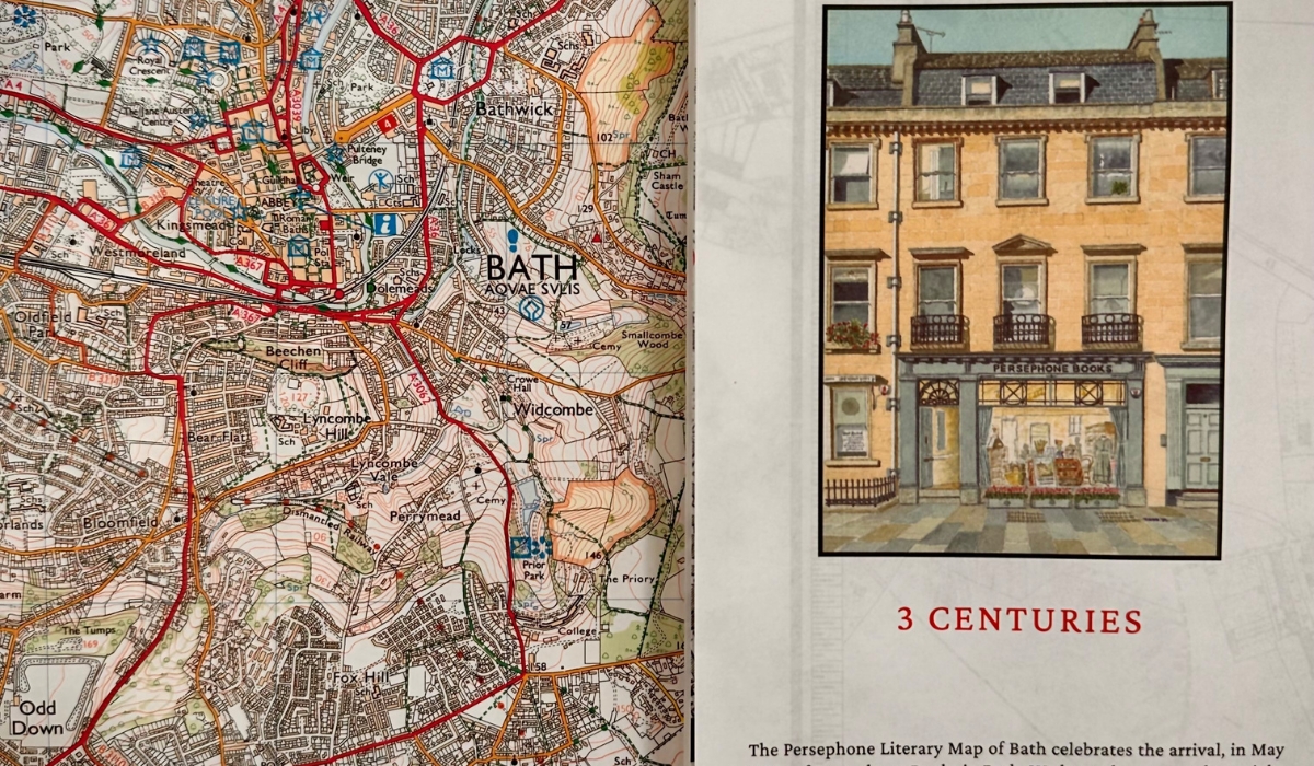
A new map is hot off our presses and it’s sure to make you see Bath in a whole new light. The Literary Map of Bath is a celebration of the city’s centuries-old literary heritage. It’s packed with addresses linked to literature’s well known – and lesser known – figures from the 18th to 20th centuries. From Jane Austen to Angela Carter, Bath has inspired countless authors over the years. Mark Matcham, who designed the map, and Philippa Lewis, who compiled the map for Persephone, its publisher, share all the details.
How did the idea for the map come about?
PL – We were in Persephone one day and Nicola Beauman, its Founder, said ‘there must be other writers in Bath besides Jane Austen. Why don’t you see if we can make a Literary Map of Bath?’. I set about compiling a list of writers, and that’s how we created the first edition of the map. The current version is the second edition.
What makes the Literary Map of Bath so special?
PL – The streets where all these people lived and worked have remained largely intact. It’s therefore remarkably easy to imagine their lives, the good and the bad, in Bath’s buildings and streets. You can really walk in the footsteps of the writers who called this great city home.
MM – We based the map on the Plan of the City and Borough of Bath and its Suburbs, 1852, by J.H. Cotterell. With such a lovely old map, you can look at it for hours, digesting every detail.
Why did you decide to use the Plan of the City and Borough of Bath and its Suburbs, as the basis for your map?
PL – I went to the Bath Record Office to find out more about which map to use, and they showed me the J.H. Cotterell map. It’s perfect, as the street names are clear and the centre of Bath has changed relatively little, so it was easy to place the writers on it. Although it’s over 150 years old, it’s easy to use as a navigational tool today.
How did you carry out research for the Literary Map of Bath?
PL – My first port of call was the Bath Bronze Plaques, commemorating famous figures who walked the city’s streets, including several authors. After this, I referred to the UK census to find more authors. I cross-checked these self-proclaimed writers with the British Library catalogue to find out if they’d published anything. Some left no trace of their writing behind – so I didn’t include them on the map – while others did. I turned to books, too. Historical memoirs mentioned local writers, who are obscure now but were prolific at the time.
Did you encounter any obstacles while researching the map?
PL – Yes – at least two of the bronze plaques are on the wrong buildings! We’ve noted this on the map so readers can find the right buildings.
What were the challenges of using such an old map?
MM – It was a challenge to make it good enough quality to print. It was also a challenge to get as much detail as we could into the scale we needed. The original map was a lot bigger than our version, so we had to crop it. We looked for the furthest points authors lived and cropped it there. That was a compromise we had to make, or the centre would have been too small. We also altered the background. The original background was sepia, but we decided to change our version to a black and white map, with red to mark information about the authors.
What did you enjoy most about designing the map?
MM – When the project landed on my desk, as a designer you think “yes please!”. It was great to revisit the project for the second edition too, to keep improving it. This edition has two more authors and a different fold.

How did you choose which authors would feature in the map?
PL – There are 18 bronze plaques for authors in Bath and most, but not all of them, are featured in the map. Of course, there were others too. In the 18th and early 19th century so many people came to stay in the city for a season or shorter, for healing spa waters, dancing, courting, gambling, or a whole host of other reasons. My criteria for inclusion were flexible, but I decided not to include authors whose connection to the city was fleeting. For example, there’s a plaque for Charles Dickens in Bath but he only stayed in a hotel here, so I didn’t include him.
Did you discover anything unexpected while creating the map?
PL – I noticed that Bath seems to have fostered families of writers, like Edith and Ellen Thompson who contributed an incredible 15,000 quotations to the Oxford English Dictionary in the 1880s. In some cases, the men of the family were praised as writers, but their wives and sisters were also writing away, and sometimes having their work attributed to men. The map features several such cases.
How is female creativity central to the map?
PL – The map’s publisher, Persephone Books, reprints out of print and ‘lost’ books that were largely written in the inter-war years by women. This focus on female creativity is also woven into the map. Most of the writers featured in the book are women. It seems to me that Bath has always been a safe and enjoyable place for women of certain means to live comfortably on their own, at least between the 18th and 20th centuries.
What do you think compelled women of this era to write?
PL – Writing could provide much-needed financial independence. At the time, women of a certain class secured a husband and security with a substantial dowry. An alternative was writing at home, which was viewed as an acceptable pastime. Writing was also a way of making a living for those scandalously separated from their husbands. And, of course, women found joy in writing too.
The Literary Map of Bath can be purchased for £5 and is available from Persephone Books at 8 Edgar Buildings, Bath or by emailing sales@persephonebooks.co.uk.
Dennis Maps is one of the leading map printers in the world, producing more than two million maps and charts every year. We offer comprehensive pre-press services, large format print solutions using both large format litho printing and large format digital print technologies, plus specialised map folding and map finishing techniques.

Dennis Maps celebrates 10th anniversary!
It’s a time of celebration at Dennis Maps, as May marks our 10th anniversary. The company was incorporated a decade ago, in 2014, and has gone from strength to strength since. We’re now one of the leading map printers in the world, producing over two million maps and charts every year. “We couldn’t have achieved this without our wonderful customers and fantastic staff. We have them to thank for such a successful first ten years in business,” says Steve Burry, Managing Director of Dennis Maps.
We’re the trusted print partner of Ordnance Survey and are proud to have produced their iconic Explorer and Landranger maps over the past decade. Over the years, we’ve worked with customers large and small, including household names like the British Geological Survey, Sustrans and Historic England. Dennis Maps prints a huge range of items for customers, in addition to maps and charts. We’re specialists in large format printing – both digital and litho – and also offer a pre-press service, small format digital printing and map finishing options. Dennis Maps’ expert team are always happy to help customers old and new with their printing needs. Our staff are the best in the business, with over 745 years of combined experience in the industry.
We’re looking forward to celebrating our landmark anniversary with our staff and customers and moving forward into the next decade with them too. “Over the coming months we’ll be celebrating our first ten years and looking forward to many more years to come!” says Steve.
Here’s what we’ve mapped out to celebrate our anniversary year:
Win a Dennis Maps’ factory tour
We’re holding a free prize draw to win a Dennis Maps’ factory tour. One lucky winner and their guest will have the chance to go behind the scenes at our headquarters in Somerset. Watch our large format printers in action, discover how Ordnance Survey maps are made, and hear about Dennis Maps’ history. You and your guest will each be given a gift bag to take away too.
Fiona Morrison, Owner of Dennis Maps’ customer Ocean Explorer, previously won a factory tour. She says: “The tour of Dennis Maps’ factory was excellent and very valuable to me as a customer. It was so helpful to understand the process from start to finish. I thoroughly recommend doing a tour if you can.”
New anniversary logos
We’re very excited to reveal our new anniversary logos. We worked with a graphic designer to create the logos that mark our milestone anniversary. We’ve chosen two – one to be used in our email footers and on printed materials, and another with fireworks for our website. We’ll be using both throughout our anniversary year. We hope you like them!
Feeling social
We’re launching an anniversary social media campaign from mid-May, with plenty of information about Dennis Maps and our services. Check out our Facebook, X (Twitter) and Instagram accounts to follow the campaign.
Dennis Maps in Denver
We’re heading to one of the world’s premier mapping events as part of our anniversary year. Steve Burry will be attending the International Map Industry Association (IMIA) Mapping Leaders Forum in Denver, Colorado, US from 4th-6th June. Dennis Maps has sponsored the conference, where Steve will also be presenting on the business, our marketing and this year’s anniversary celebrations. Keep an eye on our socials to find out more about the event.
Working on our website
Dennis Maps has been working with web design agency Zonkey for several years, continuously improving our website. Our anniversary year presented the perfect opportunity to take this further and rebuild the site. “Advances in technology in recent years mean we can now launch a site with many more accessibility features and a better responsive experience for all users,” says Alex Wood, Director of Zonkey. “Taking what we’ve learned from the site and user analytics so far, we can optimise the content people want to see and make the site easier to navigate and faster to load.” The new site will be launching this month.
Welcoming The Charles Close Society
We’re looking forward to welcoming members of The Charles Close Society on a Dennis Maps’ factory tour this summer. The Society has been operating for over 40 years and brings together those interested in the history and maps of Ordnance Survey and its Irish counterpart.
Dennis Maps in Printweek
We’re very excited to see our name in print. An interview with Steve Burry has been featured in Printweek, the premier website for the print industry. Read all about it!
Celebrating our staff
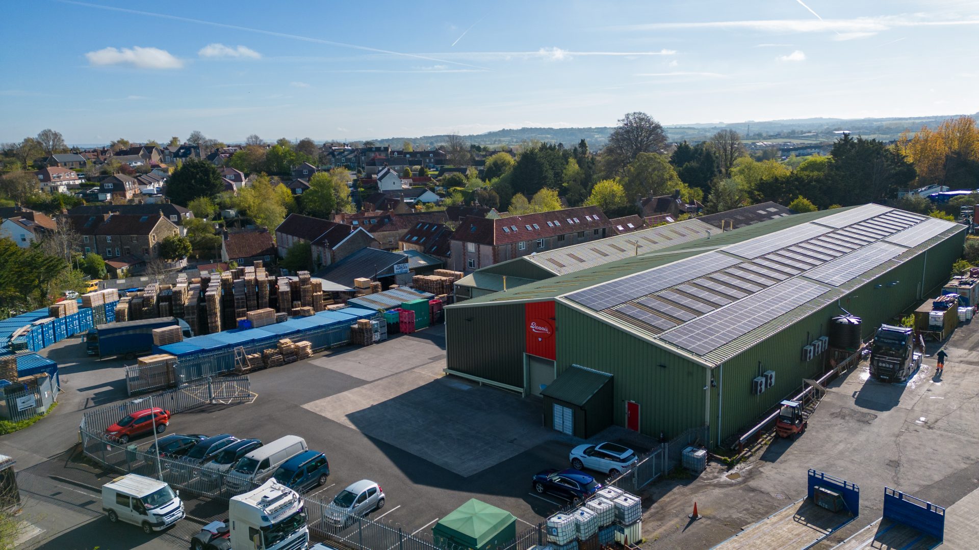
Of course, our anniversary is a chance to celebrate our staff too. We’re holding a staff get together at the end of May to mark the milestone, with plenty of cake and gifts to thank the team for their hard work. We also wanted photos and videos to commemorate our 10th year, so we hired a drone to video and photograph everyone at Dennis Maps. This was no easy feat – high winds and rain meant it took several attempts to get the footage. Luckily, we’re very happy with the results!
As you can see, we’ve got an action-packed anniversary year. We can’t wait to celebrate the milestone with our marvellous customers and incredible staff.
Dennis Maps is one of the leading map printers in the world, producing more than two million maps and charts every year. We offer comprehensive pre-press services, large format print solutions using both large format litho printing and large format digital print technologies, plus specialised map folding and map finishing techniques.
National Walking Month – discover the magic of walking this May
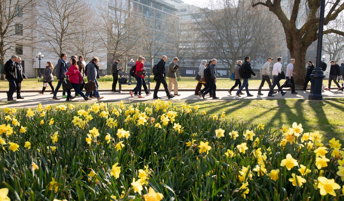
A charity is encouraging you to discover the magic of walking this May. National Walking Month takes place next month and is the perfect motivation to go out for a spring walk! “With the arrival of blue skies and warmer days, it’s a great time to head outdoors,” says Stephen Edwards, Chief Executive of Living Streets, the charity behind the event.
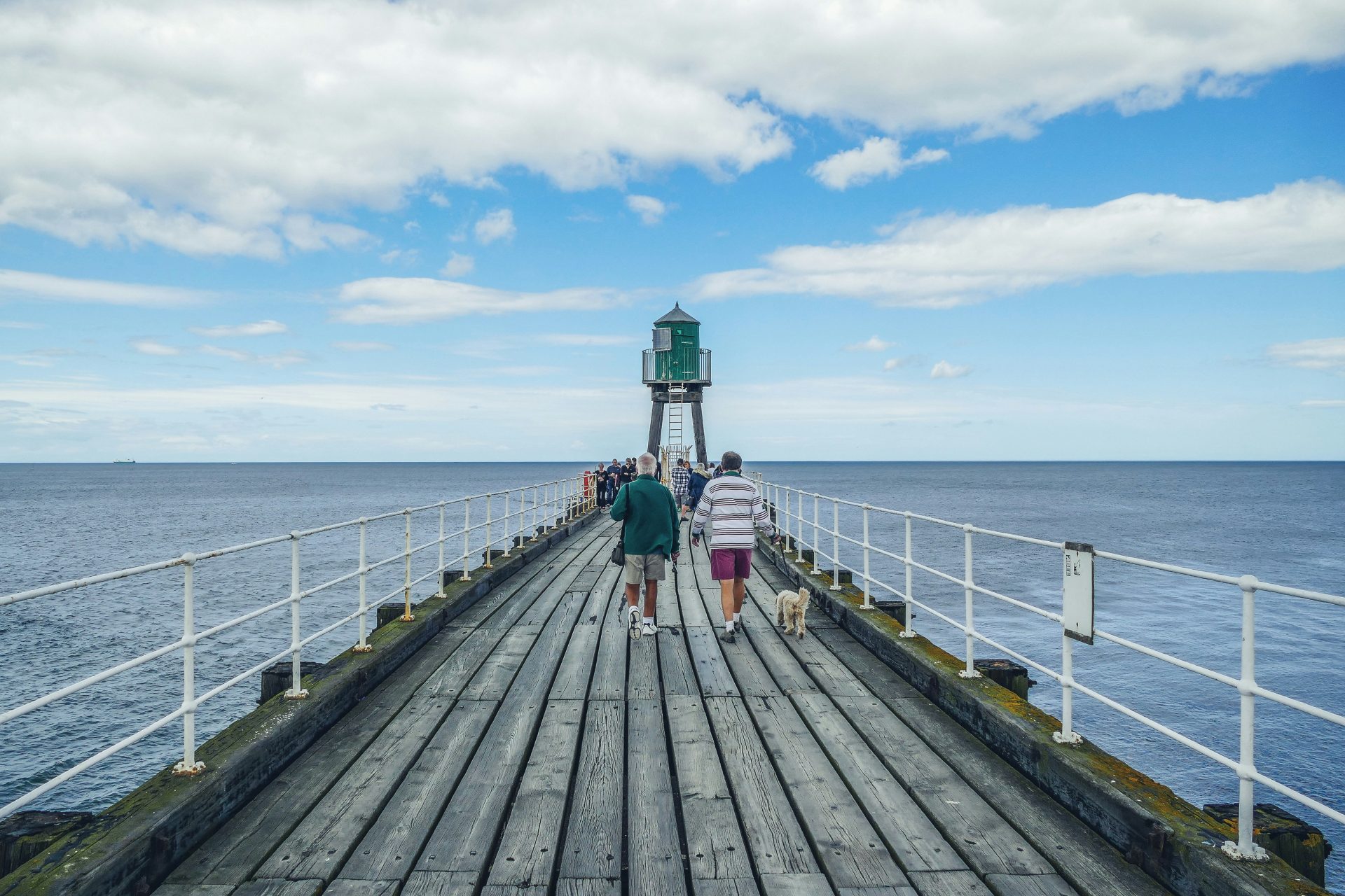
Living Streets is encouraging people across the UK to #Try20 – setting themselves the goal of walking 20 minutes each day. “Walking just 20 minutes a day can help improve mental wellbeing, as well as giving a boost to our fitness and physical health,” says Stephen. In fact, a 2023 study from the University of Cambridge discovered that daily walks can improve sleep and heart health, as well as fitness, in the long run. When it comes to wellbeing, Stephen mentions recent studies that have found serotonin levels can be boosted by walking, making you feel happier. “That’s why we are encouraging everyone to discover the magic of walking this May for National Walking Month,” he says.
Not sure where to start? Living Streets has 20 useful tips to help you build walking into your daily routine. Whether it’s having a walking work meeting or inviting friends and family for a walk, there are lots of options to get you started. The charity also has a handy checklist so you can tick off all the activities you’ve tried.
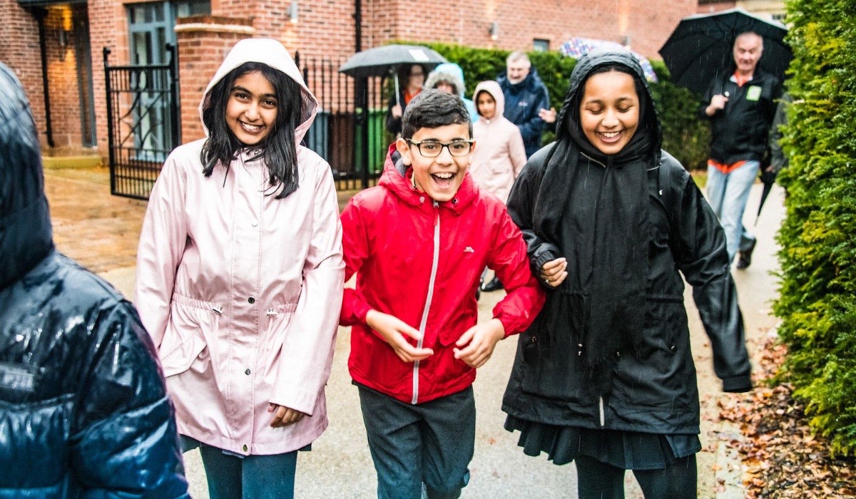
If you’ve got a school aged child you can take part in Walk to School Week too. Between 20th and 24th May families are encouraged to ditch the car and walk to and from school over five days. Activity packs are available for children, helping them meet magical beings along the way! They’ll also find out how active travel is good for people and planet. It’s time to put on your walking shoes…
Image credits
Images 1 and 3 courtesy of Living Streets
Dennis Maps is one of the leading map printers in the world, producing more than two million maps and charts every year. We offer comprehensive pre-press services, large format print solutions using both large format litho printing and large format digital print technologies, plus specialised map folding and map finishing techniques.

Recycling print waste into bags, belts and briefcases
At Dennis Maps our printing presses are always busy, producing over two million maps and charts every year. Inevitably, print waste is created from the production process and we’re always looking to reduce this. Recently, we’ve found a unique solution – recycling print waste into bags, belts and briefcases!
Our large format litho printers use printing blankets that transfer ink from printing plates to paper. These blankets are now being re-purposed by Elvis & Kresse, an award-winning company that produces high-end ethical goods. The business uses 15 types of waste materials to create luxury accessories, such as bags, belts and briefcases. It also donates half its profits to charity, including The Fire Fighters Charity and Barefoot College International.

"Why use virgin raw materials for fashion or luxury, when we have plenty of amazing materials that need a second life?” asks Kresse Wesling of Elvis & Kresse. “We also think that money needs a second life, which is why 50% of our profits are donated to charity."
Dennis Maps’ Trelleborg printing blankets are composed of rubber and canvas and are provided by BFS Pressroom Solutions, a manufacturer and distributor of printing consumables. Impressively, the company also collects used printing blankets from customers, picking up blankets at the same time it delivers other goods. BFS ensures it has a big enough batch of printing blankets to make transferring them to Elvis & Kresse efficient.
Then Elvis & Kresse collects them.
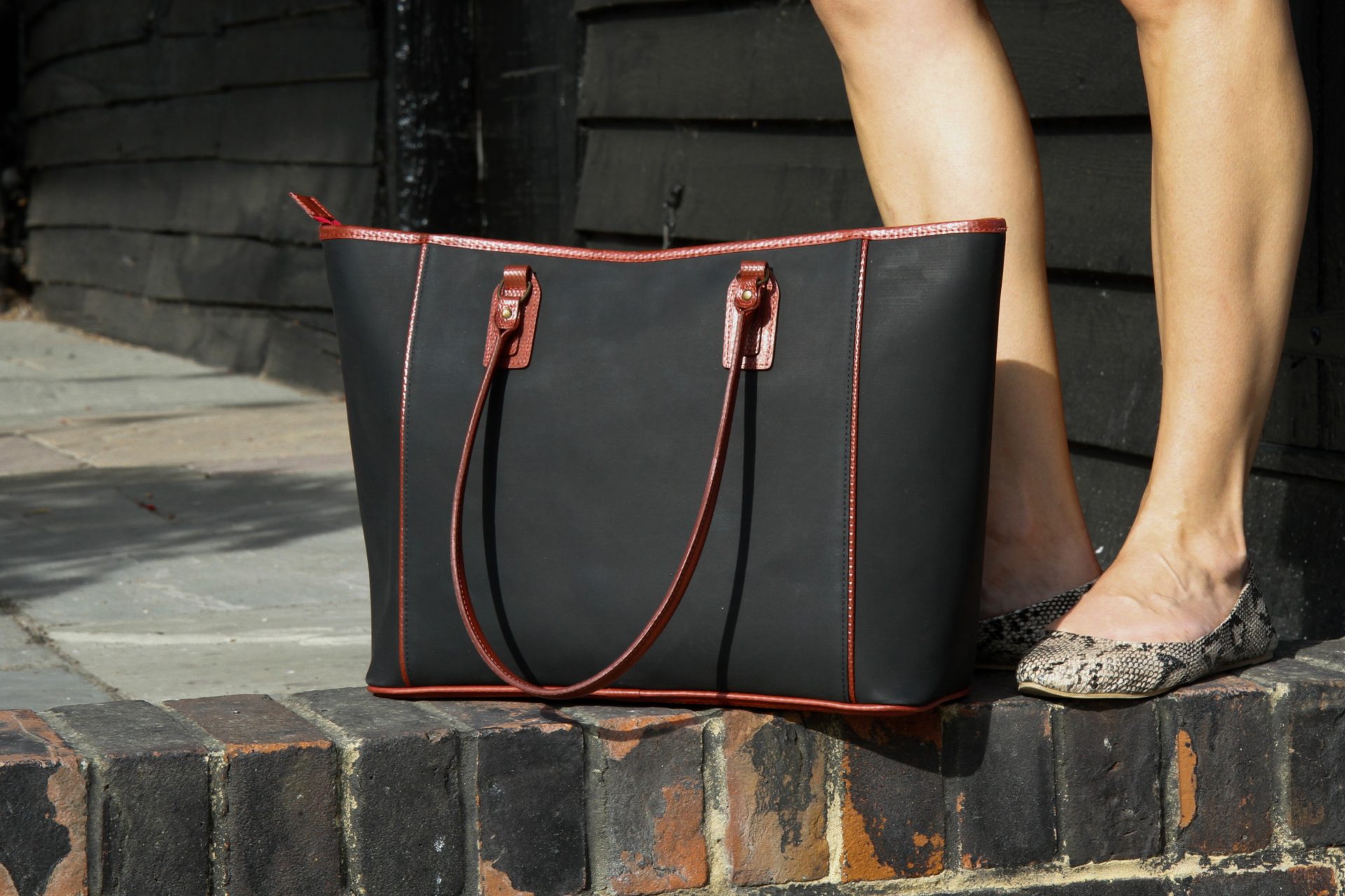
At Elvis & Kresse, the compressible layer of the printing blankets is combined with other waste materials, such as decommissioned firehoses sourced from the London Fire Brigade. The recycled materials are then transformed into high-end accessories that are sold across the world. “Elvis & Kresse’s story is inspirational and working with them is such a privilege, prompting us to be more responsible as a business and to look at ways in which we can do better,” says Nicky Hope, Director at BFS Pressroom Solutions.
BFS arranges for printing blankets that can’t be repurposed by Elvis & Kresse to undergo an alternative recycling process, with rubber waste used to create energy at recovery facilities. The company also offers its customers refurbished rollers as well as new ones, another eco-friendly option.
At Dennis Maps we’re always working towards going greener; it’s at the heart of everything we do. We’re thrilled our old printing blankets are being turned – like magic – into bags, belts and briefcases.
Dennis Maps is one of the leading map printers in the world, producing more than two million maps and charts every year. We offer comprehensive pre-press services, large format print solutions using both large format litho printing and large format digital print technologies, plus specialised map folding and map finishing techniques.

Nature to spot this spring
From bluebells to willow warblers, spring is a time of awakening for wildlife. Dr Mark Champion, from The Lancashire Wildlife Trust, shares his knowledge of the flora and fauna to look out for in Britain this season.
Fauna to spot this spring
Butterflies
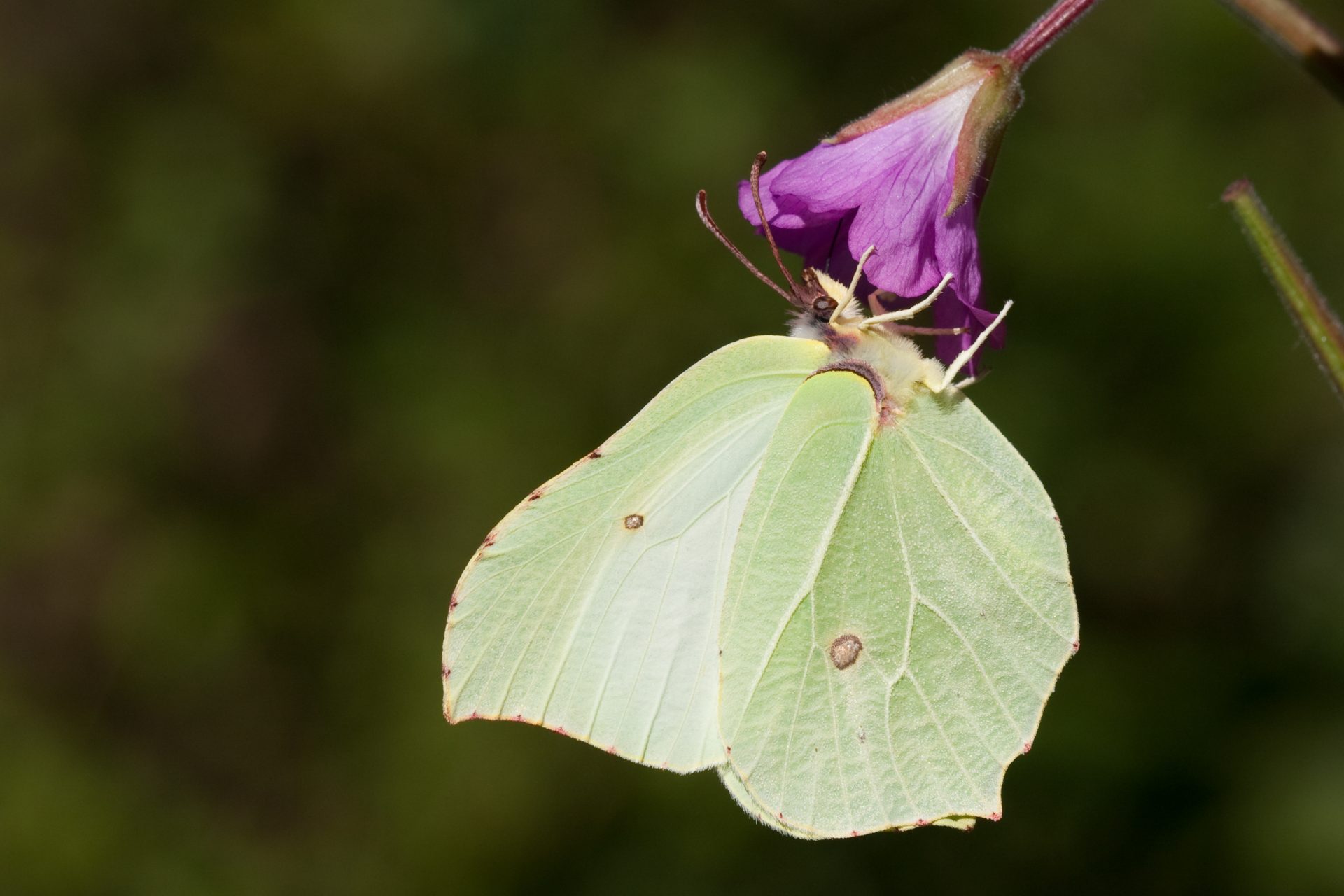
There are several early butterflies that herald the start of spring. The common brimstone butterfly, small tortoiseshell butterfly and peacock butterfly overwinter in human spaces, such as sheds, greenhouses and even behind curtains that haven’t been moved! They all tend to come out early in the season and are easy to spot. They’ll venture outside and start to lay their eggs. If you come across a nettle, look out for butterfly eggs. Both peacock butterflies and small tortoiseshell butterflies lay their eggs on nettles, as well was early spring plants. The common brimstone butterfly lays its eggs on alder buckthorn trees, so look out for them and their eggs there. Later in the season, around April, you’ll start to see a wider range of butterflies, like the common blue butterfly and speckled wood butterfly. You could potentially see as many as 30 species over spring.
Mayflies
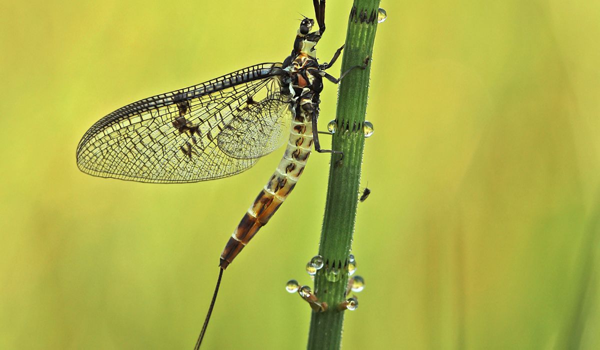
If you go near bodies of water in spring, you might spot the rise of the mayflies. It’s beautiful to see them dancing in the dappled light above the water. They’re tiny things, like little fairies, but it makes my day to see it happen. They congregate over babbling brooks, lakes and ponds. Watch out for caddisflies too. If you’re lucky you can see fish – typically trout – breaking the surface of the water and trying to catch them. They chase them along the water. It’s an interesting interaction with a different range of wildlife that you wouldn’t typically think to observe.

Bats
Warmer spring evenings are a great chance to see bats. They’re breaking their hibernation and coming out to feed at dusk. You might spot them flying over your garden or local park, catching various small insects to eat. Sometimes you can see them fluttering near streetlights too, which they’re attracted to. There are a variety of bats to spot, with pipistrelles being the most common.
Migratory and British birds
Spring is a fascinating time to watch birds in Britain. Sand martins arrive in early March, the first of the migratory birds arriving for spring. You can encounter them on open water, hunting for the first rising flies coming off lakes. Other migrant birds, such as house martins, willow warblers, great crested grebes and black caps start to arrive by mid-March. Keep an eye out for great crested grebes from midway through the month too. The males and females perform something called a weed dance and it’s spectacular. They hold weeds in their bills and wave them around rhythmically. They’re native to Britain and widespread across our islands. You’ll find them around ponds or lakes.
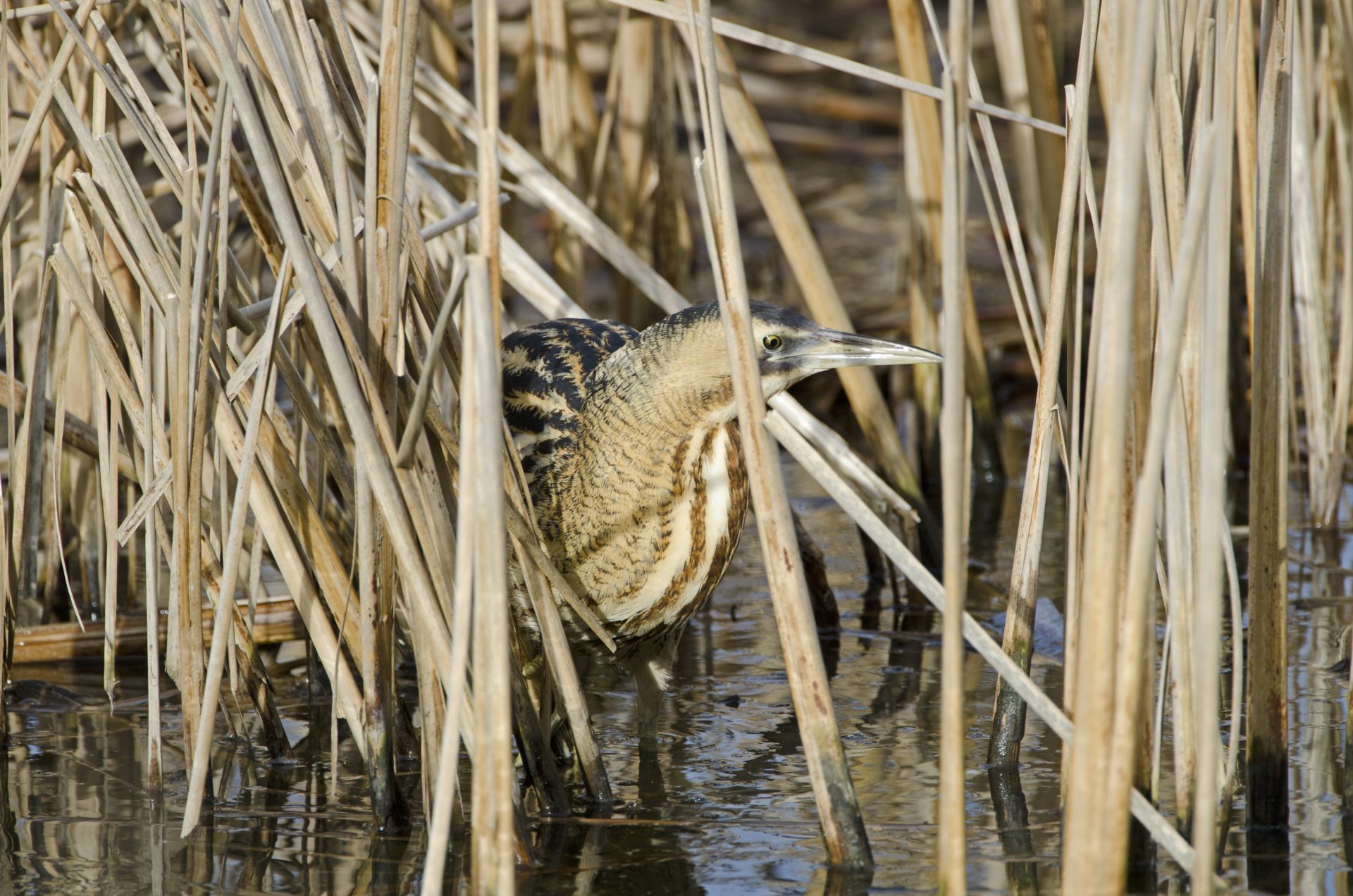
If you’re really lucky, you might come across a bittern in the reeds. Famously, they make a noise similar to blowing across a milk bottle. My favourite bird to see in spring though is the willow tit. They’re commonly in ex-industrial areas that have damp soil with poor drainage. They make their homes in well-rotted willow stumps and eat creatures that thrive there. Further into spring, we get the dawn chorus when birds really begin singing. You can hear it in all sorts of places, although you’ll find the widest range of species, and songs, at a specialist nature reserve.
Red and grey squirrels
Red and grey squirrels come out at this time of year, to enjoy the spring and try to attract the opposite sex. You’ll see a lot of mating displays, and territorial displays as the males defend their patches. Red squirrels are far less common than grey ones but can still be found on Anglesey, the Formby dunes, in some areas of the Pennines, at Poole Harbour and in several areas of Scotland.

Bees
Bumblebees can be seen first in this season, followed by honeybees. They start to visit the first of the spring blooms. Queen bees come out before the worker bees, getting their energy up ready for nest building and starting to form new colonies. If you go in your garden on a warm spring day, you’ll likely see bees floating about. It’s great to spot them because they’re part of the spring awakening, marking longer days.
Flora to spot this spring
Urban plants
Some of my favourite plants can be seen popping up in urban areas in spring. The common whitlowgrass is a small cress-like plant, that you can often spot if you’re walking in towns or cities. They come up in the cracks and spaces between paving slabs and have dainty white flowers. You could class them as weeds, but I’d argue that weeds are only plants people think are in the wrong place.
Woodland flowers
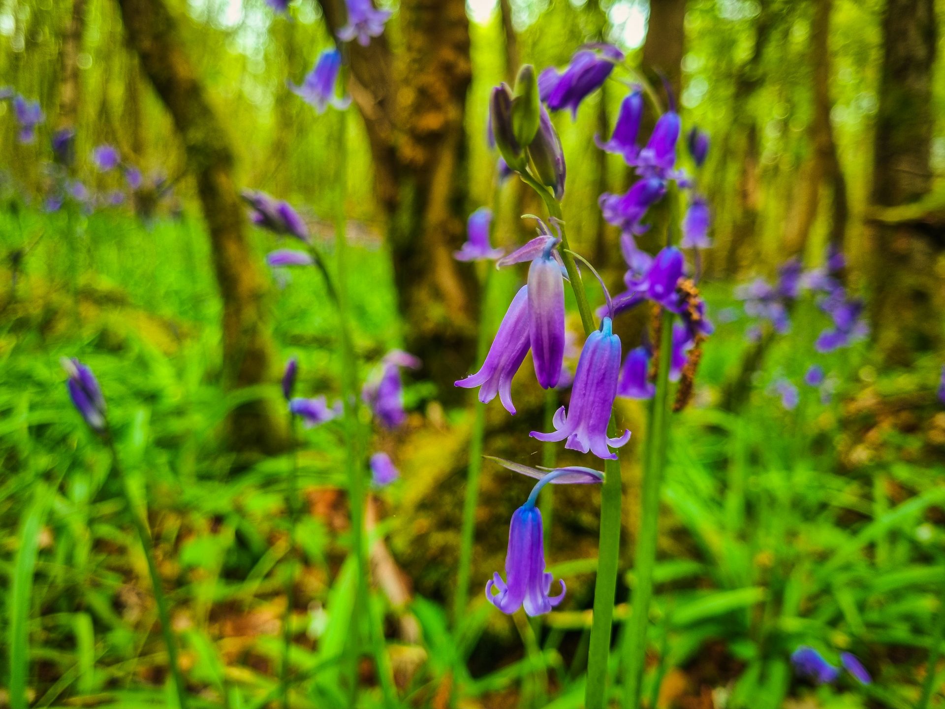
Spring is the perfect time for a woodland walk to go flower spotting. Woodland flowers are really seasonal. They appear in spring before the leaves are fully formed on trees, when they can still get plenty of light. Bluebells are beautiful flowers to spot in the woods. By April, they’ll be in full season. Bluebells flower for around four weeks at the most, so catch them while you can! This season, there are plenty of other flowers to spots in the woods too, from campion to wood anemone.
Golden scale male fern
It’s wonderful to watch ferns uncurling in spring. They spiral their leaves in winter, and they unwind their spirals, unfurling their leaves, in spring. The golden scale male fern is really special. If you catch it in shafts of spring light in the woods, you’ll see that it’s golden, almost metallic. There are little scales on the back of the leaves, that really shine and shimmer when the sun catches them.
Dennis Maps is one of the leading map printers in the world, producing more than two million maps and charts every year. We offer comprehensive pre-press services, large format print solutions using both large format litho printing and large format digital print technologies, plus specialised map folding and map finishing techniques.

Outdoor adventures to try in Wales
Today is St David’s Day and to celebrate the occasion we’ve selected our favourite outdoor adventures to try in Wales. Here’s our pick of adrenaline-filled activities, to give you plenty of inspiration for what to do in Wales.
Have a mountain hike
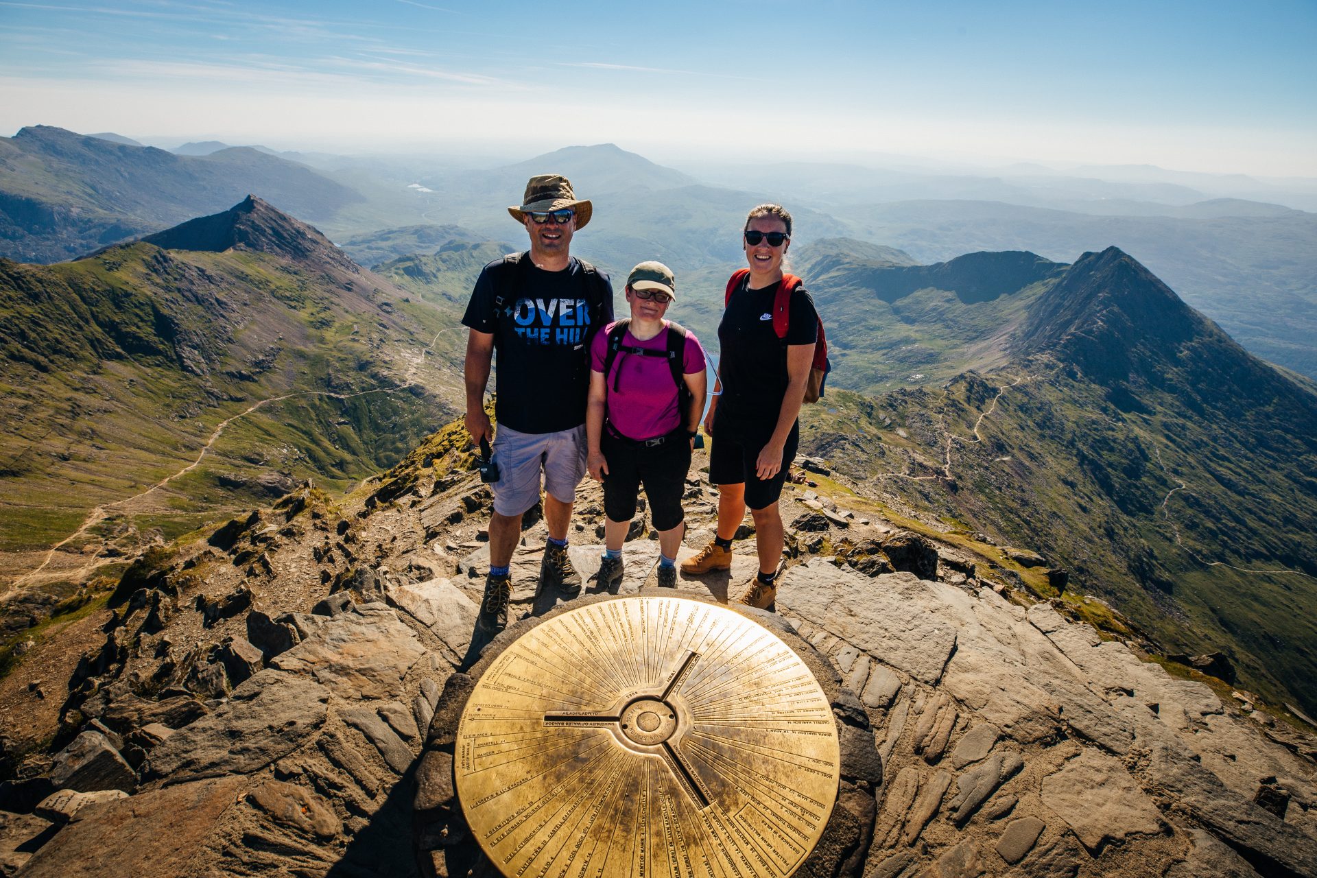
Whether you’re a beginner or a seasoned hiker, there’s a mountain hike for you in Wales. If you’re looking for a challenge, try the Welsh Three Peaks. It takes you to the summits of three iconic mountains: Snowdon, Cader Idris and Pen y Fan. According to Three Peaks Challenge, you’ll ascend over 2,300 metres and walk 17 miles, all in no more than 24 hours. If you’d like your adventure at a more leisurely pace, explore one or more of these peaks in your own time, and choose the gentlest route to the top. The Llanberis Path is regarded as the simplest way up Snowdon, the Pony Path the easiest route up Cader Idris, and the Pont ar Daf car park as the starting point for the gentlest, most accessible trail up Pen y Fan. Of course, there are many more mountains to explore as well as these famous three. Well over 100, in fact!
Go wild for water sports
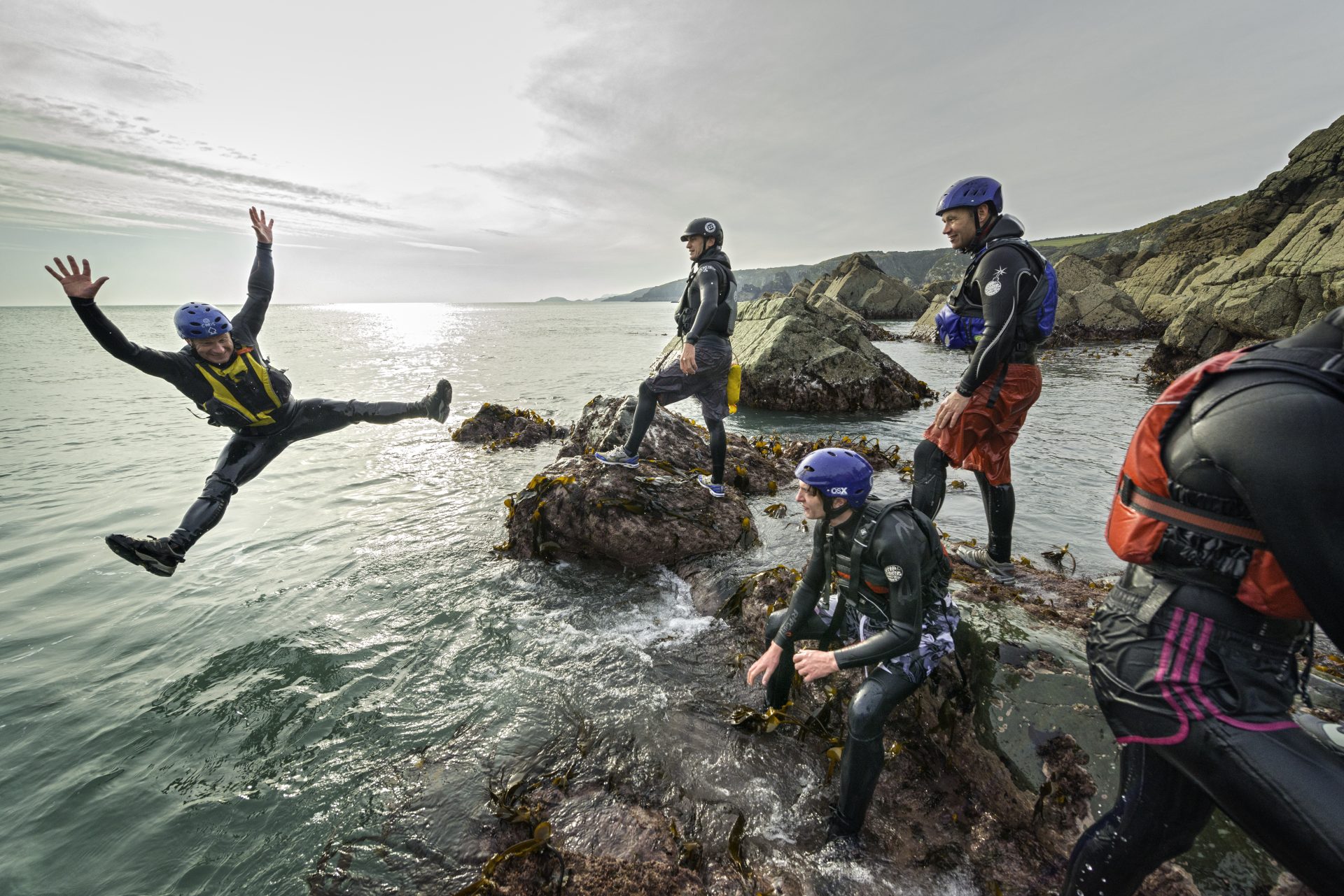
You’ll find a whole range of water sports to choose from in Wales. For a wet and wild adventure, try coasteering. It’s thought to have begun in Wales, making it the perfect place to give it a go. If you haven’t heard of coasteering, it involves finding fun ways to move along the area where the sea meets the coast. “It’s about rock-hopping, shore-scrambling, swell-riding, cave-exploring and, yes, cliff-jumping,” according to Visit Wales. “But it’s as much about discovering our wildlife and coastline at close quarters; an intimacy that walkers never experience.” We wouldn’t recommend beginners try coasteering alone, but there are plenty of guided adventures to take part in.

Canyoning is another action-packed activity that’s available in Wales. It’ll see you descend a hard-to-reach outdoor area, such as a canyon, that usually has a water course. You’ll use an array of techniques, like swimming, climbing, abseiling and jumping, to do so. Interested in other water sports? There are loads to choose from in Wales – from sea kayaking to paddleboarding and canoeing – so take your pick!
Get on your bike
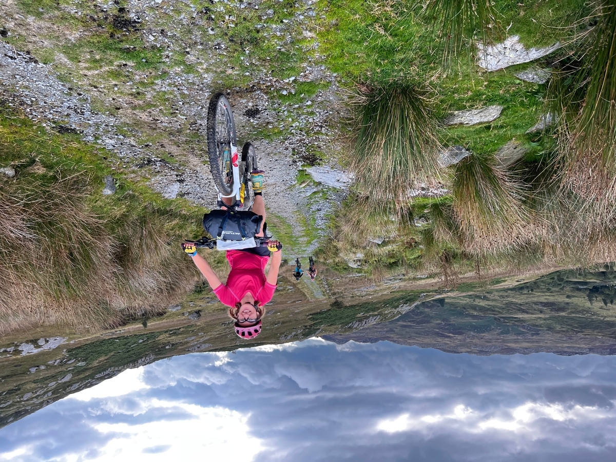
There are loads of places to cycle in Wales, however far you’d like to travel. Looking for a long-distance route? The Traws Eryri (Trans Snowdonia) is a new off-road, multi-day trail that’ll see you ascend over 4,000 metres. You’ll travel between Machynlleth and Conwy and pass through the stunning Parc Cenedlaethol Eryri on the way. According to Momentum Mag, “the route is a testament to the daring spirit of adventure seekers.” Elsewhere, Lôn las Cymru, Lôn Teifi and the Trans Cambrian Way are epic long-distance routes for two wheeled adventures. Of course, shorter routes can still offer a thrilling experience and are often suitable for the whole family. Try the Monmouthshire and Brecon Canal Trail, Mawddach Trail, and Swansea Valley. Sustrans has also pulled together a useful list that features inclusive and accessible cycling groups in Wales.

Go underground
For something a bit different, why not explore Wales underground? You can try caving or potholing at several sites across the country. The Brecon Beacons National Park is a fantastic area for an underground adventure. According to its website, it’s “one of the most exciting and varied caving areas in Britain.” The website notes the area is home to four of Britain’s longest limestone cave systems – impressive. Another spectacular cave to see is Ogof Draenen, one of Britain’s longest cave systems. We’d always recommend going with a professional company or group, unless you’re an experienced caver. Luckily, there are lots to pick from.
If you’re looking for something family-friendly, there are other underground adventures to try too. Visit Dan-yr-Ogof (The National Showcaves Centre for Wales), an impressive cave system waiting to be explored. Further north, Bounce Below offers fun for the whole family, with a series of underground trampoline-style nets in a disused mine. Bounce your way across nets that span an area larger than St Paul’s Cathedral. Whatever outdoor adventure you prefer, there’s something for everyone in Wales!
Please note that some sections of the Monmouthshire and Brecon Canal Trail are currently closed.
Dennis Maps is one of the leading map printers in the world, producing more than two million maps and charts every year. We offer comprehensive pre-press services, large format print solutions using both large format litho printing and large format digital print technologies, plus specialised map folding and map finishing techniques.
Header image, image 1 and image 2: © Crown copyright (2024) Cymru Wales
Image 2b: © Wrexham County Borough Council
Image 3: © Phill Stasiw Traws Eryri North Wales Sept 2022
Image 4: Swansea, South Wales, Photographer Wales News Service, © Crown copyright (2024) Cymru Wales
Border Riding – a unique map drawing game
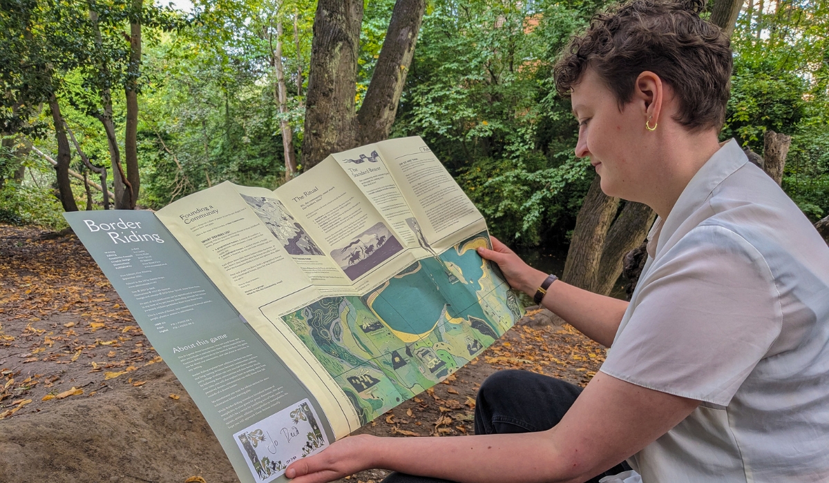
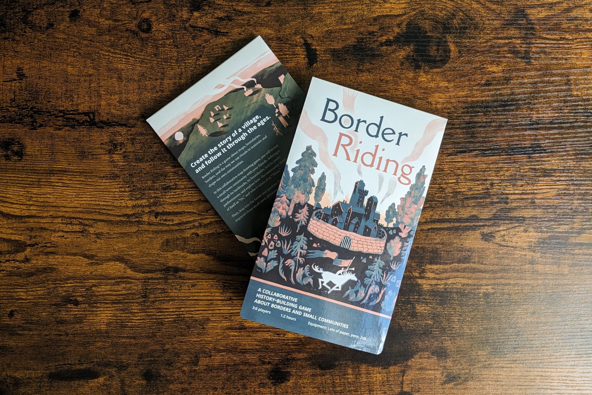
Did you know that we’ve printed our first game? And there’s something a little bit different about it – it’s a map! Border Riding is a collaborative map drawing game, where players create a community and follow it through the years. We catch up with Jo Reid, the game’s creator, and Brian Tyrrell, from its publisher, Stout Stoat Press, to find out more.
Can you tell us what Border Riding is about?
JR – Border Riding is a collaborative history building game. It’s about maps, borders, boundaries and how a small town is shaped. Players create their own community and explore small town divisions, how residents think of themselves as “us” and how they define outsiders as “them”. It takes its inspiration from the Common Riding festivals, a tradition turned festival in the Scottish Borders, where locals ride around the outsides of communities to define their boundaries.
What inspired you to create the game?
JR – When I started developing Border Riding, I was looking at the folk tales I grew up with in a Scottish Borders village. I was thinking about how to put the mechanics of a folk festival into a game. It was the idea of the squiggly border of the community, with the boundaries redrawn each year and people on horses riding around the village to mark these boundaries.
You describe the game as being ‘GM-less’. What does this mean?
JR – In a traditional role-playing game one person is the Games Master and leads the game. In Border Riding no-one is in charge, and everyone controls the narrative together. You’re not playing as an individual but as a community, so having everyone take on the same role made sense.
How did you end up working on Border Riding together?
BT – In February 2022 I put out an open call for people to submit ideas for Stout Stoat to help develop into games. The day before the closing date I received Jo’s submission. I read the first draft and knew I had to publish it! From the start, I could imagine what the game would end up looking like.
Why did you decide to present the game on a fold-out map?
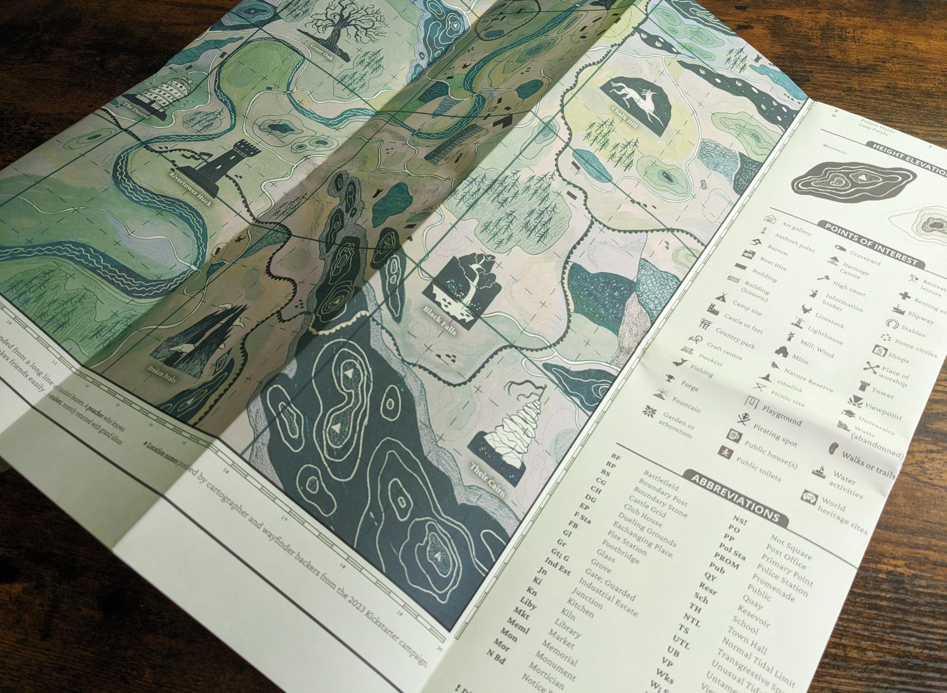
JR – It happened naturally. We were telling a story with the theme of boundaries and how communities shape them. Maps are the manifestation of this. Maps are nice visually, easy to pick up and can be put in your pocket. With a map we can capture something big, confusing and contradictory – the physical world around us.
What makes Border Riding so special?
JR – It’s special to me personally because I view it as my first game. I’ve created a few games before but it’s the first time I’ve created something this big and polished. It’s great to see so many people interested in it too. But even if no-one saw it, it’s me telling the story of my community. A lot of the time, when we look at Scottish traditions the Borders don’t get a look in. The Borders are part of our heritage too and it’s nice to be the one to bring the area to people’s attention.
BT – This is the largest game I’ve worked on and the only one in the format of a map. All the other games I’ve published at Stout Stoat are traditional A5 books. It’s definitely the most unique game I’ve worked on so far.
You’ve said that when creating a game about boundaries it’s important to recognize the real-life violence and discrimination they can create. With this in mind, you consulted Romani tabletop roleplaying game creator Penny Blake. Can you tell us more about this?
BT – Working with Penny was incredible. She grew up in Scotland in the Romani community. She has lived experience of being an outsider to the culture the game is exploring – border towns.
JR – Borders can be a big, difficult theme so we got advice from someone with lived experience of these issues. Penny helped us think about marginalised people who aren’t seen as being part of the community. She encouraged me to reflect on how to approach the portrayal of outsiders in the game and to make it clear to players that we’re being deliberate making them think about “them” and “us”.
Border Riding was funded with the help of over 1,000 supporters who raised more than £23,000 on Kickstarter. How did this feel?
BT – It made about £1,000 a day, which was jaw dropping! We had rewards for supporters, and I had to keep adding extra ones to the site.
One of the rewards on Kickstarter was for people to become cartographers and name a landmark, mountain, river or road on the Border Riding map. What kind of names did people come up with?
BT – Some made subtle references. For example, there’s a Japanese games publisher and one person named a hill after them. We had some commemorative ones too, like Eileen’s Smokehouse and Heroic Hazel’s Mead Hall, that were clearly named for someone as a gift.
What takeaways would you like players to come away with from the game?
JR – The biggest takeaway is that they have fun! Another thing is the idea of borders. They have incredible meaning in our lives, even though they’re arbitrary. With Border Riding I wanted to bring the sense that we’re creating these borders and that it’s a responsibility. What do our borders say about us and how we treat others? You’re creating a fantasy community, but it’s very much based on the real world. The game’s an accessible way for players to think about these questions in their own lives.
BT – The game has a lot of scope for storytelling and the different directions you can take it in. I’ve played it with friends, and it’s been light-hearted. I’ve also had college professors in the US email me to say they’ve used it as a tool to talk about Israel and Palestine. There are a lot of different directions you can take. I want people to reflect on what borders mean to them and what they can mean to other people.
Border Riding is available to buy from the Stout Stoat Press store.
Dennis Maps is one of the leading map printers in the world, producing more than two million maps and charts every year. We offer comprehensive pre-press services, large format print solutions using both large format litho printing and large format digital print technologies, plus specialised map folding and map finishing techniques.

Dennis Maps has something to celebrate
There’s plenty of cause for celebration at Dennis Maps! We’ve successfully passed recertification for several International Organization for Standardization (ISO) standards. We were recently recertified for ISO 9001, ISO 14001 and ISO 45001.
“These internationally recognised accreditations provide both us and our customers with reassurance regarding the strength and resilience of our management and operational systems,” says Steve Burry, Managing Director at Dennis Maps.
All three ISOs are recertified every three years, during a robust process, with an auditor on site for four days. Achieving the ISO standards is business as usual for the company too, with surveillance audits taking place in the years between recertifications. In addition, Dennis Maps holds Safety, Health, Environmental and Quality meetings monthly, where staff make sure checks are in place to maintain the ISO standards on a continuous basis.
Dennis Maps has had these ISO standards in place since the company was founded, and they’re essential to the running of the business. “We’ve long worked to these standards, and they’re fully embedded into the culture of the company,” says Steve.

More about ISO standards
Here’s some more information about all three standards, according to ISO:
- The ISO 9001 standard is focussed on quality management. It supports organisations to meet customer expectations, improve their performance and show their commitment to a quality management system.
- ISO 14001 relates to environmental management systems (EMS). The standard offers a framework for businesses to plan and implement an EMS and continually work on their environmental credentials.
- The ISO 45001 standard covers occupational health and safety management systems. It gives a framework to support organisations to improve their occupational health and safety performance and to manage risk.
Working to ISO standards will ensure we provide exceptional care to our customers, staff and the environment for years to come – definitely cause for celebration!