
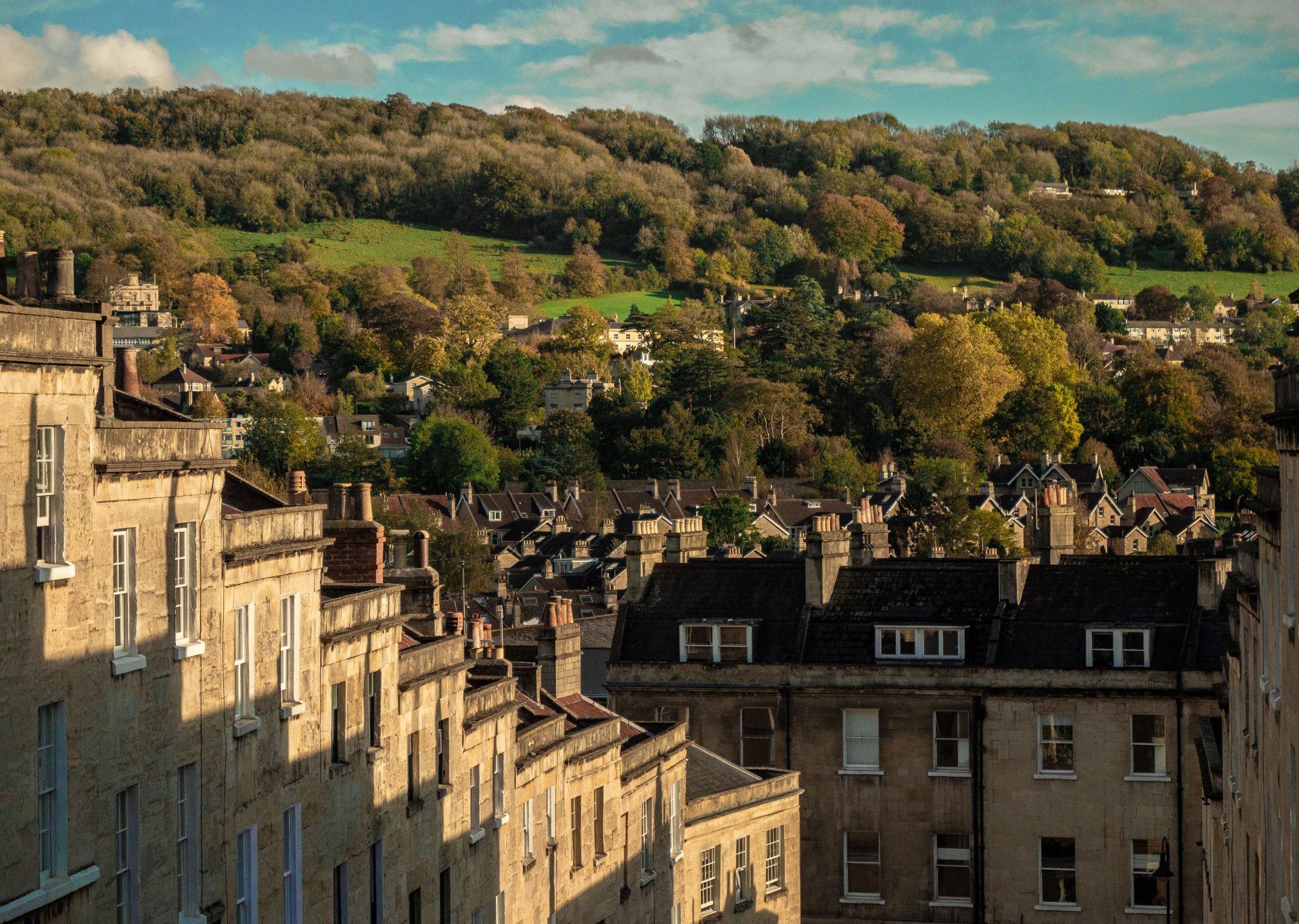
Walk the wonders of Bath
Bath may be famous for The Royal Crescent, Jane Austen and the Roman Baths, but there’s much more waiting to be discovered in this Somerset city. A newly released map has captured undiscovered walking routes in and around Bath, so you can explore all the area has to offer. Annie Legge, the map’s creator, tells us more…
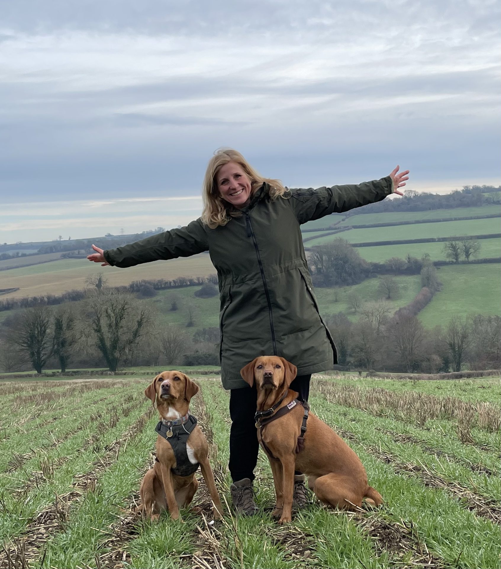 What inspired you to create the Bath 5K Map?
We were on a family walk on New Year’s Day 2022, talking about resolutions and fitness goals. I thought it’d be a nice goal to find lots of different walking (or running) routes around our home city, and to discover more of its hills, valleys and countryside. I decided to aim for 52 walks, one for every week of the year. From the start, I wanted it to be something I could share with others, to encourage them to discover more of the city.
What makes the map so special?
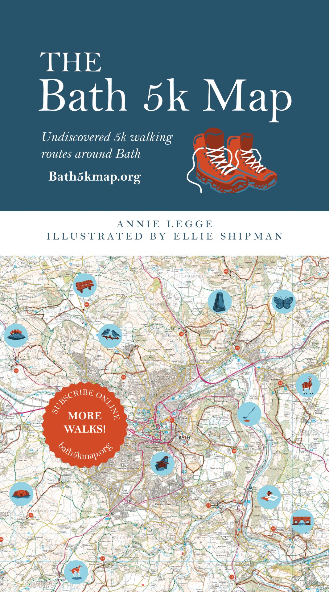
The map is both practical and beautiful, with lovely illustrations. Our first version of the map features 20 of the circular walking routes – each 5k in length – with additional routes gradually being released on an accompanying website. 5k is a good distance that doesn’t make for too long a walk.
It’s designed to spark people’s appreciation for Bath, whether they’re locals or visitors. All the walks reveal the area’s hidden treasures, from physical landmarks to places for wild swimming, and pubs to enjoy. There were whole parts of the city I never knew about before I started this project. Some of the places have taken my breath away.
How has the map evolved over time?
I soon discovered it wasn’t necessary to have 50 routes on the map. The final version has the first 20 routes, so there’s more space for detail, and the other routes are gradually being released on the website. This gives walkers access to more and more routes, without it being overwhelming. Having the website was a new idea. It offers detailed route guidance, plus additional routes, behind a subscription model.
Quite quickly, the map started to change from a personal project to a community initiative. It’s become an inspiration for walking groups. We’ve already used it for a community walk and wild swim and are in discussions about doing charity fundraising walks for World Mental Health Day in October.
Early this year a family member took their own life at the age of 24. This led me to turn the map into a tool for improving people’s mental health and wellbeing, through walking and accessing the outdoors. All the profits from its sale go to two local charities – Mentoring Plus and Off the Record, both of which support young people’s mental health.
Why do you think the outdoors can have such a positive impact on mental health?
Movement can calm your mind down and be a great way getting out of your own head. Walks with family and friends can be a good way to have deeper conversations as well. They can be great for time alone and a mental break too.
 You launched a successful crowdfunding campaign to raise funds for the map. Can you tell us more about this?
We had an initial target of £5,000 and are now over £4,700, but we’re still open for donations. The crowdfunding was to cover the cost of an illustrator (Ellie Shipman), map printing and getting the business set up.
Did you experience any challenges creating the map?
I spent a lot of 2022-23 mapping all the routes. My dogs have now been on many walks and my husband has been marched out at strange times of the day! I never knew what I’d come across along the way either. I’d find dead ends, cows, permissive paths that didn’t exist anymore. The outdoors changes season by season too. I re-walked routes in different seasons to make sure they still made sense.
The Bath 5k Map uses an Ordnance Survey (OS) map as its base map. I had to set up a company and apply to become an OS Licensed Partner to be able to use this. None of that was within my skillset or experience, so it’s been quite a process. I’ve always been fascinated by maps, but I’ve had nothing to do with making one before. I’ve loved it!
Why did you choose Dennis Maps to print the Bath 5k Map?
One of the reasons was that they’re in Frome and we wanted to keep production local, with it being a community project. They invited us to the factory, and it became obvious that they’d be a great choice. They print all the OS maps, have so much knowledge around map printing and gave me so much support.
 How did you feel when you first saw the printed map?
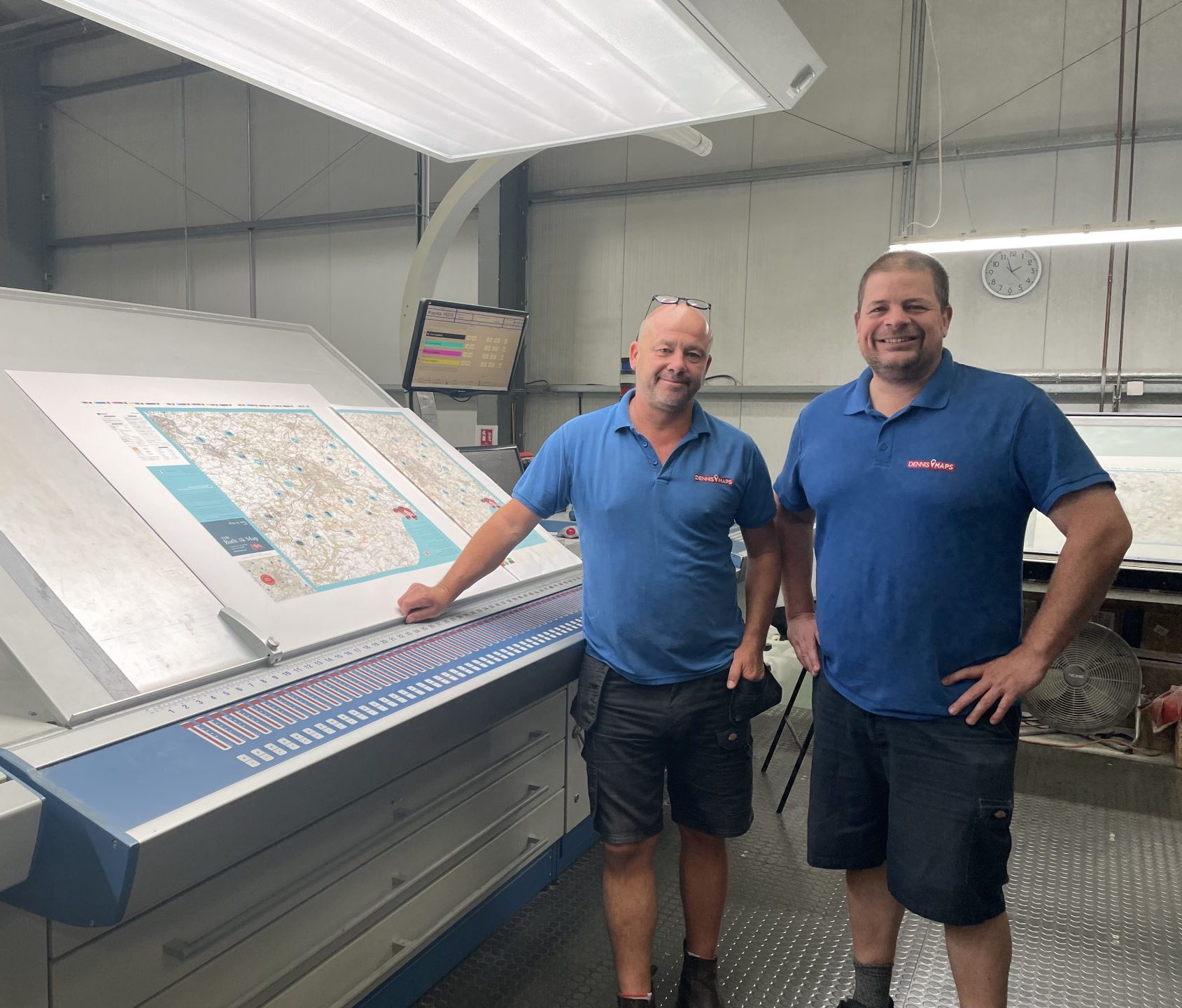
I was so nervous before seeing it. The way we had to print it meant you couldn’t see a final product until the maps were run through the large format litho printer. I went over to the Dennis Maps’ factory to sign it off and see it coming out the printer. That was amazing!
Would you create any more maps in the future?
Yes, I would love to create a version two of the Bath 5k Map, perhaps when I’ve released another 15-20 routes on the website. My longer-term ambition is to have enough routes in and around Bath to all link together, or even to develop routes for other local areas.
Keen to get your hands on a copy of the map? Head to the website to purchase a copy or find out about stockists in Bath.
Dennis Maps is one of the leading map printers in the world, producing more than two million maps and charts every year. We offer comprehensive pre-press services, large format print solutions using both large format litho printing and large format digital print technologies, plus specialised map folding and map finishing techniques.
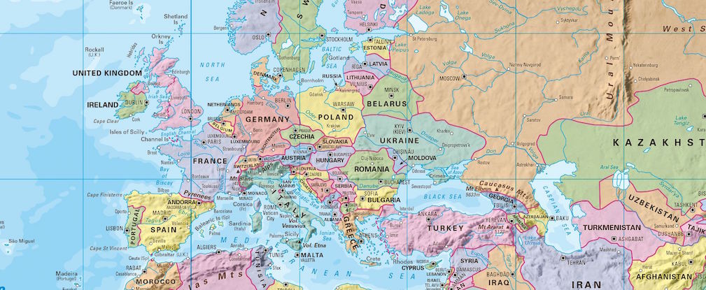
Visualise the world with a wall map
Are you looking for a unique way to see the world on a single sheet of paper? Then a wall map could be the solution. At Dennis Maps, we’ve produced a variety of wall maps over the years, for homes, offices, schools and other locations. We use a specialist large format litho printing press to create them and can print to an incredibly large size to meet your needs.
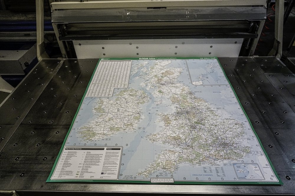
Wonderful wall maps
The wonderful thing about wall maps is that they can portray a variety of themes. Physical wall maps display many natural geographical features, such as rivers, mountains and sea depths. Political maps can include lists of countries and information such as key cities, national borders and time zones. Communications maps can be used to depict major road, rail and sea connections. We even print wall maps for Ordnance Survey that feature UK administrative counties and boundaries, plus parliamentary constituencies. As you can see, there are lots of options for wall maps!
Notably, wall maps are popular educational tools in schools, but they can be just as useful at home or in the workplace. They’re not only practical but can also act as a focal point for a room and an attractive design feature.
Wall map projections
There are several projections used for creating wall maps of the world. All of them highlight that cartographers have to make compromises when depicting our three-dimensional planet on a two-dimensional sheet of paper. Here are the three main projections we commonly print on wall maps:
- The Eckert Projection – countries are accurately sized but with their shapes distorted.
- The Miller Projection – countries have their correct shape but are not sized to scale. Those close to the north pole and south pole are shown larger than they are.
- The Lambert Projection – countries are accurately sized but their shapes are slightly distorted.
Of course, we can print other projections if you’d prefer – get in touch to see what we can do!

Encapsulation vs lamination – what’s the difference?
At Dennis Maps we can encapsulate or laminate your wall map. You may have heard the two terms used interchangeably, but encapsulated maps and laminated maps are actually completely different products. Unsure of the best option to choose? Here are the key differences:
- Encapsulated maps – these maps are sealed between two sheets of plastic film. They’re more heavy and rigid than their laminated equivalents. Importantly, they’re waterproof and tearproof too.
- Laminated maps – these maps are coated with a thin layer of plastic film, usually on their printed side. This plastic film is glossy, enhancing the look of the wall map. It also makes the map more robust. Laminated maps can be written on with some erasable marker pens. These wall maps can be made waterproof if they’re laminated on both sides.
It's useful to consider both options when choosing the best finish for your wall map.
Planet protecting packaging
After your map is printed, we’ll roll it and package it in a tube ready for delivery. We’re committed to protecting our planet and this is reflected in our packaging choices. All our wall maps are packaged using recyclable cardboard and paper tape. And our map paper is carbon balanced as well. So, when you print your map with us, you can rest assured that you’re helping the environment too.
Here to help
Got any questions? Then do get in touch. We’re always here to help.
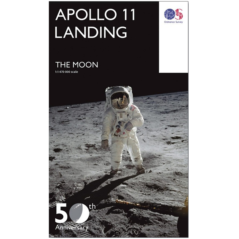
Case study: Ordnance Survey Apollo 11 Landing Map
We’re used to printing a variety of maps, but one map we printed was really out of this world! We were tasked with printing the Ordnance Survey Apollo 11 Landing Map, an exciting project for the team. We were honoured to produce the map to celebrate the 50th anniversary of Neil Armstrong and Buzz Aldrin’s first venture onto the moon. The unique document is focused on a large section of the moon’s near surface, where Apollo 11 landed. We printed the map in a variety of formats, including a large wall map, for customers to marvel at the moon.
You might also enjoy our post on Wall Maps.
Find out more about large size printing near me.
Dennis Maps is one of the leading map printers in the world, producing more than two million maps and charts every year. We offer comprehensive pre-press services, large format print solutions using both large format litho printing and large format digital print technologies, plus specialised map folding and map finishing techniques.

The best bike rides in Britain
With warmer weather here (fingers crossed) it’s the ideal time to get on your bike. Whatever type of ride you’re looking for, there are plenty of options across England, Wales and Scotland. We’ve rounded up our favourites, from multi-day rides to day-long excursions and shorter adventures. Take your pick!
The best bike rides in Wales
Traws Eryri
Length: 130 miles
Traws Eryri (Trans Snowdonia) is a brand-new cycle route that’s set to open this summer. It’s a multi-day off-road trail with 4595m of ascent – not one for the faint hearted. The north Wales route has been designed by charity Cycling UK and travels from Machynlleth to Conwy, through the wilds of Wales and Parc Cenedlaethol Eryri (Snowdonia National Park). The trail is designed for mountain bikes but can be tackled on gravel bikes too. Traws Eryri officially opens on 23rd August, so if you try it soon, you could be one of the first to cycle it! Sign up with Cycle UK to get updates about the new route.

The Taff Trail
Length: 55 miles
The Taff Trail is a well-known route in south Wales, connecting the vibrant capital of Cardiff with the market town of Brecon. The scenery is constantly shifting – great if you want variety on your cycle. You’ll take in plenty of sights, including Cardiff Bay, several castles – Cardiff Castle, Castell Coch and Cyfarthfa Castle, mountains, the towns of Merthyr Tydfil and Pontypridd and Brecon Beacons National Park. In need of a pit stop? Visit Wales recommends Tongwynlais’ Plan2Ride bicycle café, for a cuppa, cake and any cycle repairs.

The Peregrine Path
Length: Around 7.5 miles
According to Sustrans, the Peregrine Path is “straight out of a children’s storybook”. The family-friendly ride certainly has magical sights to see. The trail starts in Monmouth and ends at Symonds Yat Rock, following the River Wye and the Welsh/English border. Seek out the ruins of Monmouth Castle, stop at the mystical King Arthur’s Cave and look out for peregrine falcons soaring over Symonds Yat Rock at the end of your journey. Kymin is also an excellent spot for a family picnic, so don’t forget your sandwiches.
The best bike rides in England
Devon Coast to Coast, England
Length: Around 99 miles
It may be one of the lesser-known coast to coast routes, but it’s definitely worth exploring. The Devon Coast to Coast passes through one of Britain’s most beautiful counties. It starts in the seaside resort of Ilfracombe and stretches south to Plymouth, winding around Dartmoor along the way. Sustrans notes that crossing the “dizzying” Gem Bridge – which stands 24 metres above a valley – is a not-to-be-missed part of the ride. The charity also recommends a shorter section of the route called the Tarka Trail for beginner cyclists and families.
Lakeside Way at Kielder
Length: Around 26 miles
Cycling Lakeside Way is a great way to explore Kielder Forest. The trail loops around the shoreline of Kielder Water reservoir, northern Europe’s biggest man-made lake. The forest is a haven for wildlife. If you’re lucky you might spot otters, red squirrels and ospreys. Unusually, art features on the trail too, making it something quite unique. There are several pieces of contemporary art and architectural along the route – see if you can spot them all.

The Camel Trail
Length: Around 17 miles
The Camel Trail is another one of our favourites. It’s an accessible route that’s mostly traffic free, so is suitable for beginner riders. It connects the pretty port of Padstow with Poley’s Bridge. This route’s the perfect place to wonder at north Cornwall’s amazing scenery and wildlife. North Cornwall Council notes that otters, dormice and bats can all be seen along the trail, so keep a look out. There’s a bird hide for a spot of birdwatching near Wadebridge as well. Foodies will enjoy the trail too, with Rick Stein’s fish and chip stop in Padstow and the Camel Trail Tea Garden for a Cornish cream tea en route.

The best bike rides in Scotland
The Hebridean Way
Length: Around 184 miles
The Hebridean Way is all about the wild, wind-swept scenery, as you cycle across these remote islands. The trail transports you through the Outer Hebrides, from Vatersay to Lewis, through ten islands and their changing scenery. Causeways and ferries are used to move between them, adding variety to the journey. Visit Outer Hebrides recommends cycling the route over at least six days, for plenty of rest and time to savour the scenery. It’s also pulled together a useful directory of shops, restaurants and places to stay along the route.
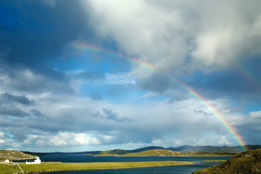
The Water of Leith Walkway
Length: Around 12 miles
This multi-use trail is an opportunity to see a quieter side to the Scottish capital, as you follow the winding Water of Leith. One Google reviewer calls it “a tranquil gem of a route, that'll get you where you want to go in a more serene, relaxed way”. It can be cycled as well as walked, starting at the foot of the Pentlands at Balerno and heading north to Leith docks. Make sure you stop at the scenic Craiglockhart Dell, charismatic Dean Village and historic St Bernard’s Well.

The Canada Trail
Length: Around 2.5 miles
The Canada Trail might sound like it belongs across the pond, but it’s proudly Scottish. Set in the Callendar Estate, near Falkirk, it’s a mountain bike route that runs through some wonderful woodland. It’s been graded an easy trail by the Estate, so can be tackled by even the youngest riders. Mountain bikes can be hired from the Callendar Estate Activity Centre and the trail can be self-guided or led by a qualified guide. Stop by the Estate’s Milk Barn for homemade cakes and refreshments, for a treat at the end of your journey.
Header Image Source: Phill Stasiw, Traws Eyryr
You might also enjoy our post: The best long-distance walks in Britain
Dennis Maps is one of the leading map printers in the world, producing more than two million maps and charts every year. We offer comprehensive pre-press services, large format print solutions using both large format litho printing and large format digital print technologies, plus specialised map folding and map finishing techniques.
Celebrate the sea this National Marine Week
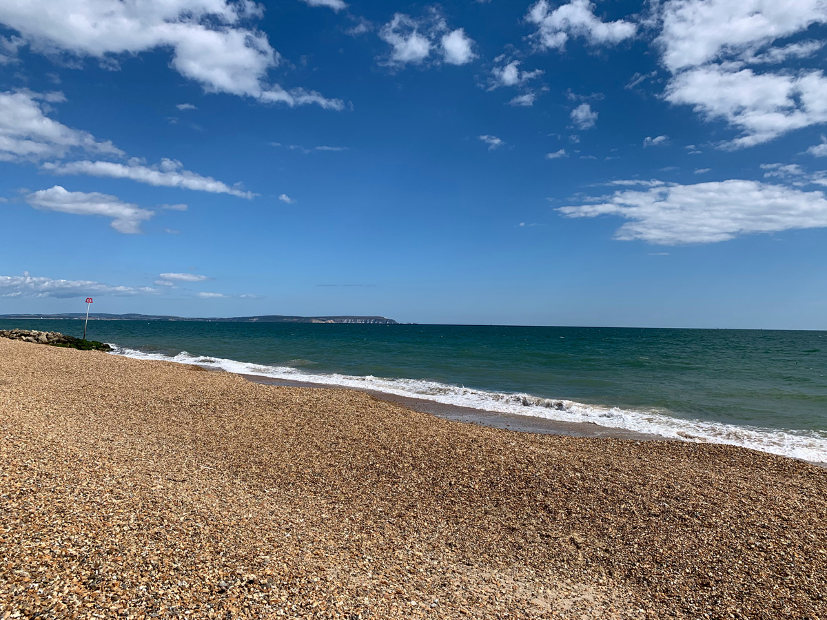
Sea hares, brittlestars and solar powered sea slugs – they’re just some of the magical and mysterious creatures that live in our seas. This summer, you’re invited to join a celebration of the lesser-known wildlife in the waters around the British Isles. National Marine Week runs from Saturday 22nd July to Sunday 6th August, over a fortnight to factor in different tide times around the UK.
The annual seaside celebration is open to all, but this year has a particular focus on inspiring the next generation to care for our seas and shores. Did you know that more than 330 species of fish, as well as 28 cetaceans, seaweeds, seagrasses and living reefs inhabit UK seas? Plastic pollution, development at sea and damaging fishing practices mean there’s never been a better time to protect our waters and the life within them.
“…Our seas are awash with fascinating creatures, habitats, and plants,” says Lissa Batey, Head of Marine Conservation at The Wildlife Trusts, the grassroots movement behind the event. “This year’s National Marine Week reminds us of the great diversity around our shores and why it is so important we look after our seas for people, wildlife and climate.”
There are plenty of fun activities to dive into over the fortnight, to support and celebrate marine plants and animals. From shore safaris to rock pool rambles and beach cleans, there’s something for everyone. Want to find out more? A list of volunteering activities and events is available on The Wildlife Trusts’ website.
You can help from home too. The National Marine Week website has plenty of advice on how you can support marine plants and creatures to thrive. It recommends making small changes to reduce your plastic use and stop this material entering the marine environment. Small actions such as switching your toothbrush for a bamboo one, using bars of soap rather than pump bottles and changing clingfilm for beeswax wraps, can all make a difference. Another way you can support our seas is by conserving water. For example, filling your kettle with the volume of water you need and turning the tap off while you brush your teeth. There are lots of ways to protect marine plants and animals this National Marine Week and beyond – so get involved and make a splash!
Keep up to date with National Marine Week news by following The Wildlife Trusts on Facebook, Twitter and Instagram. Young marine conservationists who volunteer and work with the movement are taking over its social media channels, to shine a spotlight on marine wildlife and projects protecting it.
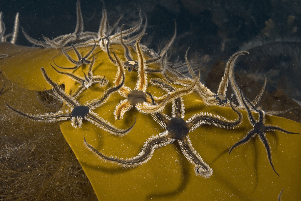
And in case you were wondering:
- Brittlestars are related to starfish and have five long arms. They are brittle by name and nature, shedding parts of their arms if threatened or disturbed. They live in groups, in rock pools and as deep as 85 metres down in the sea.
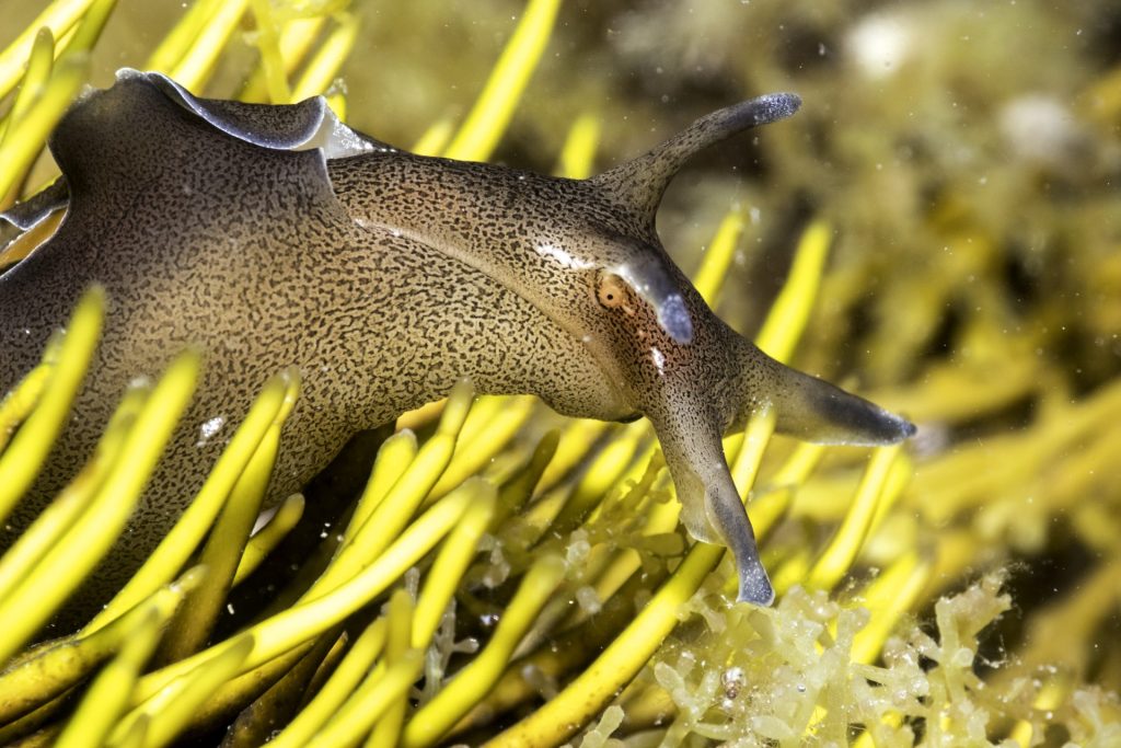
- Sea hares are marine snails that look like sea slugs but have internal shells. You can find them in rock pools and shallow waters. They eat seaweed and it’s believed that this food decides their colour. Maroon sea hares feast on red seaweed and green sea hares on green seaweed.
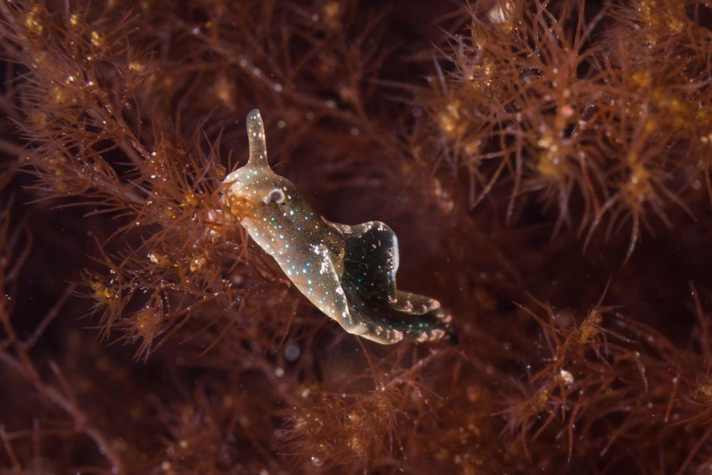
- Solar powered sea slugs are quite remarkable. They carry out photosynthesis after eating algae and ingesting chloroplasts. They’re often red or bright green.
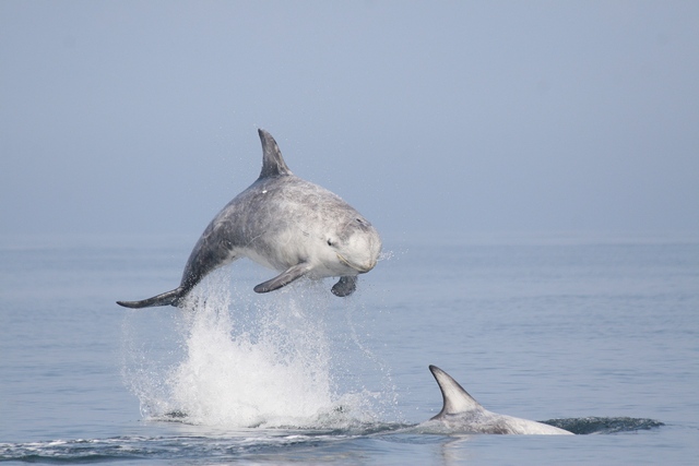
- Risso’s dolphins live in deep offshore waters and appear whiter than other dolphins. They’re stocky with large, blunt heads.
So now you know!
Dennis Maps is one of the leading map printers in the world, producing more than two million maps and charts every year. We offer comprehensive pre-press services, large format print solutions using both large format litho printing and large format digital print technologies, plus specialised map folding and map finishing techniques.
Top outdoor challenges to try
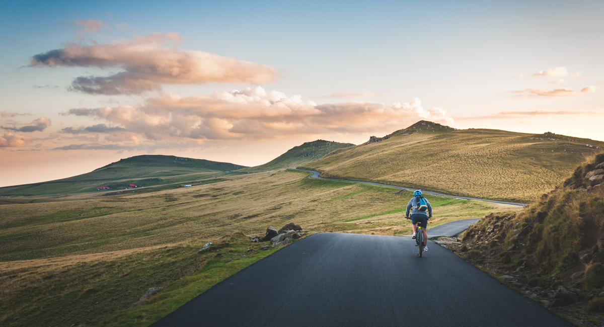
Looking for a challenge? Then look no further – we’ve rounded up the top outdoor challenges in Britain for you to try. Whether you prefer running, swimming, cycling or all three, there’s something for you. There are plenty of events taking place over the rest of 2023, so you won’t have to wait long to try one!
Running challenges
The AJ Bell Great North Run
Date: 10th September
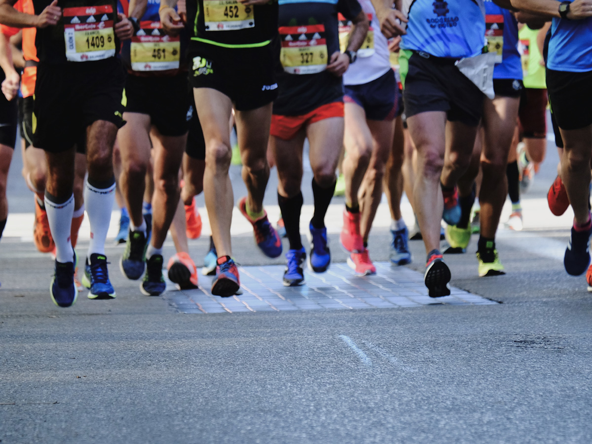
The Great North Run’s claim to fame is that it’s the world’s largest half marathon –perfect if you’re after a lively event. To add to the excitement, Sir Mo Farah has announced he’ll join this year’s event, the last race he’ll run professionally. Join Sir Mo and thousands of others for the 13.1-mile route, which stretches from the city of Newcastle to the sea at South Shields. Ballot entries have been snapped up but there are still charity places available.
Richmond Marathon
Date: 10th September
If you don’t secure a place for the London Marathon there’s an excellent alternative. The Richmond Marathon goes through one of south-west London’s most beautiful boroughs. It starts at the famed Royal Botanic Gardens, Kew and even passes through the historic Hampton Court Palace. The event claims to be “London’s flattest marathon” – a great opportunity to beat your PB and enjoy the scenery. Public entries have sold out, but places are still available via the run’s official charity partners.
The Loch Ness Marathon
Date: 1st October
North of the border, Baxters Loch Ness Marathon is a stunning route with an opportunity to spot the fabled Nessie! The course runs alongside Loch Ness, through epic Highland scenery, and finishes in the city of Inverness. Other options include the River Ness 10k, River Ness 5k and the Wee Nessie for little ones aged five and under. Entries close soon, so sign up while you can.
13 Valleys Ultra
Date: 29th September until 1st October
Completed a marathon? It might be time for an ultra! The 13 Valleys Ultra is a new ultra-marathon in the Lake District National Park. There are four routes to choose from – 60km, 100km and 180km, with a 20km trail as an easier option too. Whichever you pick, you’ll be treated to fantastic scenery running through the UNESCO World Heritage Site. Ordnance Survey (OS) is the event’s official mapping partner, a stamp of approval for the Ultra. Check out OS’s long distance trail running tips, if you’re thinking of entering the race.
Dragon Slayer Ultra
Date: 6th August
The fearsomely named Dragon Slayer Ultra is an ultra-marathon that begins and ends at Wales’s Chepstow Castle. It’s a hilly trail that goes through the Wye Valley and along the famed Offa’s Dyke, crossing the border between Wales and England. There’s a challenging 35-mile option, plus the interestingly named 12-mile Dragon Tickle. Entries are still open for the summer event.
Cycling challenges
The National Three Peaks Challenge
Date: Any – you choose
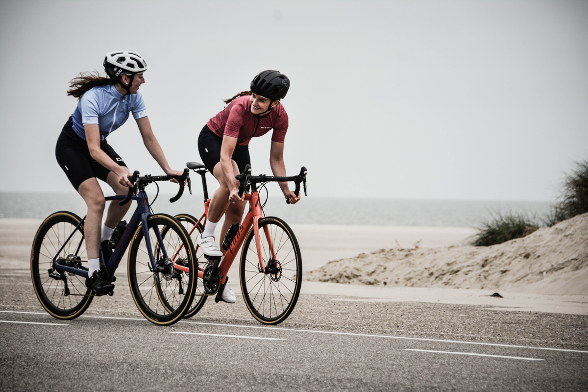
You’ve probably heard of The National Three Peaks Challenge, but did you know you can cycle between the mountains? According to the official website, there are several routes to choose from when cycling to Ben Nevis, Scafell Pike and Snowdon (Yr Wyddfa) – covering well over 400 miles. Whichever route you plan, the site notes you’ll tackle about 4,000 metres of ascent, so it’s certainly a challenge. Register your adventure on the website to be featured in the archive and get sent a certificate after completion.
The Cotswold Classic
Date: 19th August
The Cotswold Classic offers three cycling routes through the Cotswold Area of Outstanding Natural Beauty (AONB). There’s a long (118km), middle (82km) and short (59km) route. Start from Stratford-upon-Avon and follow your favoured route, taking in stately homes, medieval villages, and glorious countryside in the AONB.
Kielder Forest Gravel Epic & Kielder Borders Gravel Epic
Date: 9th and 10th September
Into off road biking? Then this is for you! Dubbed “the biggest gravel weekend of the year” by the event organiser, it’s made up of two days of racing – Kielder Forest Gravel Epic on the first day and Kielder Borders Gravel Epic on the second. There are long and medium routes on offer over the weekend, both passing through England’s largest working forest.
Land’s End 100 Sportive
Date: 16th September
Pick from a long, medium and short route when you cycle the Land’s End 100 Sportive. The event begins at St Michael’s Mount, an iconic landmark on the Cornish coast. Expect quiet roads and plenty of Cornish landmarks, including Stithian’s Reservoir, Newlyn Harbour and Land’s End, the race’s namesake. Much of the route follows the coast, so it’s a great choice for seaside lovers.
The Beast Sportive
Date: 20th August
The Beast is a long-distance journey through the Lake District, boasting challenging passes, country lanes, forest roads, lake shores and even seaside promenades. Whatever your scenery of choice, you’ll find it on The Beast. There are two feeding stations along the route to keep you going and a chill out area at the end, which may be needed after 108 miles!
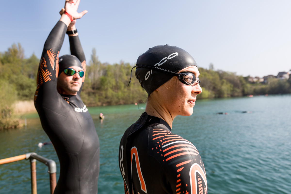
Swimming challenges
Swim Serpentine
Date: 16th September
Set in the heart of London, this swim takes place in Hyde Park’s iconic Serpentine Lake. Entries for different lengths are available, ranging from half a mile to a lengthy six miles. General entries are sold out, but charity places are still on offer. A range of charities are on board – including Alzheimer’s Society, Rethink Mental Illness and Macmillan Cancer Support – so you choose the cause that means the most to you.
The Big Brutal Swim
Date: 10th September
Don’t let the name put you off – there’s something quite special about The Big Brutal Swim! It’s held in the glacial-formed Llyn Padarn, one of Wales’s deepest lakes, overlooked by Snowdonia’s incredible mountains. There are three lengths to pick from – 2.5k, 5k and 10k, with different categories for wetsuit and non-wetsuit entrants.
Salty Seadog Long Swim
Date: 5th August
This challenging open water event is held at Dorset’s Hengistbury Head and is geared towards experienced swimmers. Choose your distance – 2.5km, 3.8km or 5km laps of the sea. Cake will be available on the beach post-race, to make the day go even more swimmingly.
Blackpool Pier to Pier Open Water Swim
Date: 9th September
There are plenty of sights to see at the Blackpool Pier to Pier Open water Swim! It’s a challenge that allows you to explore the famous seaside resort, on the land and in the water. Entry to the 1.6-mile swim includes a free heritage tram ride to the town’s North Pier, before you enter the water and swim to Blackpool’s South Pier. You’ll catch sight of the famous Blackpool tower on route and finish at a water park near the Pleasure Beach.
Fireworks 500
Date: 4th November
Fireworks 500 is a great choice if you want a swimming challenge over a shorter distance. The night swim covers 500 metres of open water at Capernwray Dive Centre, a quarry close to Lancaster. You can choose to go at a gentle pace or a more competitive one. There’s a fireworks display after the race – to finish the night off with a bang.
Other challenges to try
Can’t decide between running, cycling or swimming? There are plenty of challenging triathlons to choose from if you’re looking for a multi-sport event. Check out York Triathlon, the London Triathlon and Helvellyn Triathlon.
Read next: What's so great about doing a Triathlon
Dennis Maps is one of the leading map printers in the world, producing more than two million maps and charts every year. We offer comprehensive pre-press services, large format print solutions using both large format litho printing and large format digital print technologies, plus specialised map folding and map finishing techniques.
Mapping the magic of Dartmoor
Mapping the magic of Dartmoor
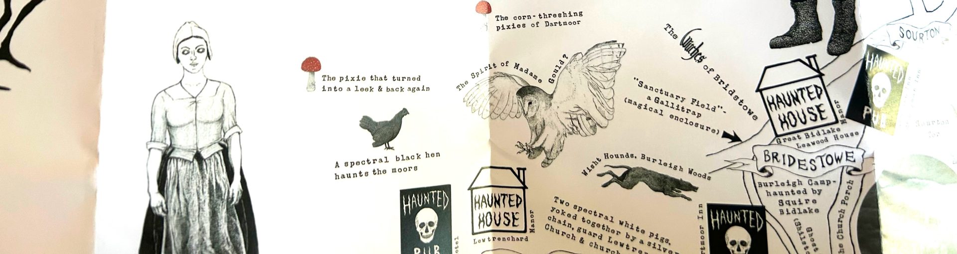
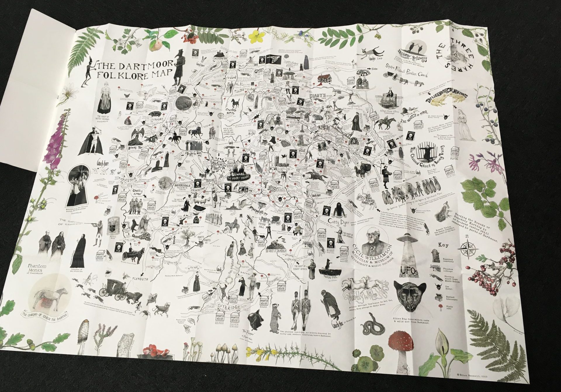
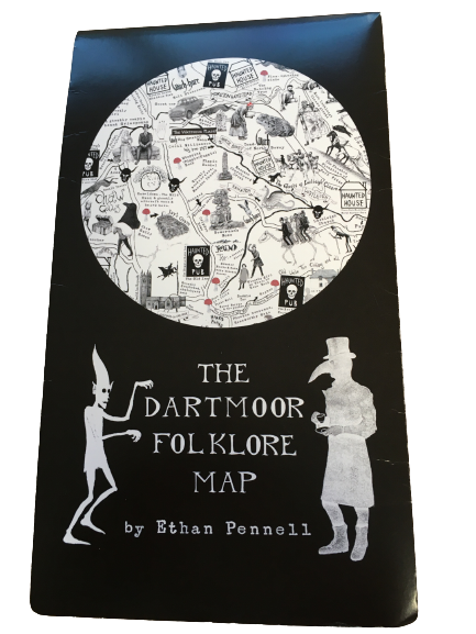
When you gaze at a map what do you expect to see? Roads, hills and rivers are common features, but what about phantom hounds, witches and pixies? The Dartmoor Folklore map shows the moor as you’ve never seen it before – as a place of magic and mystery. Created by artist Ethan Pennell, the illustrated map explores folk tales from the area. We catch up with Ethan to find out more about the most mystical map we’ve produced yet.
What inspired you to create The Dartmoor Folklore Map?
My love of folklore and Dartmoor. I’m from Kent but I moved to the area, mainly because of the moor. I’d visited a few years before and felt a real pull to the place, its mystery and its magic. Originally, I started with a series of oil paintings of Dartmoor, and then thought I’d like to create a map. The idea was to produce a map as a bit of a teaser for a folklore book – which I’m still working on. The book will be a companion to the map, covering its stories in more detail.
Did any other maps inspire you?
Definitely! I was influenced by mappae mundi – medieval world maps created from a European perspective – and the Hereford Mappa Mundi in particular. I love the way they reference fantastical creatures. The map at the beginning of JRR Tolkien’s Lord Of The Rings, and old Ordnance Survey (OS) maps were inspiring too. Since childhood, I’ve been fascinated by all sorts of maps.
 Do you believe any of the folklore tales depicted in the map to be true?
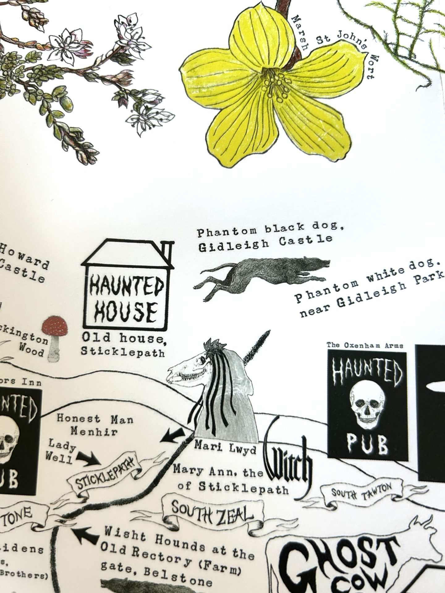
I’m open to it, I like a good story. Saying that, some are certainly made up. In the 19th century it was a way of attracting tourists to Dartmoor. But people do claim to have seen things. I have it on good authority from a dear friend that she came across a pixie on the moor, at Scorhill Stone Circle. For me, it’s more a sense of something, an uncanniness about the place. I’ve been in Dartmoor’s Wistman’s Wood at midnight on Halloween, and I certainly felt the atmosphere. I haven’t seen a pixie yet but never say never!
Do you have a favourite folklore tale from the map?
I do rather like the subversive ones. There are quite a few about witches turning into different animals and leading huntsmen a merry dance. Then there’s another one about a goblin that used to sit on a stone outside Lustleigh at night, causing locals to avoid that area after nightfall. I love the stories about phantom cottages too. They’re cottages that appear and then disappear. There are similar stories about phantom woods as well.
How did you carry out research for the map?
I spent a lot of time in libraries and specialist libraries, using their archives. I visited the archives at Exeter University, including the Theo Brown Archive. I also read a lot of articles and bought a lot of books. I’m always scouring second hand bookshops. Going to the places on the map and talking to the locals helped a lot too.
 Why did you pick Dennis Maps to print the map?
I realised they were specialists in producing maps, and environmentally friendly too. I like that the map is made from FSC paper and printed using vegetable-based inks. I used to work for Greenpeace and have spent a lot of time protesting environmental damage, so it’s important to me. When I found out the map would be the same size as OS Explorer maps (952mm x 1270mm) that sealed the deal too.
Can you talk us through the process of creating the map?
I started sketching it by hand in pencil, then going over my drawings in pen. I created all the features – roads, rivers, etc – separately and used Photoshop to make a massive map-sized space, that I built up with layers. There was a bit of freedom as I could move the images and text around. Rather than using a standard font, I used old printing blocks to create the text, which took me ages! I worked on the map evenings and weekends, around my job at the Arts University Plymouth.
Did you encounter any hurdles during its creation?
Yes, I’m not the most technical person, so it took me a while to get to grips with Photoshop. A couple of years in, I was thinking this is never ending, I had to accept it will be done when it’s done. It took seven years to complete. Patience was a big thing I had to learn.
What were the high points of the process?
I realised the individual images I’d created could stand alone, which was nice. And seeing the finished product of course. I’m so happy with the finished map. The feedback has been amazing. There’s something really exciting about launching it and seeing where it goes. I hope the stories can help people feel more of a connection to the mysteries of Dartmoor and the moor itself. Hopefully the map adds a bit more enchantment into the world.
The Dartmoor Folklore Map is available on Etsy, as a limited edition of 250 signed copies.
Next: Read our Top ten books about outdoor adventure
Dennis Maps is one of the leading map printers in the world, producing more than two million maps and charts every year. We offer comprehensive pre-press services, large format print solutions using both large format litho printing and large format digital print technologies, plus specialised map folding and map finishing techniques.

Think Big, Think Dennis Maps campaign launch!
Have you spotted our new campaign? We’re excited to say that we’ve launched our Think Big, Think Dennis Maps campaign – to keep customers old and new updated on the services we offer.
It’ll run throughout June, on our website, social media channels and as a mailshot. It’s intended to let customers – both current and potential – know how our large format litho printing, and other services, can help them or their clients.
We’re experts in large format litho printing and can create a huge variety of products on our specialist printing presses. Did you know we can print in a wide range of sizes, up to over A0? We print everything from large format posters to wall maps and lots in between. Bigger is better at Dennis Maps! Something else in mind? Then get in touch and we’ll see what we can do. We’re always happy to help.
In addition, we also offer:
- Specialist folding services – turning posters into smaller promotional products
- Digital printing, both large and small format
- Pre press services
- Map finishing services
Handily, we can provide a complete service from beginning to end – printing, folding (if needed) and packaging your or your clients’ products, before delivering them to a named address. Whatever the concept, we can make it a reality. Want to find out more? Then contact us at enquiries@dennismaps.co.uk. We look forward to hearing from you.
Keep an eye out for the campaign and do sign up to receive our newsletter, for more information and updates on Dennis Maps.
Dennis Maps is one of the leading map printers in the world, producing more than two million maps and charts every year. We offer comprehensive pre-press services, large format print solutions using both large format litho printing and large format digital print technologies, plus specialised map folding and map finishing techniques.

Dennis Maps celebrates cyber certification
At Dennis Maps we’ve got something to celebrate! We’ve recently been awarded Cyber Essentials Plus certification – the second time we’ve achieved the accolade. “This accreditation provides us and our customers with real reassurance about the resilience and security of our IT systems,” says Steve Burry, Managing Director at Dennis Maps.
What’s Cyber Essentials Certification?
Cyber Essentials is an accreditation system run by the National Cyber Security Centre, a government organisation that offers advice and support around digital security. The scheme helps us protect our IT systems against online threats. There are two levels of certification: Cyber Essentials and Cyber Essentials Plus. The first level of certification is a self-assessment option that offers protection against a range of common cyber threats. The technical controls offered by Cyber Essentials act as a deterrent to cyber criminals. The advanced certification, Cyber Essentials Plus, involves the same protections, but with the addition of a hands-on technical verification.
We’re pleased to say we’ve been awarded both levels of certification. These along with our ISO 27001 accreditation – a standard for information security management that’s internationally recognised – provide assurance that we manage our data to the highest security standards.

A rigorous process
We passed the basic Cyber Essentials certification for the first time in 2020, reapplying every year since. In 2022 and this year we successfully passed the process for Cyber Essentials Plus certification too – an extra stamp of approval for our IT security systems. We were supported by Geeking It Simple, our IT support company, to achieve the certification. Once we’d achieved Cyber Essentials, we worked towards Cyber Essentials Plus, which has four elements:
- External penetration test
The first element is an external penetration test. This test checks if a hacker could access internal systems via a variety of hacking methods. This tests the robustness of the security infrastructure we have in place to keep our systems safe. - Internal vulnerability scan
Phase two is an internal vulnerability scan. This is run across the network to identify any misconfigurations or unpatched vulnerabilities. - Infected file check
During the third stage an assessor tries to download infected files – that have been created by the assessors’ company to act as virus files – onto Dennis Maps’ systems, to see if they can circumnavigate our security. This includes downloading from the internet and via email attachments. - Inspection of mobile devices
For the fourth and final stage the assessor, Indelible Data, carried out a visual inspection of company mobile devices, to make sure they’re configured in compliance with our policies.
We had to pass all four stages to complete the Cyber Essentials Plus assessment, a rigorous but important process. Passing the assessment is certainly cause for celebration!
You might also like our post: Got an idea? We’re here to help
Dennis Maps is one of the leading map printers in the world, producing more than two million maps and charts every year. We offer comprehensive pre-press services, large format print solutions using both large format litho printing and large format digital print technologies, plus specialised map folding and map finishing techniques.
Historical maps to get your hands on
At Dennis Maps we print an array of modern maps and wall maps, but did you know we produce historical ones too? Over the years we’ve printed a range of historical maps, that all offer a fascinating insight into the past. Here’s a selection of some of the ones we’ve had the pleasure of printing.
Ordnance Survey Apollo 11 Landing Map
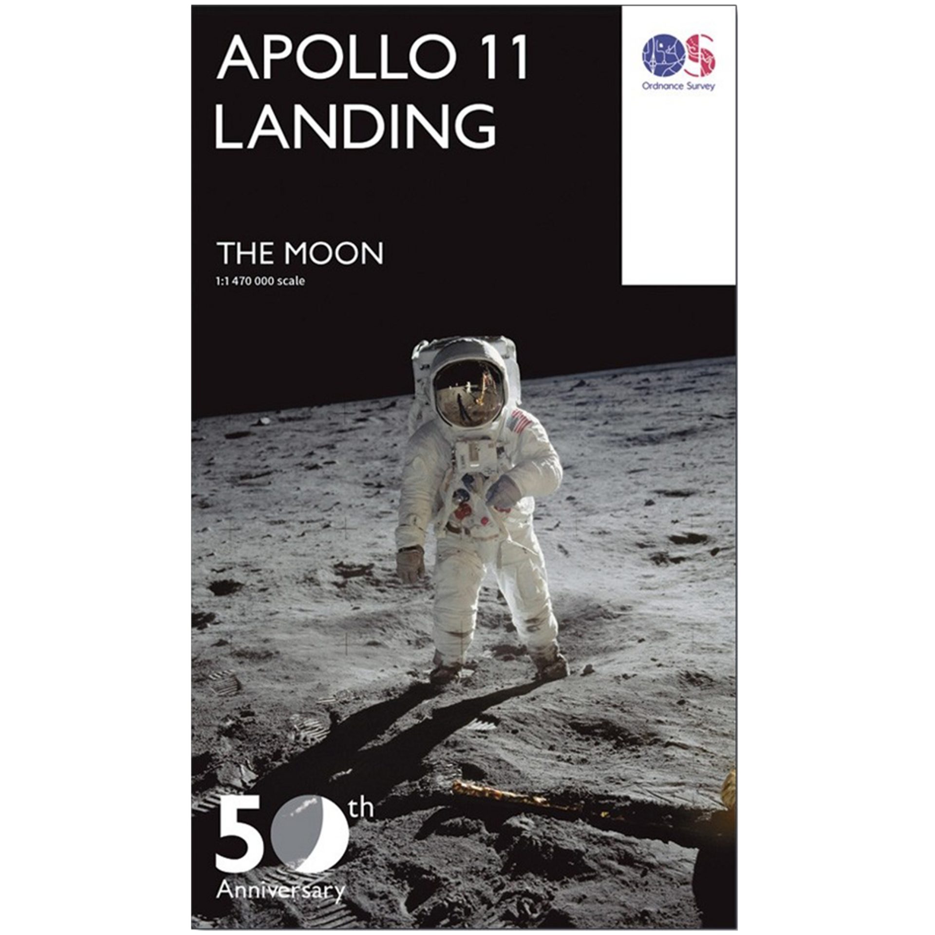
Now here’s a map that’s out of this world! We were thrilled to print the Apollo 11 Landing Map to mark the 50th anniversary of Neil Armstrong and Buzz Aldrin’s first steps on the moon. The unique document has been created with height data provided by NASA and captured by the Kaguya Terrain Camera and Lunar Orbiter laser Altimeter, then shaded to depict heights. On the map you’ll find a large area of the moon’s near surface, centred on where Apollo 11 landed. There are several versions of the map available to buy. We recommend displaying it on your wall, where you can always marvel at the moon.
William Smith 1815 Geological Map
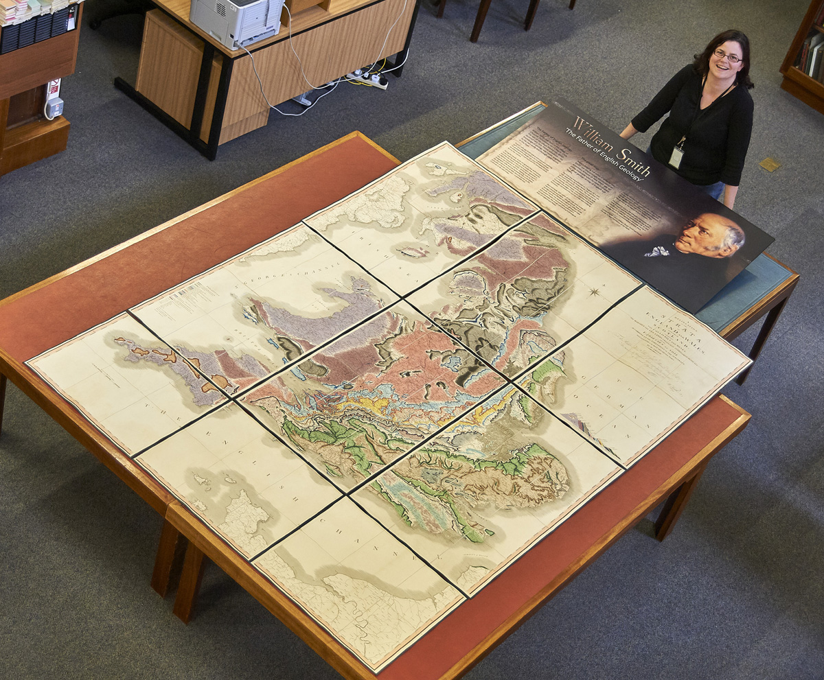
William ‘Strata’ Smith is commonly referred to as ‘The Father of English Geology’ for his ground-breaking 1815 map. We worked with the British Geological Survey to reproduce the renowned document, which mapped the geology of England, Wales and part of Scotland for the first time. Originally, the map was printed in 15 sections, each of which was folded into six panels, due to the limited size of printing presses in the early 1800s. Its original scale was five miles to the inch, making the whole map a humungous eight feet high by six feet wide. Luckily, it was never printed as one sheet! This reproduction has been created at roughly half scale, a more manageable size that still captures the beauty and features of the original map.
Copyright Trustees of the Natural History Museum, London
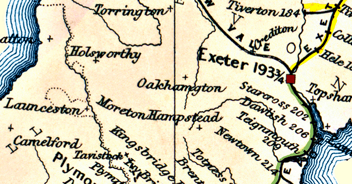
Bradshaw’s Railway Map Great Britain and Ireland – 1852
This large map is a fascinating depiction of railway routes and stations as they were in Great Britain and Ireland in 1852. It’s a detailed reproduction of the rare original, and features enlarged plans of key urban areas, including London, Glasgow and Manchester. We produced the map on 90gsm Progeo paper, a media developed specifically for map printing, giving the Railway Map a high opacity. It’s also durable when folded due to its cross grain – and will last for years to come.

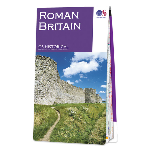
OS Historical Roman Britain
This map offers an important insight into one of the defining periods of British history – Britain under Roman rule. It’s split into North and South sheets covering the entirety of Great Britain, highlighting roads, cities and ancient monuments. Key events, dates and archaeological evidence are featured too. OS Historical Roman Britain includes plenty of information about life in Roman Britain, to immerse you in the period. Get your copy, to be enjoyed in the comfort of your own home or out and about discovering Roman Britain.
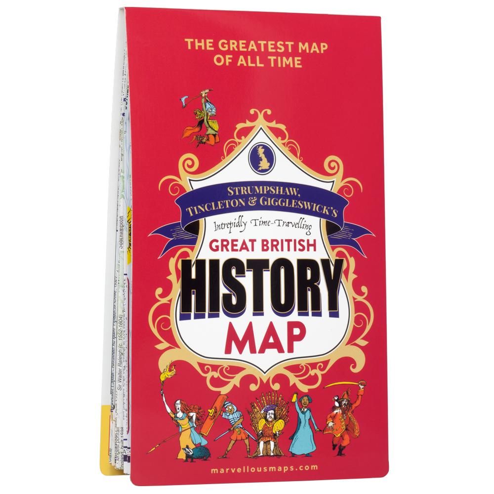
The Great British History Map
Travel back to bygone Britain with the Great British History Map, part of Strumpshaw, Tincleton & Giggleswick’s Marvellous Maps series. From the Viking-plundered north to the Jurassic south coast, it’s full of insights into the past that’ll inspire your future adventures. The full-colour, two-sided map is packed with more than 600 castles, forts, monuments, sacred spots and hives of industry. It brings history to life with 250 must-visit museums, festivals and events, as well. Look out for some timeless trivia too – there are plenty of historical facts to learn. Pick it up for a real blast from the past.
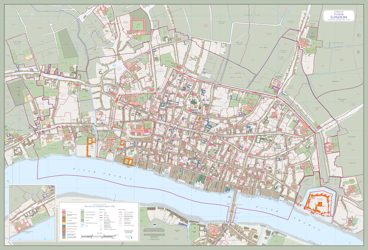
Tudor London The City and Southwark in 1520, Second Edition
Step back in time to London and its suburbs as they were in the early 16th century. The 1520 map captures a long-lost city, before the dissolution of the monasteries, the Great Fire of London, and WW2 bombing, among other events, wiped out many of its buildings. In this best-selling map you’ll find London’s taverns, parish churches, company halls, commercial buildings and houses, contrasted with green fields surrounding the city walls. Flip to the reverse of the map for further details, including a directory of buildings and streets, a map of the city’s wards, and explanations of the map’s historical features. It’s worth noting that it’s a modern map depicting the history of London, rather than a reproduction of an old map.
OS Historical Ancient Britain
Ordnance Survey’s (OS) map of Ancient Britain is packed with ancient archaeological sites and monuments for you to discover. You’ll find a range of places you can visit with the map – Hadrian’s Wall, Sandbach and Offa’s Dyke among them. Use the colours and symbols to delve into different archaeological periods, from the Stone Age to the early Middle Ages – set against a modern map base. The Ancient Britain map has a 1:625 000 scale and is double sided to cover the whole of Britain. Inside you’ll also find lists of museums to visit and suggested reading, should you want to explore Ancient Britain further – which we’re sure you will!

British First World War Trench Maps
We were honoured to help reproduce four British First World War Trench Maps for Ordnance Survey (OS) – a sobering but important project. The trench maps were reissued to commemorate the 100th anniversary of the end of World War One. It’s thought that more than 33 million British maps focused on the Western Front alone were created in the war years, the majority by Ordnance Survey. The trench maps have standard mapping as their backdrop and are overprinted with information such as targets, defences and trenches. The National Library of Scotland played a key role in helping create the reproduction maps. Further information about World War One mapping can be found using its online maps library.

Heritage Cartography Manchester 1845
This is part of a national series of maps of villages and towns in Britain in the mid-1800s, during the Industrial Revolution. The map reflects this period of huge industrial and social change, making it a must-buy for those interested in the era. Early large-scale surveys carried out by Ordnance Survey form the basis of this map of Manchester. You’ll spot plenty of markers of industry, from cotton mills to dye works and coal wharfs. Each map is produced in the style used by early Victorian cartographers, adding to their authenticity. Why not pick up a map of your town or village, to see how it looked at the time?

Read next Walk The Wonders Of Bath
Dennis Maps is one of the leading map printers in the world, producing more than two million maps and charts every year. We offer comprehensive pre-press services, large format print solutions using both large format litho printing and large format digital print technologies, plus specialised map folding and map finishing techniques.
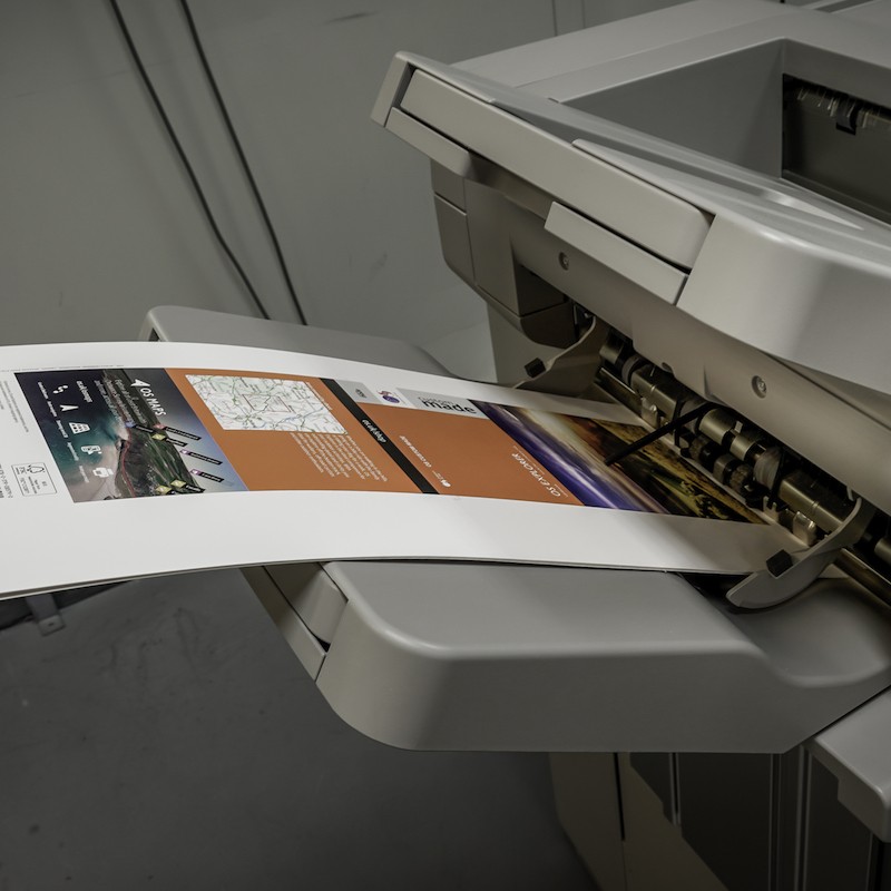
Think BIG, print small
Over the years we’ve become known for our large format digital printing, but did you know we offer small format digital printing too? “We provide a high-quality service that will meet all your small format printing requirements, whatever they may be,” says Roger Gilson, Operations Director at Dennis Maps.
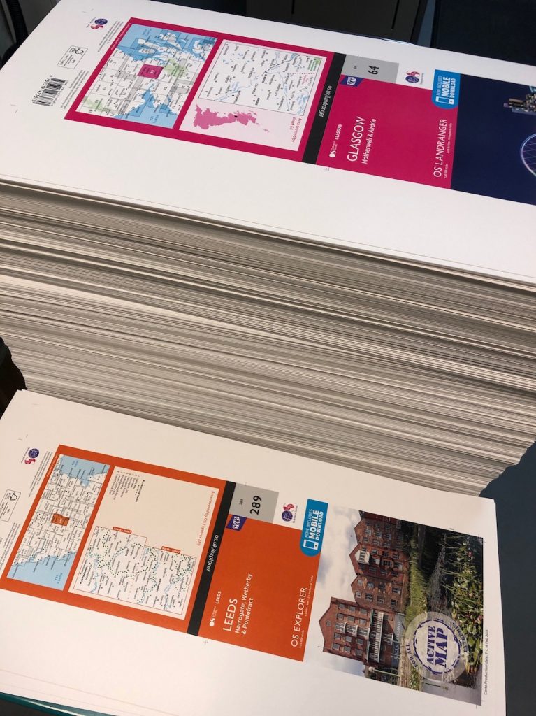 Small format digital printing at Dennis Maps
Our small format digital printing service can create prints from A5 up to SRA 3 (450mm x 320mm) size. For media larger than this we offer large format digital printing and large format litho printing services. We use a high performance Ricoh Pro C7200 printer for all small format digital printing at our Frome factory.
What benefits does small format digital printing offer?
Small format digital printing is a cost-effective choice that offers you plenty of flexibility. Our Ricoh Pro printer produces high-quality prints and is comparable to litho printing technology. The service is available whether you’re looking for a single print or a large print run. There’s a quick turnaround for delivery too, so your prints will arrive before you know it.
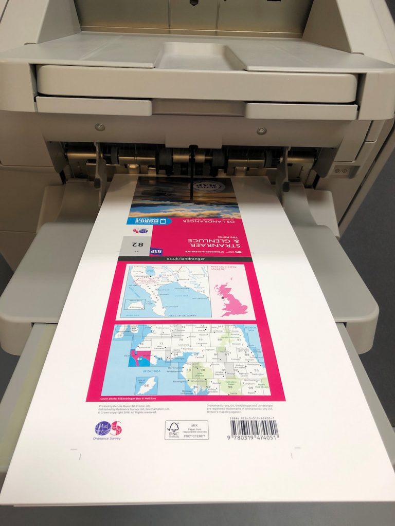 What media can Dennis Maps print on?
We can print on a variety of paper, including matt, silk, gloss and uncoated, in a range of weights up to 360gsm. Unsure which paper to choose? We’re always happy to offer advice.
The perfect finish
We offer a number of finishing options for your printed products, such as lamination, folding and scoring.
A huge array of printed products
Our small format printer can create a huge array of products.
- Small posters – these can be a powerful way to convey a message to clients and a key part of a marketing campaign. If you’re looking for large format posters, we can print those too.
- Business cards – we can print your business cards, so you have them to hand to introduce you and your company to potential clients. You can choose to have them printed single or double sided, and they can also be gloss or matt laminated for added impact.
- Leaflets and flyers – they’re a fantastic way to promote your message, whatever you’re looking to advertise. We can help, whether you want a single flyer or a print run into the thousands.
- Pocket size maps – maps of all sizes are our speciality! We offer small, pocket-sized maps in a variety of papers and sizes, and with different folding options.
- Menus – we can print a range of menus, to display food and drink options to your customers.
Got something else in mind? Then get in touch to see how we can assist you. We’ll always endeavour to meet your requirements. If you’ve got big ideas but want to print small, we’re here to help.
Dennis Maps is one of the leading map printers in the world, producing more than two million maps and charts every year. We offer comprehensive pre-press services, large format print solutions using both large format litho printing and large format digital print technologies, plus specialised map folding and map finishing techniques.