
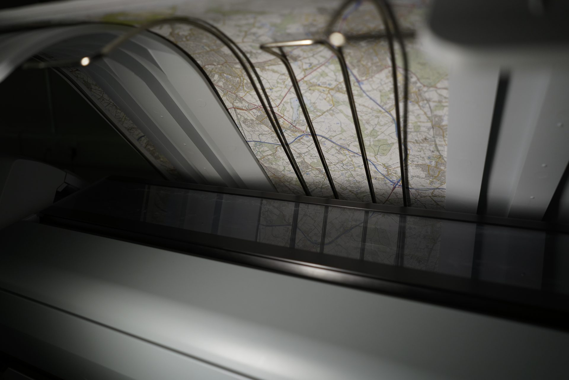
Large format digital printing – when bigger is better
If you’re looking to print something sizeable, our large format digital printing service could be the perfect solution. “Large format digital printing allows our clients to use striking text and images to deliver content with real impact. The communication power of ink on paper should never be underestimated,” says Steve Burry, Managing Director at Dennis Maps. Read on to find out all you need to know about this specialist printing service.
Endless possibilities
There are endless possibilities when it comes to large format digital printing. “The scope of what can be printed onto a large sheet of material is vast,” says Steve. Posters, maps, charts, CAD drawings, canvas prints and self-adhesive films… we’ve printed them all! Something else in mind? Contact us to see what we can do.
A customised service
Whatever you plan to print, we’ll customise our service to meet your unique requirements. We’re completely flexible around your printing needs and will guide you through the process of creating your product from start to finish, whether you want one copy or many more.

Top of the range technology
Large format digital prints are produced on our two Canon ColorWave 3800 digital print devices, which are designed to work with a variety of graphic arts applications. They both benefit from Océ CrystalPoint toner technology, which is much more cost effective than conventional inkjet solutions. With CrystalPoint, prints dry very quickly and can be finished straight away – whether they need trimming, folding or packaging. It’s the perfect option if you need your printing finished speedily.
CrystalPoint creates a durable product that will withstand outdoor use – making it ideal for posters, maps and charts. It’s a sustainable solution too, with no ozone depleting emissions and minimal waste disposal. When you choose our large format printing service you get the benefits of toner and inkjet technology. It really is the best of both worlds.

How CrystalPoint works
CrystalPoint operates on a principle known as Solid In – Solid out, a method that utilises a clean system that doesn’t need any solvents. Instead of ink, our printers use small, solid pearls, which are round to help them easily roll into the printer. Once they reach the printer, they're heated to form a toner gel. The Imaging Devices then fire the gel onto your chosen material. These gel droplets are targeted with extreme precision for a perfectly accurate print. They keep their shape on all print mediums, ensuring a crisp finish that’s free from feathering – which can be a problem in conventional inkjet printing. The toner crystallises on the print material and is then well bonded to the media, for a long-lasting finish.
A wide selection of quality materials
We’ve got a large range of specialist media for you to print your product on and years of experience sourcing these materials from quality suppliers. Choose from a range of FSC-certified papers, including plain paper, map paper, recycled paper and poster paper. We also offer Tyvek (which is waterproof and tear proof), canvas and self-adhesive film. Got another material in mind? Get in touch and we’ll be happy to discuss this.
Alternative printing options
We colour profile our large format digital printers to match our large format litho print quality, so you can choose between the two technologies. Large format litho printing is an excellent option if you’re planning a really large print run. It’s more cost effective for sizeable orders than its digital counterpart.
Looking to print something smaller in size? We print in smaller formats too, with our medium format digital print equipment printing up to SRA 3 (450mm x 320mm). Our Ricoh Pro C7200 printer is perfect for printing products like leaflets and map covers.
Why work with Dennis Maps?
We’re the UK’s premier map printer and can trace our heritage back to 1850. We’ve printed a huge range of products over the years, working with businesses large and small, across the public and private sectors. We’re also proud to be the trusted print partner of Ordnance Survey, Great Britain’s national mapping agency. Our skilled employees have years of experience in the industry and take pride in providing customers with the highest quality products. If you’re looking for a large format digital printing service, we’d love to help. Bigger is better at Dennis Maps!
Big Print Sizes
When you need high quality, large format printing, think Dennis Maps – we can help design and deliver the perfect printing solution for you and your business.
Dennis Maps is one of the leading map printers in the world, producing more than two million maps and charts every year. We offer comprehensive pre-press services, large format print solutions using both large format litho printing and large format digital print technologies, plus specialised map folding and map finishing techniques.

Five podcasts for the adventurous at heart
The weather may be wintry, but we can get plenty of inspiration for adventure, even when we’re indoors. We’ve pulled together our top five podcasts to inspire your experiences in the great outdoors.
Overheard at National Geographic
Ever wanted to be a fly on the wall at Nat Geo? Well now you can be! The podcast’s premise is that it builds on the intriguing conversations overheard at the company’s HQ. Listen in and follow photographers, scientists and explorers as they venture to the furthest reaches of our wonderful world. Join photographer Esther Horvath as she discovers Ernest Shackleton’s lost ship, Endurance, explorer Andrés Ruzo in search of the Amazon’s “boiling river”, or a group of Nepali climbers as they scale “the savage mountain”, K2. Whichever episode you choose, it’ll open up a whole world of adventure.
Listen in on platforms including Amazon Music, Google Podcasts, Apple Podcasts and Spotify
The Dirtbag Diaries
The Dirtbag Diaries began way back in 2007, inspired by the idea of sitting round a campfire sharing tales of adventure. It’s a collaboration between writers, artists, photographers and listeners, sharing stories, both serious and humorous, from wild places. Creator Fitz Cahall says “My goal is to nurture, strengthen and empower connections with the natural world. Simply put, I want people to shut their laptops and turn off their iPhones and go live the life they daydream about.” With more than 300 episodes, you can keep it playing throughout the autumn and beyond, to inspire your next big adventure.
Hear it on Apple Podcasts, Spotify or Stitcher
Living Adventurously
Join Alastair Humphreys, a National Geographic Adventurer of the Year, to hear about ordinary people leading extraordinary lives. Alastair interviews a range of individuals – from artists to students – to find out what living adventurously means to them. He also discovers the universal obstacles that stood in the way of their adventures and how they overcame them. One listener says it will “give you the spark you need to live life more adventurously.” And what could be better than that? If you like what you hear, check out Alastair’s other podcasts – The Doorstep Mile and There Are Other Rivers, too.
Catch it on several podcasting apps and directories, including Spotify, Apple Podcasts and Google Podcasts
OS GetOutside
Ordnance Survey’s (OS) GetOutside podcast delves deep into Britain’s wild places. According to OS, “It’s a podcast so outdoorsy you can almost smell the wood smoke!”. GetOutside is packed with fascinating interviews and plenty of information and inspiration to get you active in the great outdoors. Each episode includes easy steps to help you make your outdoor adventures a reality, whether you’re in search of an epic adventure or a family-friendly outing. Not sure where to start? The ‘Take back your lunch break’ episode is designed for desk-bound dreamers, with advice for a more adventurous lunch break and commute.
Hear it on platforms such as Apple Podcasts and Google Podcasts
The Adventure Podcast
Episodes are delivered as long-form conversations with pioneers in discovery and exploration. Matt Pycroft, a filmmaker, presents the podcast and speaks to guests ranging from Arctic scientists to mountaineers, and everything in-between. Catch episode 78 with Sean Conway – who’s cycled across Europe and swam the length of Britain – for some serious inspiration. Then listen in to episode 57, to find out more about Ben Saunders, who broke the record for the longest polar venture by foot. Been describes what motivates him, giving listeners plenty of food for thought.
Listen to the Adventure Podcast on Soundcloud, Spotify, iTunes and Stitcher
Looking for something more specific? Then check out the podcasts below.
Hiking: Hiking Thru, Hiking Unfiltered, The Training For Trekking Podcast, The Distance Hiker Podcast
Running: Marathon Training Academy, Running for Real
Cycling: Bikes & Big Ideas, The Cycling Podcast
Water sports: Wild Swim Podcast, The Joy of SUP – The Paddleboarding Sunshine Podcast
Dennis Maps is one of the leading map printers in the world, producing more than two million maps and charts every year. We offer comprehensive pre-press services, large format print solutions using both large format litho printing and large format digital print technologies, plus specialised map folding and map finishing techniques.
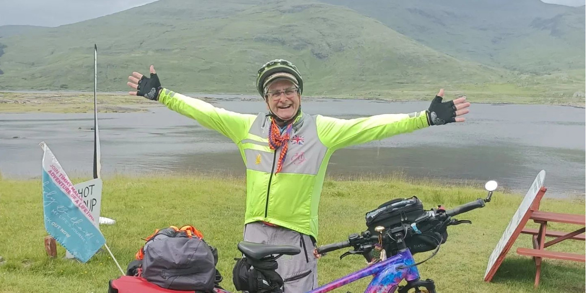
“It’s about seeing where my curiosity takes me”
Timmy Mallett’s curiosity has certainly taken him far – 4,730 miles, to be exact. He’s spent 118 days on his bike circumnavigating Britain, finishing his epic ride in August. Timmy is well-known as the star of 80s and 90s TV and radio shows, a lead in pantomimes and a talented artist. Now he’s famed for his incredible journey, too.
It was a paper map at home that sparked the idea for his adventure. It’s filled with dots, marking where he’s performed in shows across Britain, but there are still some gaps to fill. “I started thinking, that’s different, that’s interesting, what would I find if I was to go there?” explains Timmy. Ultimately, it was about seizing the day, an attitude inspired by his late brother Martin. “For Martin every day was the best day ever. He had Down’s syndrome and lived every day in the moment,” says Timmy. “My way of being in the moment is to cycle and to look at things to paint.”
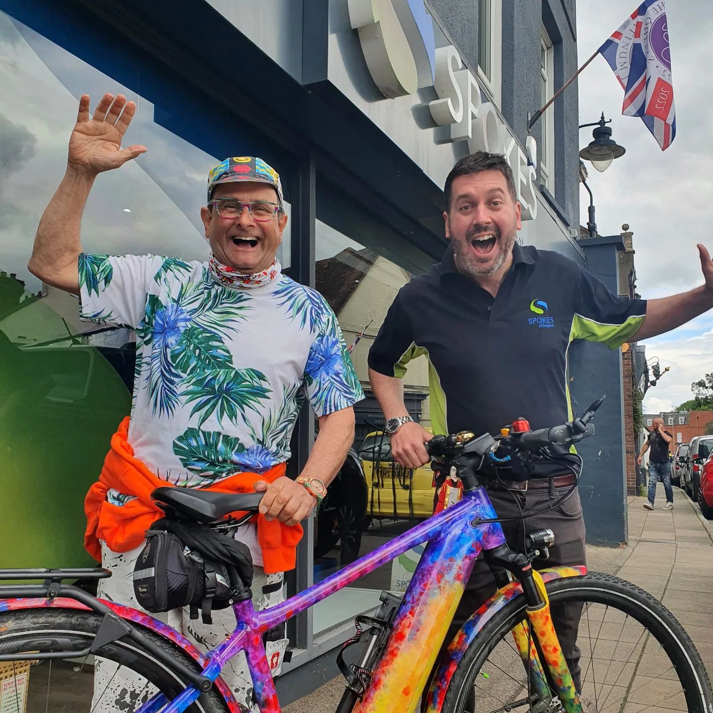 Packing up his paint brushes, Timmy set off from Paddington station on a sunny morning in March. Gazing at the Thames, he knew the next time he saw the river would be when his circumnavigation was complete, a “wonderful” feeling. From London, he travelled south-east, then south around the coast, making his way around England, Wales, Scotland and then England again, before returning to Paddington last month. Timmy travelled on a characteristically colourful e-bike, which he painted himself with the help of a specialist company. The TimmEEEE bike is anything but boring, with its rainbow of colours, sparkle and picture of the iconic Pinky Punky.
With a life-long love of cycling, Timmy’s got several long-distance bike rides under his belt, and plenty of experience with regular bikes, as well as electric ones. He’s biked through Northern Ireland, Lincolnshire and Cumbria. He also took on the challenge of cycling the renowned Camino de Santiago pilgrimage route, charting the experience in his Utterly Brilliant! autobiography. Timmy’s circumnavigation of Britain is his biggest adventure yet though, and one he took the time to prepare for. He chose his bike carefully – opting for a Giant Explore E+ 1 bike – and did plenty of training rides too.
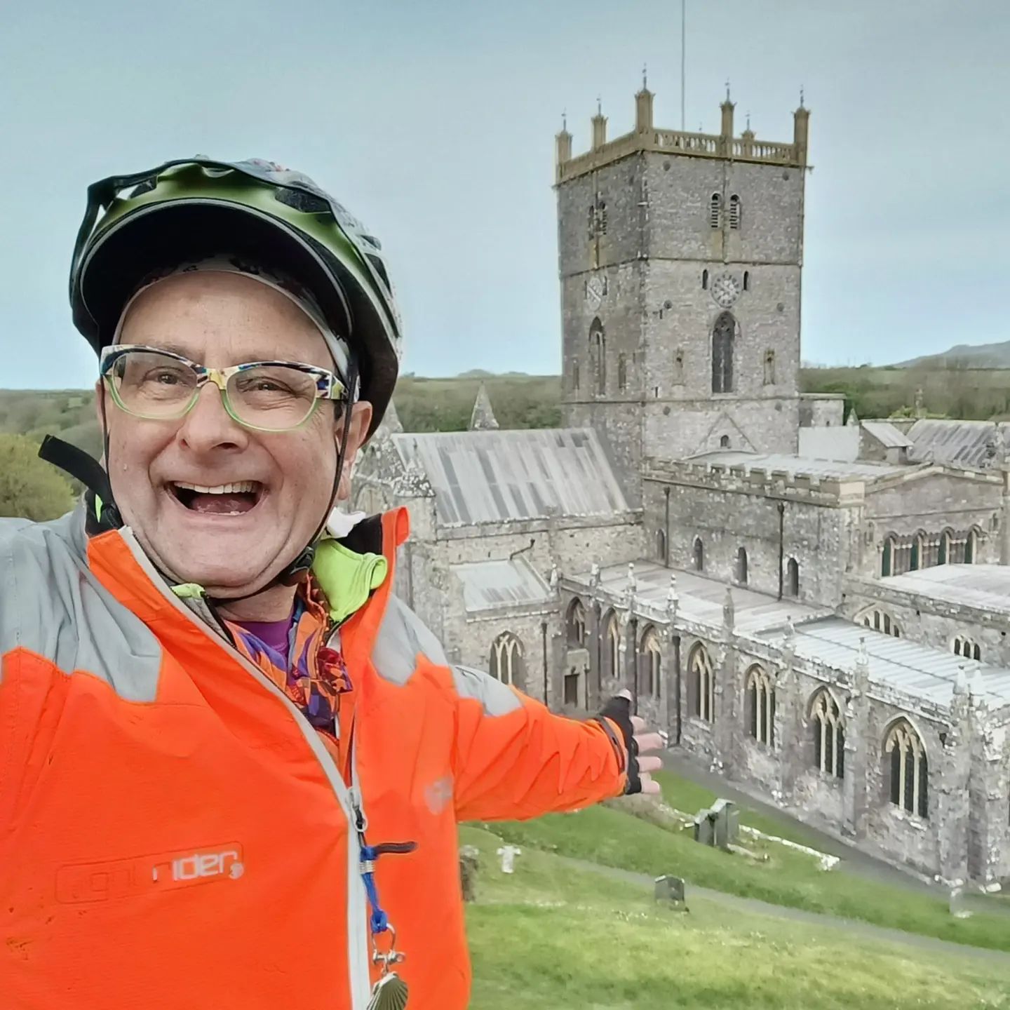 Navigating his way around Britain was quite a feat but one he achieved with the help of printed and digital maps. Ordnance Survey created six different A4 books of maps, customised to cover Timmy’s entire journey. Each day, he would use these to plan and tweak his route. When he finished a map, he’d send it home and start on the next one. “I’ve kept the OS maps and I’m delighted with them,” enthuses Timmy. Along the way, he also used Komoot to plot his route and transfer it onto his bike GPS, Wahoo. Strava came in handy as well and let fans follow his journey.
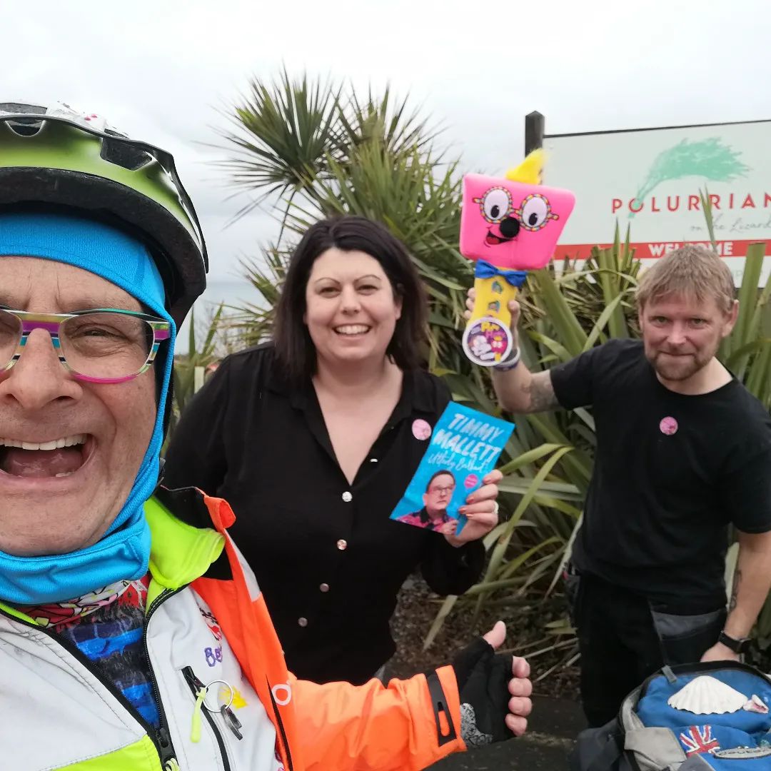 He decided to brave the ride without the safety net of a support team. But he wasn’t without good company, enjoying encounters with friends, family and fans along the way – both planned and unexpected. In Norfolk, he met fans who’d driven two hours to find him and offer their support. At Fraserburgh, he went for a sunset swim with a group of wild swimmers. In Duthie Park, Aberdeen, a long-time fan flagged him down with a Pinky Punky. “Very quickly, I made it a rule that I would always stop,” says Timmy. “The journey has strengthened my love of this country because of the smiles and reactions I’ve had along the way.”
Timmy wasn’t in a rush and savoured all the moments of his venture, both big and small. “One thing I was clear on is that it’s not a race,” says Timmy. “Less is more!” He set off with the idea of cycling 40 miles per day but quickly reduced this to 30-35 miles per day, with plenty of rest days and some visits home. Timmy extended the length of the circumnavigation and would venture down extra routes if they caught his interest. “It’s about seeing where my curiosity takes me,” he says.
It’s this curiosity that led him to explore Britain’s coastline, from tourist hotspots to forgotten corners of our islands. He describes North Wales as “absolutely fantastic”, parts of Lincolnshire as “glorious” and the coast of Fife as “really lovely” but will not be drawn on his favourite part of the journey. “I’m hesitant to say I’ve got a favourite place because there’s an opposite to that and that’s a least favourite. I wouldn’t be that rude to somewhere!” What he will say is that even in places he thought he wouldn’t enjoy there was always something to celebrate. “This is a gobsmackingly beautiful country, and every single bit has got something joyous”.
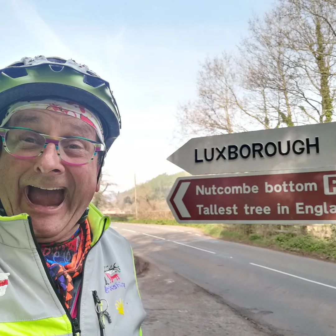
That’s not to say the circumnavigation wasn’t without its challenges. The Highlands could be remote and lonely, despite their beauty, while the hills between Cornwall, Devon and Somerset were physically hard. Frustrations could also arise with flat tyres and cycle paths that led to nowhere. Yet despite it all, Timmy pushed on. Certain points on his journey were milestones to celebrate. Noticeable corners of Britain stood out for him, from Ness Point to Lands’ End and Cape Wrath. “These compass points have a certain magic, that reminds us how brilliant it is to attempt something and to succeed.”
He also achieved an impressive feat with his artwork. Incredibly, Timmy sketched on every day of his journey. The result is a unique catalogue of Britain’s coast, that he plans to keep working on for some time. He was inspired by painters that had gone before him, John Constable, J M W Turner, and L S Lowry, to name a few. Timmy would often stand in the same spots they once frequented, looking at the same “sublime” views. He would turn his sketches into paintings there and then or work them up in his accommodation on an evening, before posting them home.
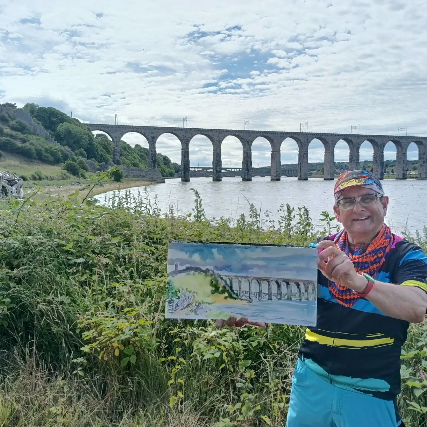 Now he’s back, he plans to turn the watercolours and pictures into bigger oil paintings, which he’ll be doing for “quite some time”. And what about his next adventure? “I’ll have to have a discussion with Mrs Mallett!” he laughs. If his many bike rides are anything to go by, it won’t be long until he’s back in the saddle. Whatever he comes up with next, we’re sure it’ll be utterly brilliant.
All images © Timmy Mallett
Dennis Maps is one of the leading map printers in the world, producing more than two million maps and charts every year. We offer comprehensive pre-press services, large format print solutions using both large format litho printing and large format digital print technologies, plus specialised map folding and map finishing techniques.

How to protect the planet on a walk or hike
Many of us enjoy walking and hiking but how much thought do we give to protecting the planet when we’re out and about? Here are our top tips on how to care for the area you’re visiting and the wider environment too.
Drive down your emissions
Why not pick a route that’s close to home so you can walk there and back? Bonus points for the extra exercise! Check out Slow Ways for plenty of inspiration on local walks. It’s a project that’s plotted routes connecting Britain’s villages, towns, cities and national parks. If you want to go further afield, consider walks or hikes you can get to by bike or public transport. You could even car share with others going to the same destination. Liftshare and GoCarShare are websites where you can find passengers and drivers to share journeys with, cutting CO2 emissions.
 Care for outdoor clothing and footwear
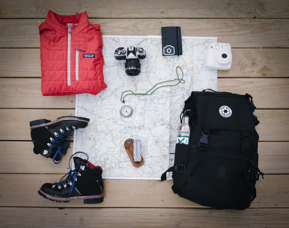
Make your outdoor clothing and footwear last longer by following care instructions, e.g., washing clothes at 30 degrees or waxing walking boots. If you no longer need outdoor items, donate them to friends, family or charity so they can be used again. In need of extra gear? Make it second hand. “Charity shops and online auction sites are amazing for buying kit,” Sam Knight, from Ramblers Scotland, told us in a recent blog post. Check out eBay, plus Vinted, Gumtree, Facebook Marketplace and Facebook Groups. You never know what you might find! Part of a walking group? Sam suggests getting hand me downs from other members of the group. If you prefer your clothes new, source them from an ethical company, so they protect you and the planet.
Crack the code
Make sure you follow the Countryside Code if you’re walking or hiking in England or Wales. In Scotland, it’s the Scottish Outdoor Access Code. Both advise you how to care for the environment and enjoy the outdoors responsibly. It’s worth reading the relevant code in full, but here are some key points:
- Stick to marked paths, to protect wildlife and crops.
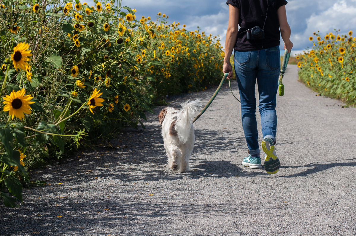
- Remove any dog waste if your four-legged friend is walking with you.
- Be careful not to stand on young trees.
- Don’t light fires and only set up BBQs in designated areas.
 Clear up any litter
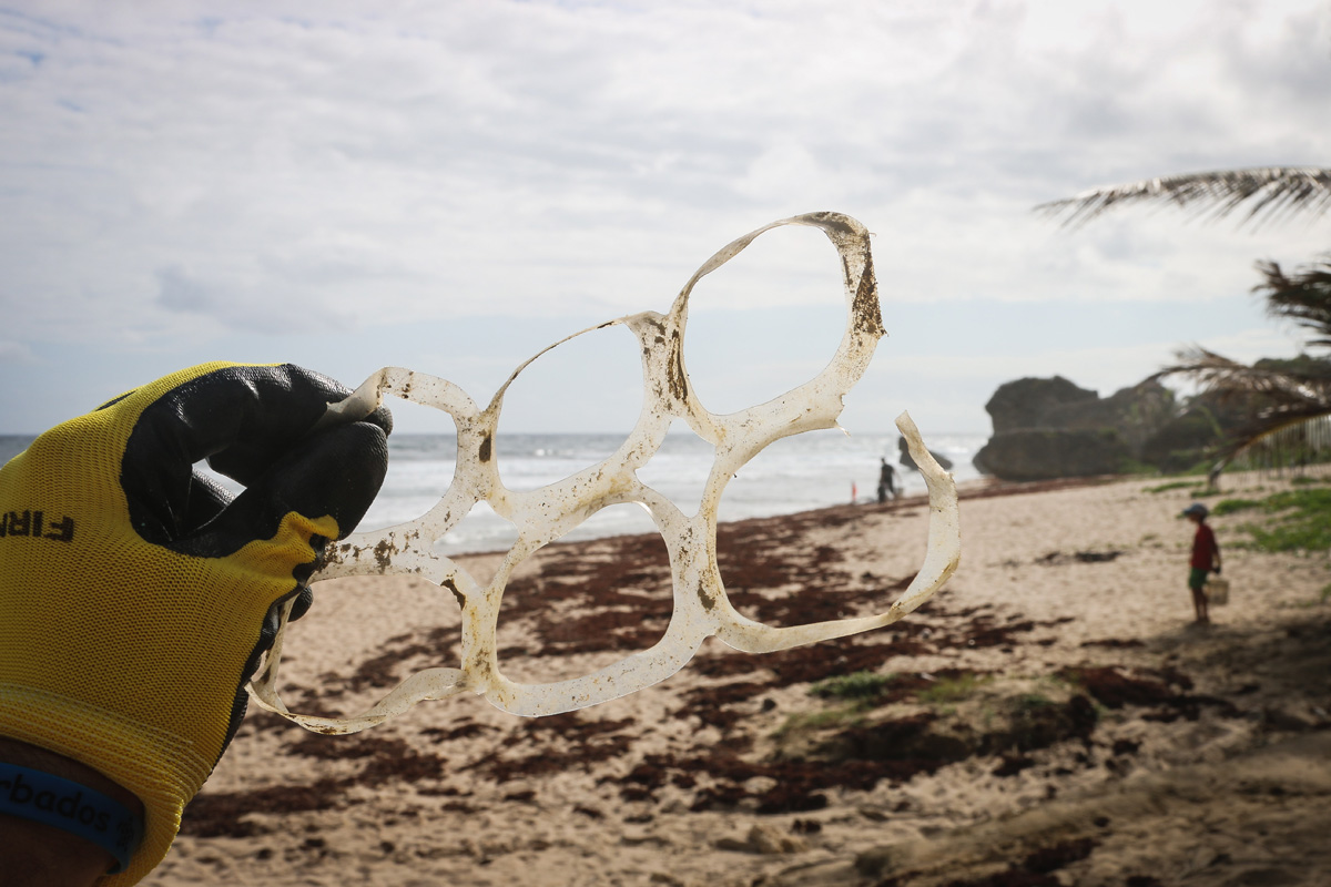
Make sure you don’t leave any litter or recycling on your walk or hike. Sam Knight suggests going one step further and doing a two-minute litter pick as well, to leave the area in a better condition than you found it. If you’re planning a coastal walk, you could combine it with a group beach clean. The Great British Beach Clean takes place Friday 16th – Sunday 25th September, with beach cleans organised across the UK. As well as removing litter, you’ll record the rubbish you find. The results will help the Marine Conservation Society – which runs the event – campaign for environmental action. Find your nearest beach clean.
Go green with your map
You can protect the environment when choosing a map for your walk or hike, too. Dennis Maps is the official print partner of Ordnance Survey and prints a huge variety of maps for other organisations as well. All our map paper and cover boards are carbon balanced, with emissions offset through a World Land Trust programme and Climate Partner. On top of that, we use vegetable-based printing inks and FSC© certified paper and card. Our waterproof and weatherproof maps are incredibly durable but can eventually be recycled too.
 Make your food and drinks eco friendly
Up to 10% of greenhouse gas emissions globally are linked to food that isn’t eaten, according to the UN environment programme. We can all help reduce this. If you’re bringing a picnic for your walk or hike, check out apps Olio and Too Good To Go, where you can pick up surplus food locally and tackle food waste. Pack reusable cutlery and packaging, like beeswax wraps, for extra eco points. Choose a reusable bottle for drinks when you’re out and about, too. There’s also a handy app called Refill to help you sip sustainably. On it, you’ll find the locations of over 274,000 Refill Stations where you can top up your water bottle for free.
Dennis Maps is one of the leading map printers in the world, producing more than two million maps and charts every year. We offer comprehensive pre-press services, large format print solutions using both large format litho printing and large format digital print technologies, plus specialised map folding and map finishing techniques.
Discover Slow Ways around Britain
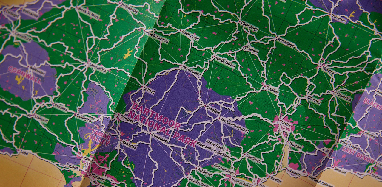
There’s something special about Slow Ways – it’s a giant citizen geography project that’s seen thousands of volunteers record walking routes connecting Britain’s villages, towns, cities and national parks. Routes are graded by difficulty and often connect to public transport hubs, to help with accessibility. What started as a website has evolved into print, with the first Slow Ways Journey Planner hot off the printing presses. It’s made up of beautifully illustrated maps created by the Community Interest Company and Dennis Maps’ customer Urban Good. We catch up with Dan Raven-Ellison, Founder & Chief Exploration Officer at Slow Ways, to find out more about the national walking network
Why did you call the project Slow Ways?
It’s about going the slower way and enjoying the benefits of that. There’s the whole Slow Movement – which promotes taking our time to notice and connect with the environment and each other – and it’s part of that too. We don’t always need to be in a rush. There are so many rewards from investing in a walk, run or bike ride rather than jumping in a car.
How did Slow Ways get started?
It really got going just before the first lockdown. I’ve always done lots of walking and started to realise that many things could be better about Britain’s walking routes. We should be able to walk between neighbouring villages, towns and cities, but there are barriers in the way. When you drive, signs give you directions but when it comes to footpaths there’s an expectation you can find your own way. In 2020, we started asking volunteers to design Slow Ways routes and add them to our website for others to try. Since then, we’ve crowdfunded to create the Slow Ways Journey Planner, which beautifully maps all these routes.
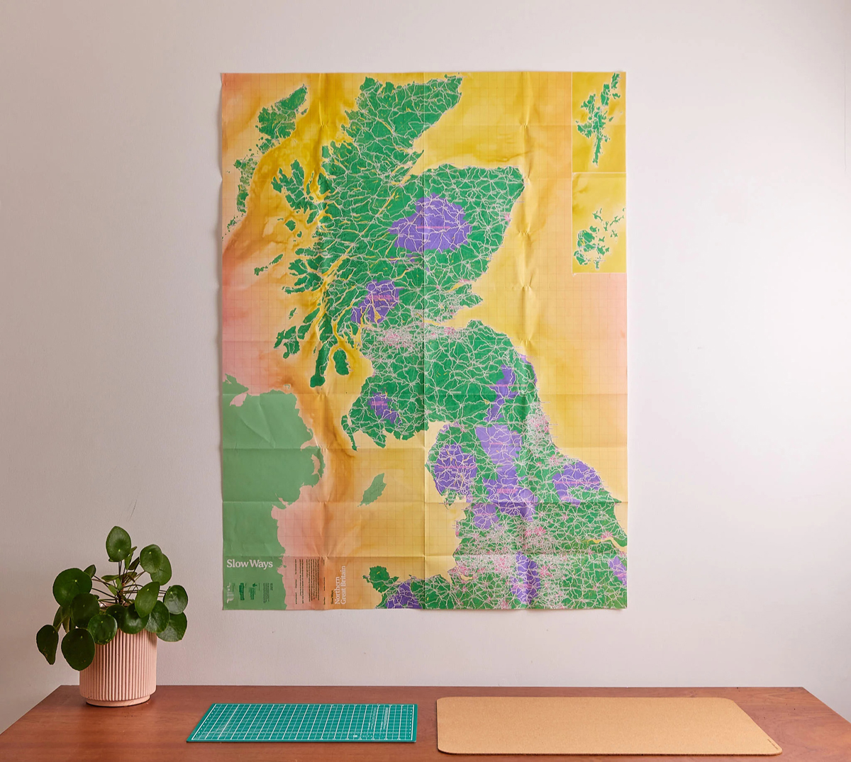 What makes Slow Ways so special?
It’s not just a network of routes. It’s about hope, aspiration and possibility, not just in terms of where you go on a route, but conversations you might have, creative thoughts on your journey or connecting to a community in new ways. It’s about uniting people across Britain to map an inspiring network of paths. Each of the lines on the map can be looked at literally, but what I love is that every line represents the ideas, blisters and determination of the volunteers who mapped and checked them. There’s so much community and heart in each line.
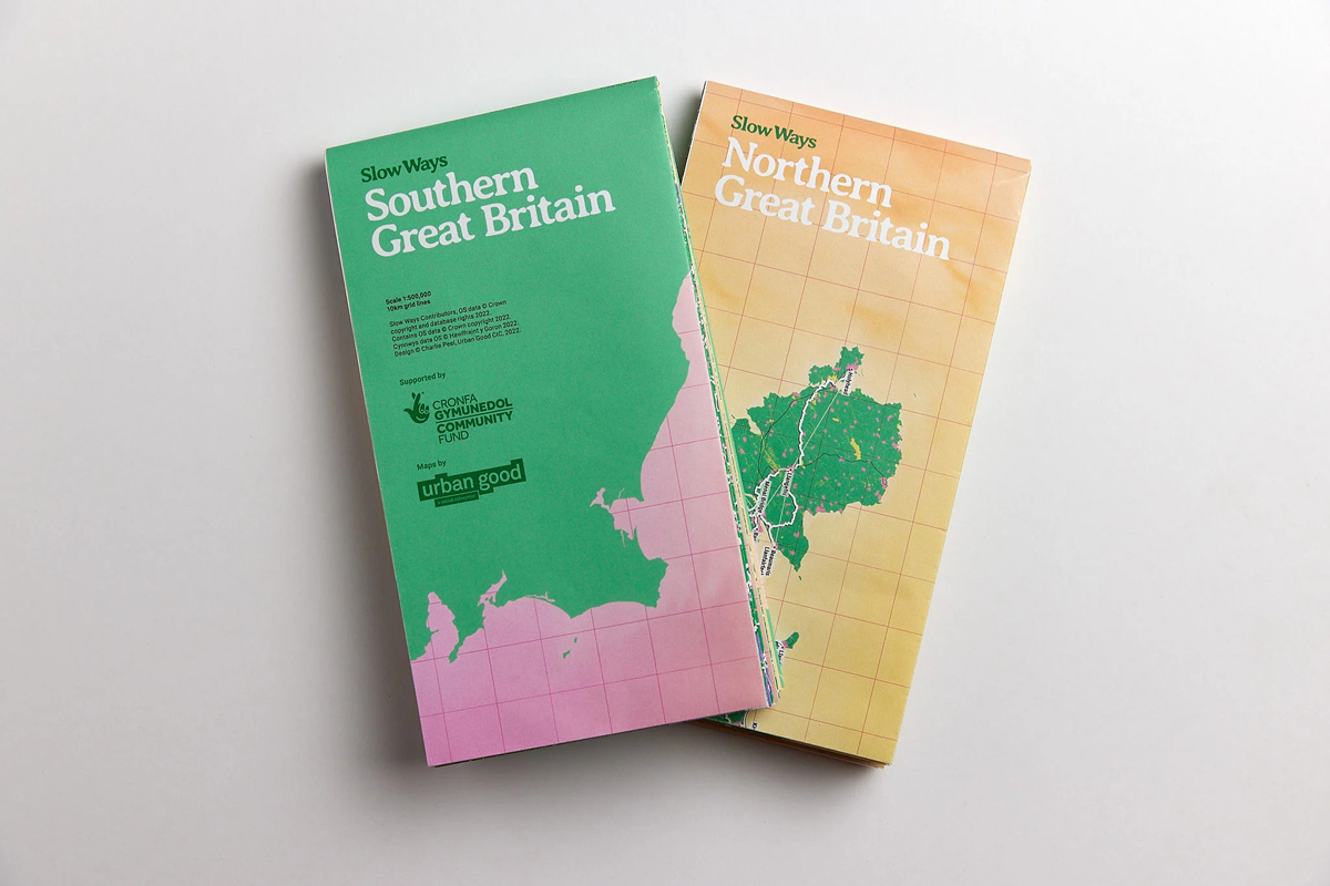 How did you decide to have two maps and a 1:500,000 scale?
There are well over 2,000 settlements and more than 8,000 routes covering 120,000 km of Britain. All these routes are important. Once you get to a smaller scale you lose important detail. If we went down to one map, we couldn’t show routes in urban centres either.
 Tell us more about the Journey Planner…
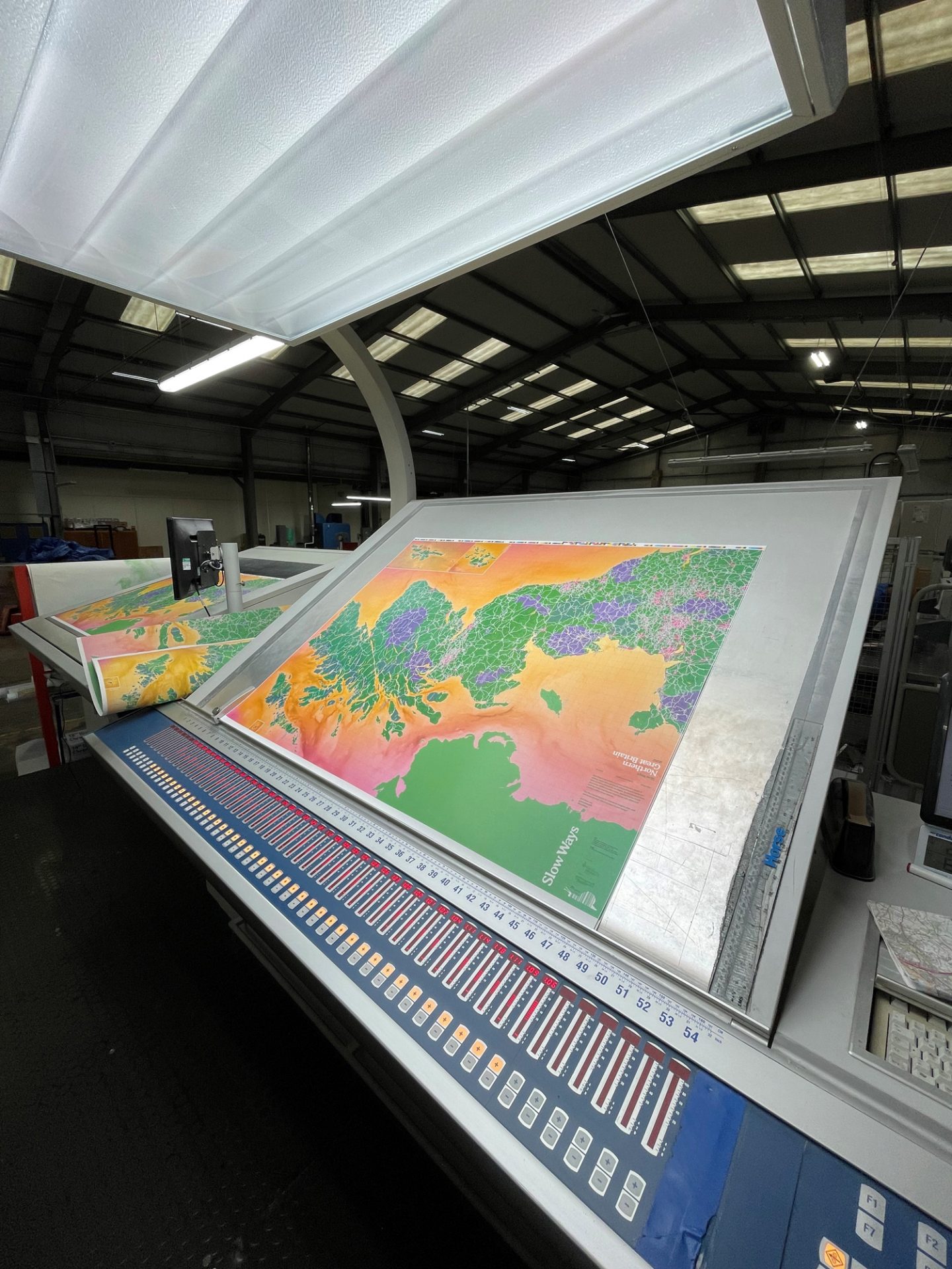
The maps are really a collaboration between Charlie Peel at Urban Good and our volunteers. They came off the printing presses last week and are available to pre-order. There’s something so beautiful about getting everyone’s contributions into printed resources. The Journey planner has two maps – a north map and a south map. Orkney and Shetland are cut-outs and pull-outs from the north map. We wanted to highlight where they are, their geography and to honour them. Charlie designed the maps to feature white routes, so you can colour them in when they’re completed.
 Did you experience any challenges creating the maps?
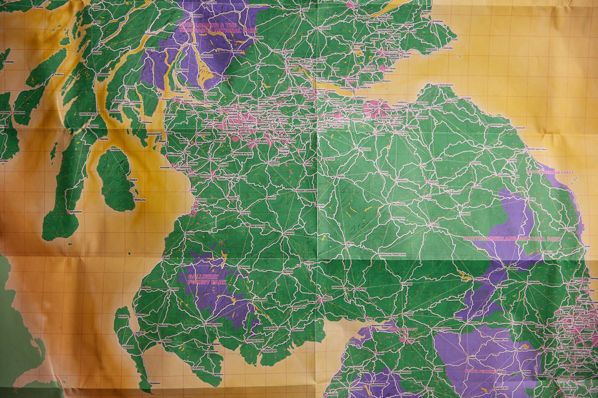
On the aesthetic side, we had to figure out how to make the routes pop on the maps, so Charlie designed white lines outlined by black ones. It was hard to get the colours right overall too. They had to be visually striking but practical. There were challenges around scale as well. It’s a planning map so people can see the whole network, but the scale needs to be easy to understand. Charlie also rotated the south map so it’s a landscape map, and overlaps with the portrait north map, so everything can be seen clearly. There were a number of design challenges, but we found unique solutions!
What stage of the project are you at now?
Now we’re at the stage of getting volunteers to check the routes others have recorded, to make sure they’re good enough to be in the network. We’re looking for people from every single place in Britain to help us. The maps show all the proposed routes, that we need to walk, check and review. It’s a network of possibilities and we need to check them all.
How have volunteers added their own spin to journeys?
There are so many examples! David is walking from Brighton to New Brighton, near Liverpool on Slow Ways Routes but he’s doing it in chunks. Then there’s Ingrina, who’s written about being a woman walking on her own from London to the South Downs National Park. You can find plenty more stories on our website.
Slow Ways aims to get its maps to teachers, schools, colleges, key politicians, decision makers and influencers across the country too. Why do you think this is so important?
We want to show policy and decision makers what’s possible and to inspire them to support what we’re doing. We’d like them to share our aspiration of having a national walking network that inspires and supports people who use it. That means having paths and routes people can trust, with lots of good data, maps and signage. Maps are an incredibly inspiring way for people to connect with ideas like this. Teachers can sign up to request a free pair of maps for their school, college or university on our crowdfunding page. If you want to have a big map of Britain on a wall, why shouldn’t it be of walking routes rather than roads?
Is there anything exciting coming up for Slow Ways?
We’re planning to produce our south map in Welsh and our north map in Scottish Gaelic. We’re not aware of many maps like the ones we’re doing in these languages, so we’re really proud of this. Without a doubt, we also want to look at options for bigger maps too, so we can zoom in closer to the landscape. The maps are constantly evolving. The plan is for Slow Ways to be immortal!
 Get involved
Check out the Slow Ways website to submit a new route, or to test an existing one. There are thousands across Britain to choose from! You can also join in the conversation on social media using #SlowWays.
Dennis Maps is one of the leading map printers in the world, producing more than two million maps and charts every year. We offer comprehensive pre-press services, large format print solutions using both large format litho printing and large format digital print technologies, plus specialised map folding and map finishing techniques.
The best long-distance walks in Britain
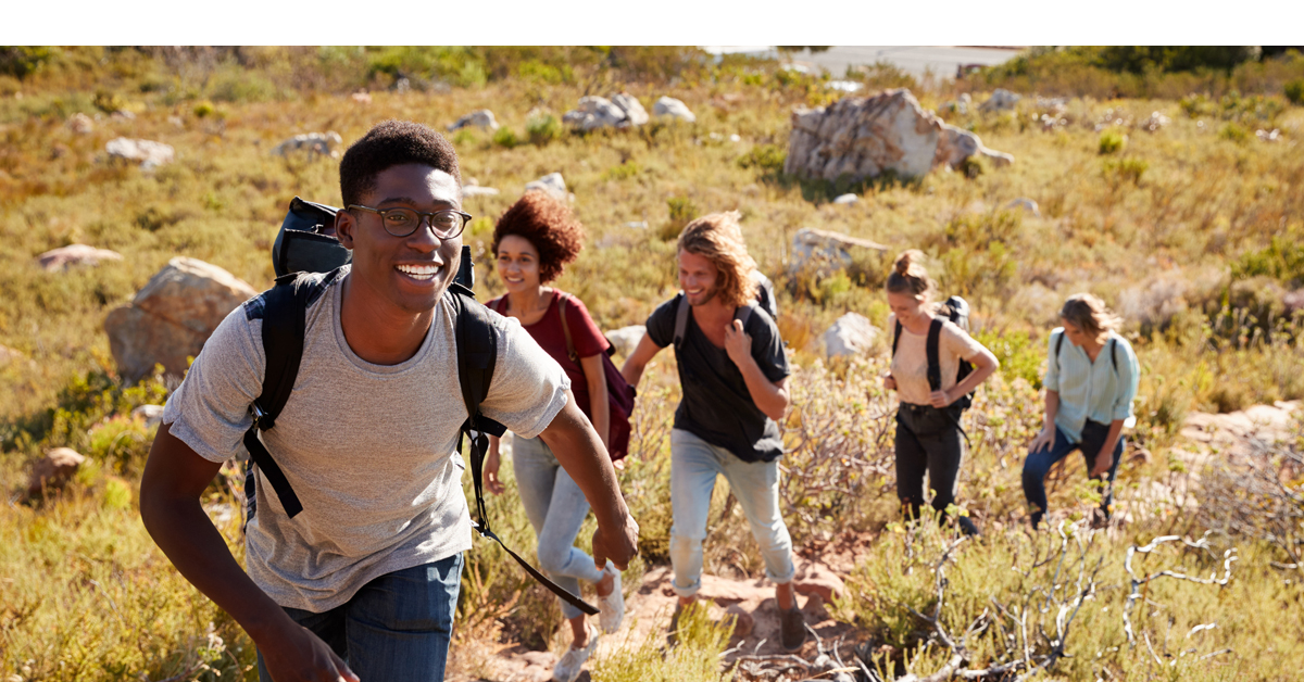
With warmer weather here, it’s a great opportunity to get out on a walk or hike. Why not try a long-distance route in England, Wales or Scotland when the weather is fine? From the Coast to Coast to the West Highland Way, there are loads of walks to explore. We’ve rounded up five of our favourites.
Wales Coast Path, Wales
Length: 870 miles
Not to be missed: Stroll along the golden sands of Tywyn beach, visit the magnificent Conwy Castle, and stop by the country’s longest pier at Llandudno.
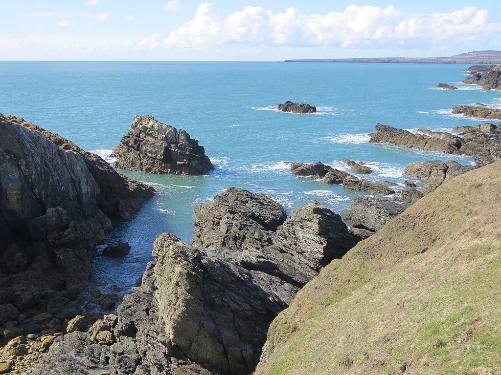
“The coastal path is one of the crowning glories of Wales,” says First Minister, Mark Drakeford, and we agree. The Wales Coast Path covers the country’s entire coastline – an incredible 870 miles. It’s the first continuous route along a country’s coast in the world, making it something quite special. The path begins – or ends – in Chepstow, Monmouthshire and travels north to Queensferry, Flintshire. It can be challenging with lots of ascents and descents – it rises and falls almost 96,000 feet altogether, almost three times the height of Everest. But it’s worth the effort. The award-winning route passes 16 castles and 100 beaches along the way, so there’s plenty to hold your interest. This year marks the path’s tenth anniversary, with lots of events being held to celebrate. Find out What’s on.
Plan your adventure with Wales Coast Path Map
Coast to Coast route, England
Length: Around 190 miles
Not to be missed: Try the “best gingerbread in the world” at Grasmere, check out the mysterious Nine Standards, and enjoy a steam train ride at Grosmont Station.
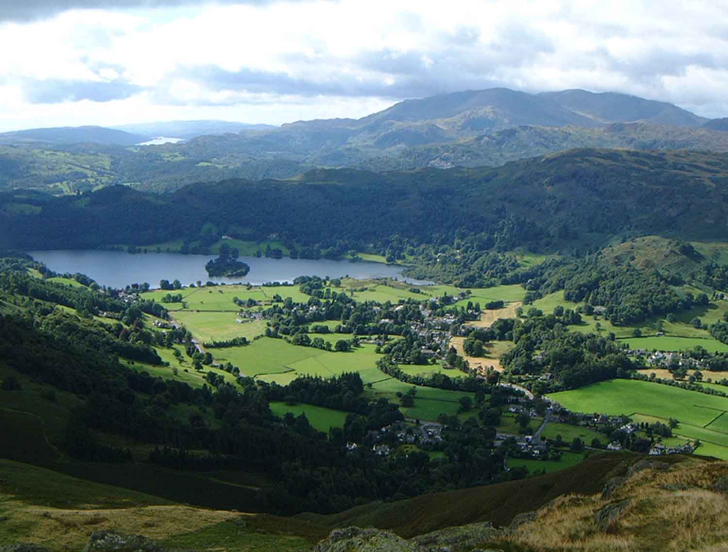
The Coast to Coast route begins by the Irish Sea at St Bees, Cumbria and ends by the North Sea at Robin Hood’s Bay, North Yorkshire. Don’t forget to dip your boots in the sea at the start and end of the route – it’s a tradition. The walk isn’t one path but many routes that together forge an epic course across the north of England. The Coast to Coast winds its way through three national parks – the Lake District National Park, Yorkshire Dales National Park and North York Moors National Park – making for some stunning and varied scenery. The route can be walked, cycled or even ran, if you’re feeling energetic! Lots of sections aren’t signposted so bring along your compass and map.
Look up your route with OS maps or Harvey Maps Coast to Coast map
West Highland Way, Scotland
Length: 96 miles
Not to be missed: Have a wee dram of whisky at the Glengoyne distillery and take a break at Weir’s Rest picnic spot. Get a picture with the Sore Feet statue in Fort William, to mark the end of your journey.
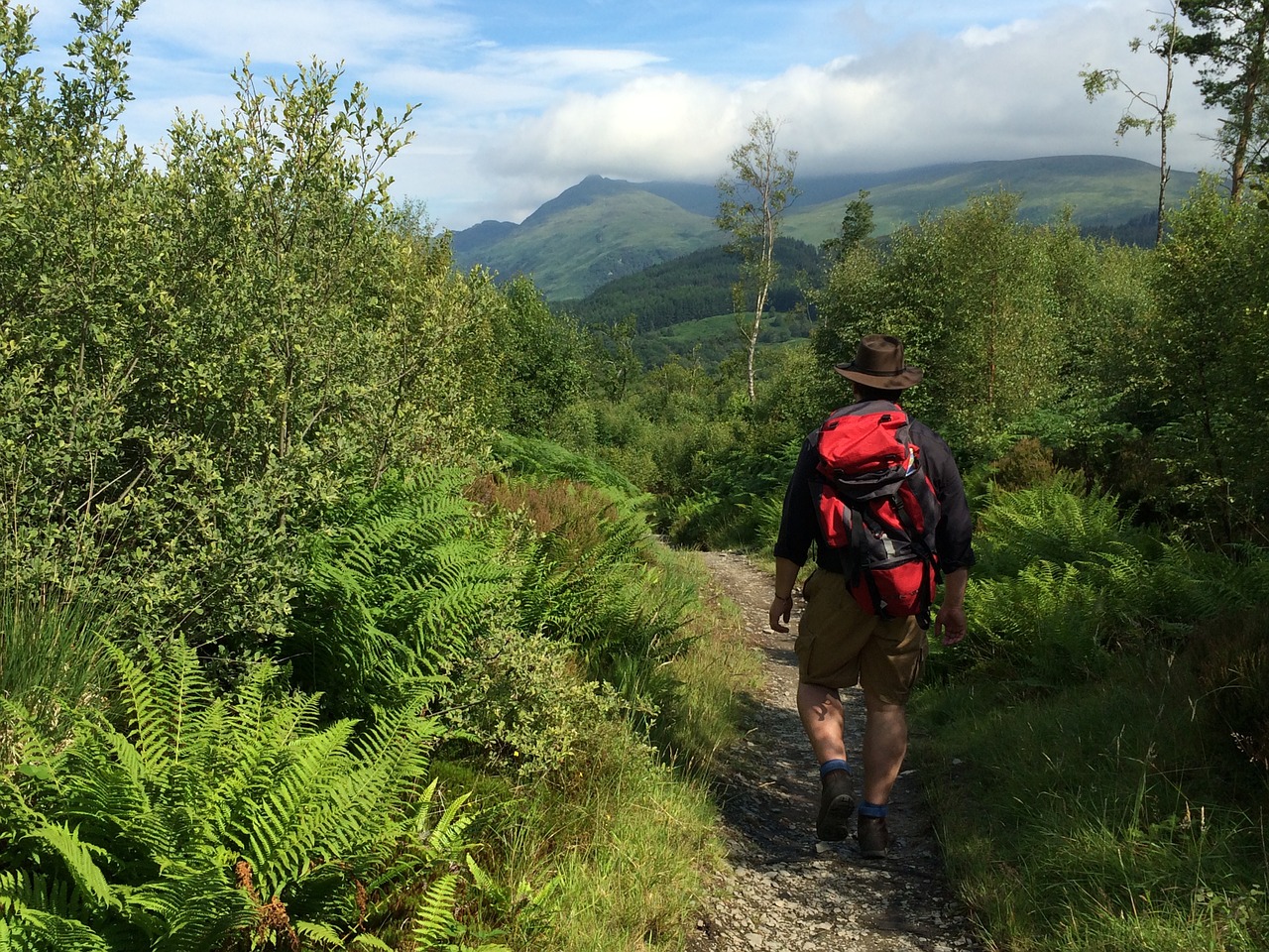
Looking for a walk with stunning scenery? Then look no further. A Tripadvisor review calls the West Highland Way “a spectacular way to experience the Scottish Highlands” and it really is. Starting at Milngavie, near Glasgow it travels north through the famed Highlands to Fort William. When it opened in 1980 it became the country’s first official long-distance footpath and it’s been popular ever since. It’s easy to see why people are drawn to the route, with its moors, mountains, forests and glens. You can even climb several Munros – Ben Lomond, Buachaille Etive Mòr and the famed Ben Nevis – on your journey. Luckily, easier routes are available too! Stop by Inversnaid Waterfall and the Falls of Falloch as well. Both add an air of drama to the landscape. And keep an eye out for wildlife. You might spot golden eagles, wild goats and red deer en route.
Offa’s Dyke Path, England and Wales
Length: 177 miles
Not to be missed: Browse for second-hand books in Hay-on-Wye. Further north, visit the Pontcysyllte Aqueduct & Canal, an awe-inspiring ‘stream in the sky’.
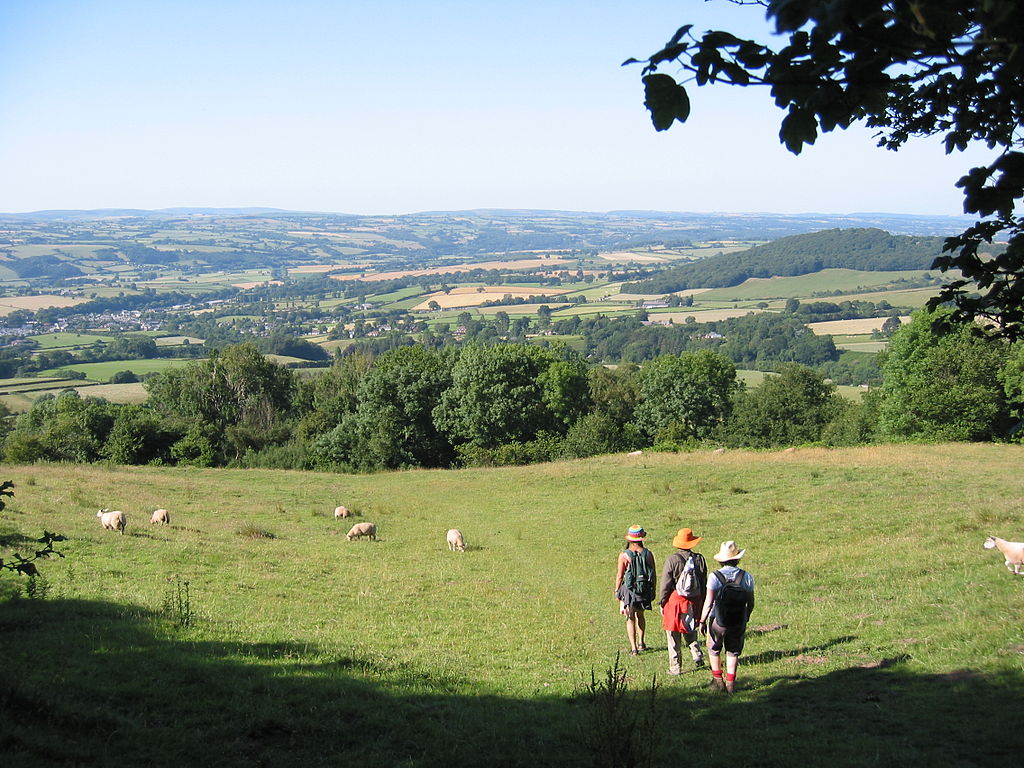
You’ll feel history come alive along Offa’s Dyke Path, one of England and Wales’s renowned National Trails. The route follows the border between the two countries, and Offa’s Dyke, the longest ancient monument in Britain. The Dyke was likely built by Offa, King of Mercia in the 8th century to safeguard his kingdom. “Much of the Dyke is still traceable along the 80 miles from the Wye valley to Wrexham,” according to Offa’s Dyke Association. The Dyke isn’t the only history you’ll experience on your walk either. The trail offers many tantalising glimpses into the past. Look out for Chepstow Castle, a testament to Norman might, the ruins of Tintern Abbey, and the medieval Powis Castle. Offa’s Dyke Path runs from Sedbury Cliffs, close to Chepstow, north to the seaside town of Prestatyn. It links up to the Wales Coast Path – letting you walk the country’s perimeter – should you want more of a challenge!
Use a Harvey Maps product to navigate the path
Capital Ring
Length: Over 70 miles
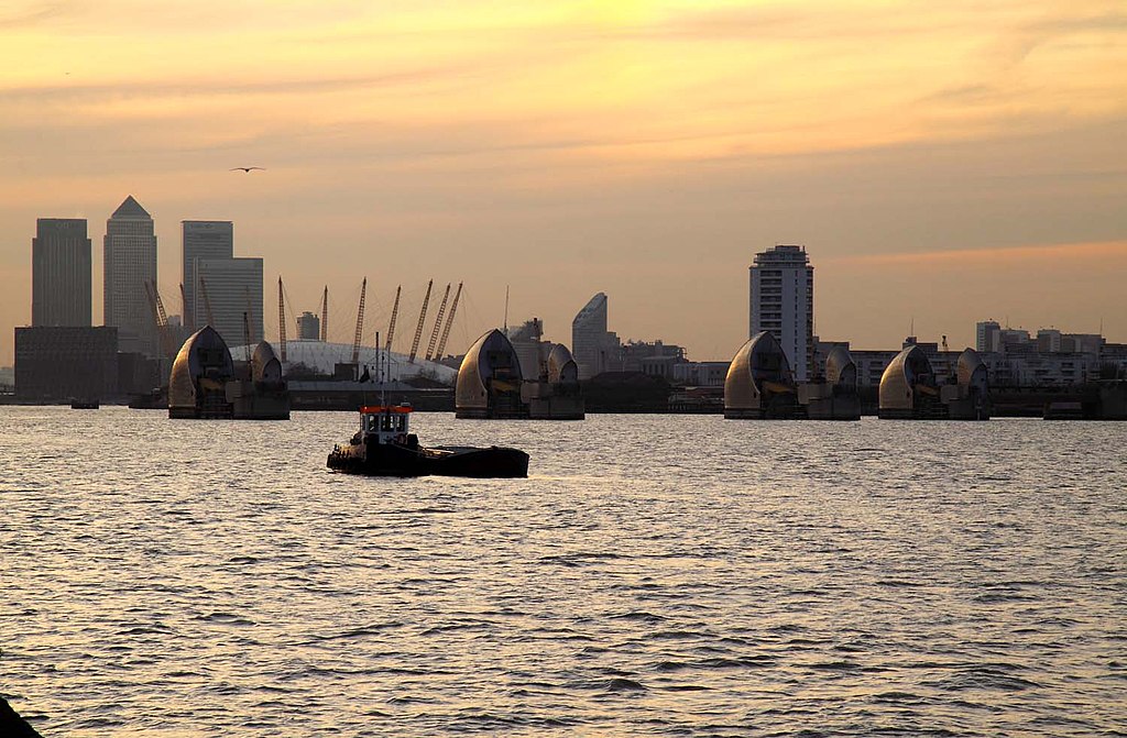
Not to be missed: Marvel at the mighty Thames Barrier and stroll around Eltham Palace and Gardens.
The Capital Ring shows that city routes can be just as inspiring as rural ones. This is a walk with a difference – it’s based around inner London. But it’s a version of the city you’ve probably never seen before. Going in a loop, you’ll travel from Woolwich to Becton District Park, through many of London’s green spaces. You’ll pass through nature reserves, parks and woods. The walk features plenty of blue spaces too, with lakes, rivers and canals to admire. “Walking its length brings home both the sheer scale of the capital and the abundance of greenery nestled among its roads and buildings,” Alex Dudok de Wit wrote for Time Out. You can walk the Capital Ring in one go or choose from its 15 sections. Finished the full walk? Transport for London has a certificate you can download to mark the occasion.
Pick up a map to plan your adventure
Long distance walks across the world
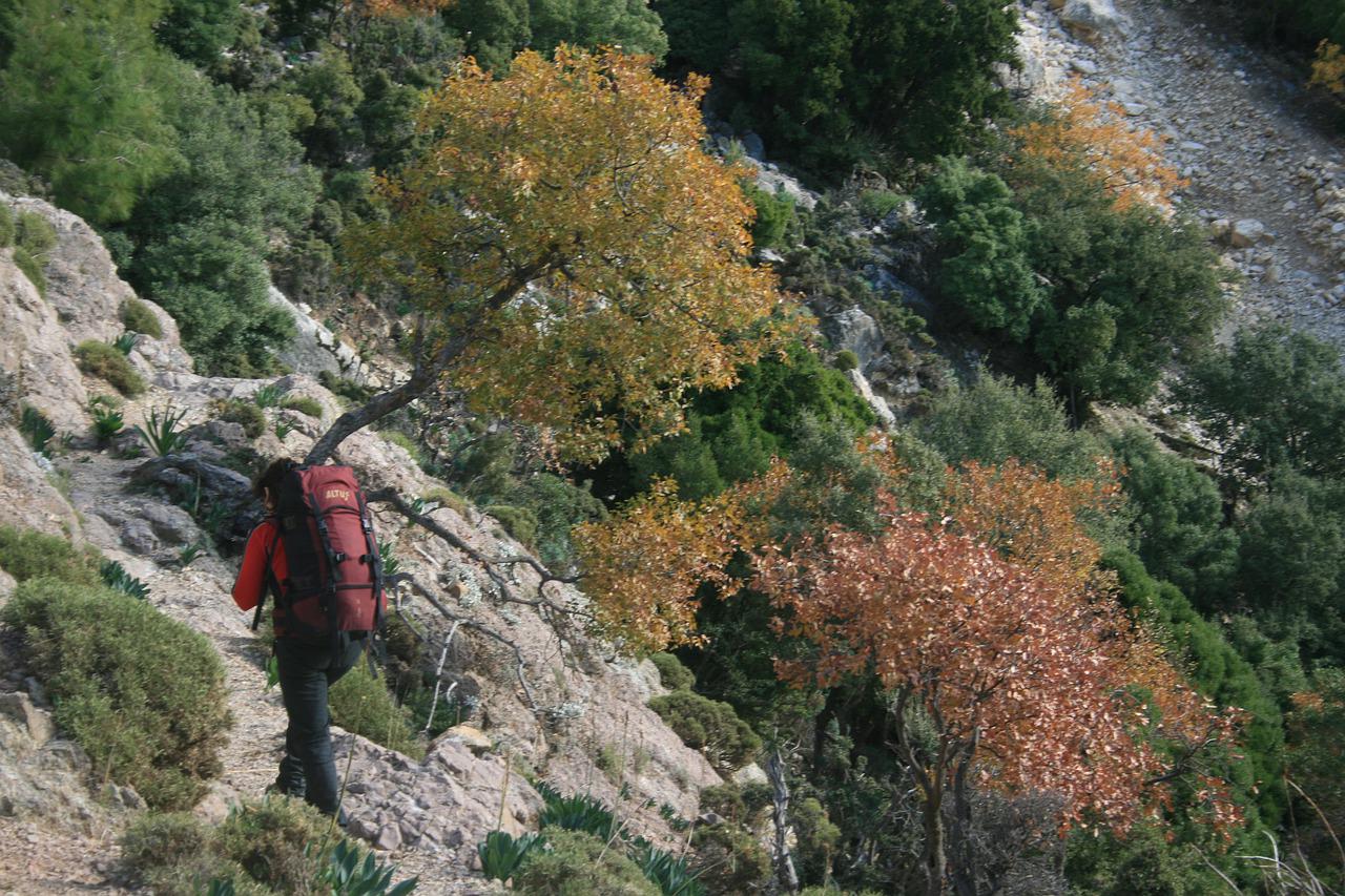
Why not go global with your long-distance walk? Here are some routes you could try:
- Abel Tasman Coast Track, New Zealand
- Appalachian Trail, US
- Camino de Santiago, France, Portugal and Spain
- Greater Patagonian Trail, Chile and Argentina
- Heysen Trail, Australia
- Hong Kong Trail, Hong Kong
- Inca Trail, Peru
- Lycian Way, Turkey
- Pacific Crest Trail, US
- Tsitsikamma Trail, South Africa
Dennis Maps is one of the leading map printers in the world, producing more than two million maps and charts every year. We offer comprehensive pre-press services, large format print solutions using both large format litho printing and large format digital print technologies, plus specialised map folding and map finishing techniques
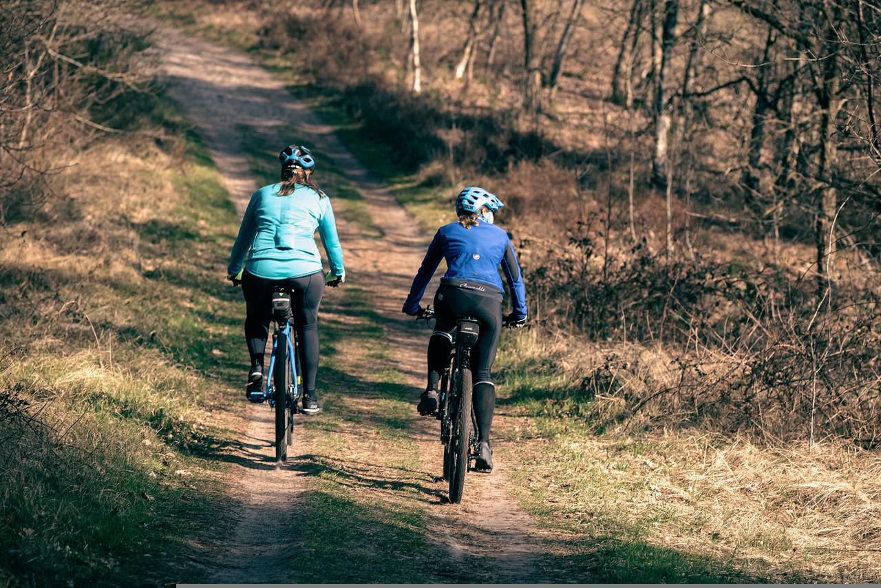
Top tips for beginner cyclists
Cycle to Work Day takes place on 4th August, a great opportunity to test out your pedal power by riding to work. In honour of the occasion, we caught up with Zoe Banks Gross, Head of Partnerships and Public Affairs at walking and cycling charity Sustrans, to get her top tips for beginner cyclists. “Cycling is for everyone!” says Zoe. “It’s a great way to get from A to B and to feel healthier and happier, plus it’s good for the planet”. Here are her cycling tips to get you started.
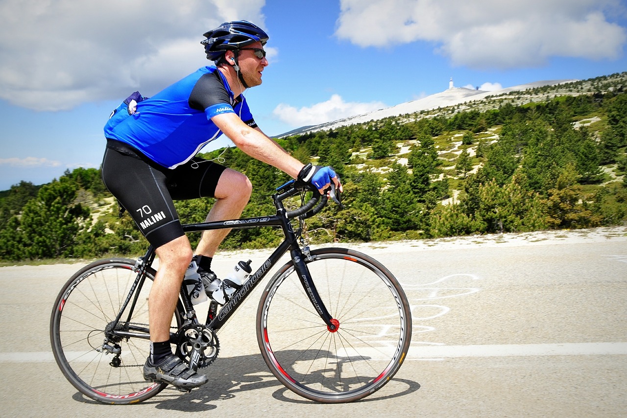 Pick comfortable clothing
I cycle to work in my usual clothes, but I make sure they’re comfortable and breathable. I do carry a pack a mac throughout the year, and waterproofs and warm clothes for winter. Make sure you’ll be warm and dry, so you can enjoy your journey. It’s important to wear clothing that’s bright and reflective to make you more visible too.
Choose the right cycle
When you’re choosing a bicycle, make sure your legs can be almost fully extended when in the saddle, with your tiptoes on the floor. Your knees will be bent and uncomfortable all the time if the bike is too small and it’ll be difficult to stop and get off if the bike is too large. If you can afford to buy a bicycle new, it’s worth going to a bike shop and getting expert advice. If you have a disability, there’s a huge range of adaptive bikes to choose from. Wheels for Wellbeing is an amazing organisation that promotes inclusive cycling. Check them out for more information on trying and buying adapted bikes.
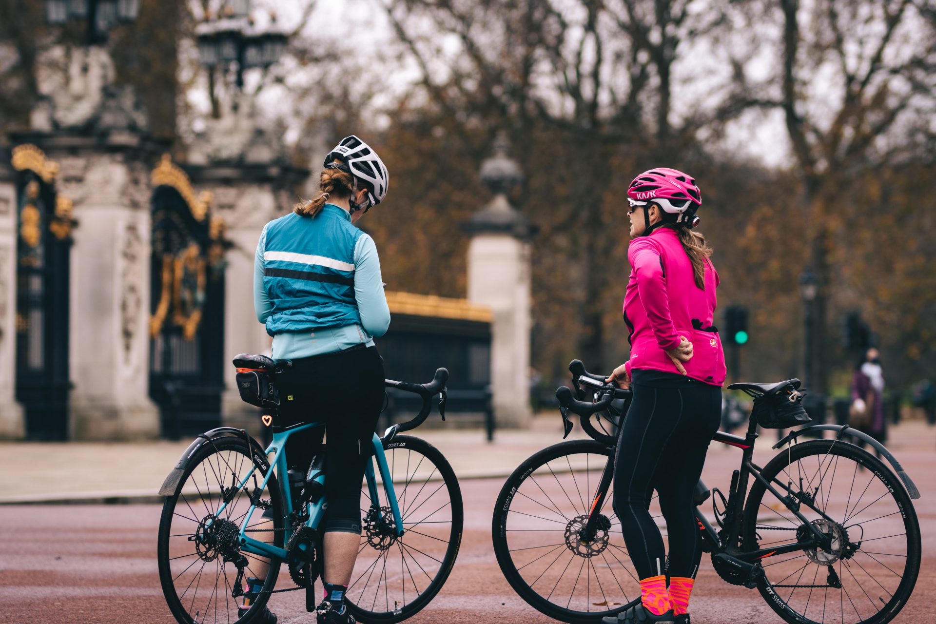 Cycle safely
Before you start cycling, make sure your bike is safe to go on the road. Have a bike mechanic look at it if you’re unsure. Invest in lights for the front and back of your bicycle prior to taking it out. Choose carefully if you need to pick up a helmet as well. I wouldn’t recommend a second-hand helmet because you won’t know if it’s been in an accident. Helmets have expiry dates too. Look out for this so you’ll know when it will need replacing. When you’re out and about, make sure you can lock up your bike, preferably with a D lock. Park your bike somewhere safe, ideally with CCTV, locking both the frame and wheel together.
Build on your knowledge and skills
Some local councils offer cycling lessons, which are great if you’re not yet confident on busy roads. It’s a superb way to build up your skills as well. Learn the Highway Code too so you have the knowledge to cycle safely. For example, it’s important to know that as a cyclist you’re allowed to cycle in the middle of the lane, because you’re going to be more visible and safer there.
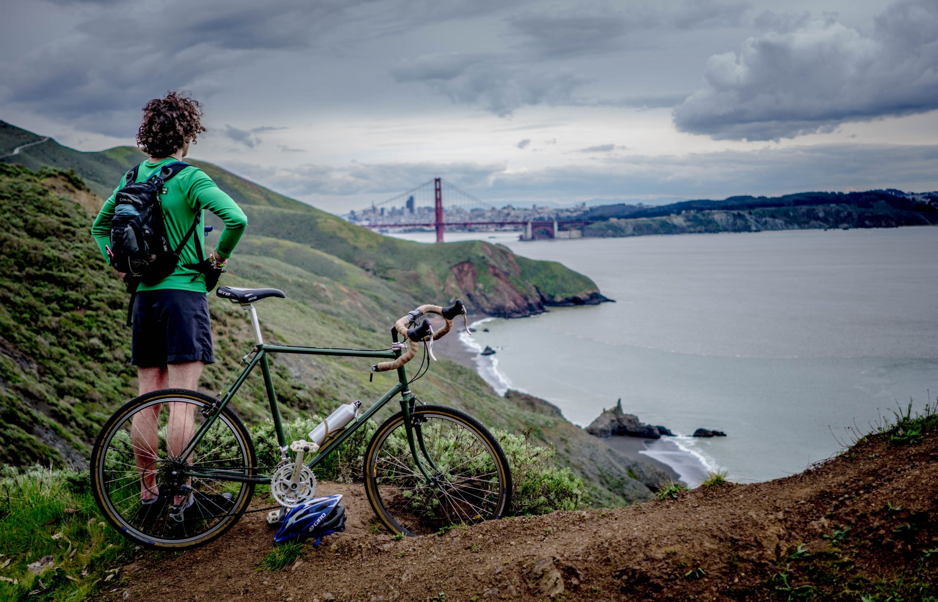 Find the right route for beginners
If you’re just getting started, an empty car park or multi-use sports area can be good places to improve your balance and confidence. The National Cycle Network is an excellent place to ride if you’re honing your cycling skills. It’s a network of signed routes and paths across the UK, for cycling and walking, of which Sustrans is the custodian. Quite a few stretches are traffic free and are relatively quiet. Sustrans produces cycle maps as well, in addition to route information on the Sustrans website. I’d also look at a website called CycleStreets, which helps you plan cycling routes on quieter streets and paths. There are so many out there!
Pedal with a pal
Find a buddy to cycle to work with. It can be a terrific way to find safe and comfortable routes to your work and to get into the habit of cycling. Having a quick chat on the way to work is also a fun way to start the day. Once you’re a more confident cyclist, you might want to join a club. There are clubs out there for all types of cycling.
 Get kids cycling
Cycling with older family members gives kids confidence for eventually cycling alone. For little children, visit a bike library to try out different seats and trailers and see what’s right for your family. Cargo bikes can be a great way to get kids on a bike and can be used for grocery shopping too. When they’re ready for their own bike, don’t go for one with stabilisers. Start with a balance bike instead, to give them a chance to practice balancing. Once they’re ready for a pedal bike, check they can reach the brakes easily. Go for an adjustable saddle so it grows with them too. And consider a well-fitted helmet. Other than that, pack extra snacks to keep motivation levels high!
 Cycle to Work Day
Cycle to Work Day is the biggest cycling commuting event in the UK. This year it’s set to be bigger than ever, as it celebrates its tenth anniversary. Register with the Love to Ride community, where you can log your journeys, set goals and win prizes. “Cycling to and from work is an amazing way to decompress from the day and to have a work-life balance,” says Zoe. So, what are you waiting for? It’s time to get on your bike!

Zoe Banks Gross
Zoe Banks Gross is Head of Partnerships and Public Affairs at Sustrans South. She’s passionate about getting more people cycling and walking, and making the outdoors a more inclusive environment. In 2014 she founded East Bristol Kidical Mass to get families out cycling together. Zoe has also taught dozens of women in Bristol to cycle. She likes running, hill-walking and cycling in her free time.
Dennis Maps is one of the leading map printers in the world, producing more than two million maps and charts every year. We offer comprehensive pre-press services, large format print solutions using both large format litho printing and large format digital print technologies, plus specialised map folding and map finishing techniques.
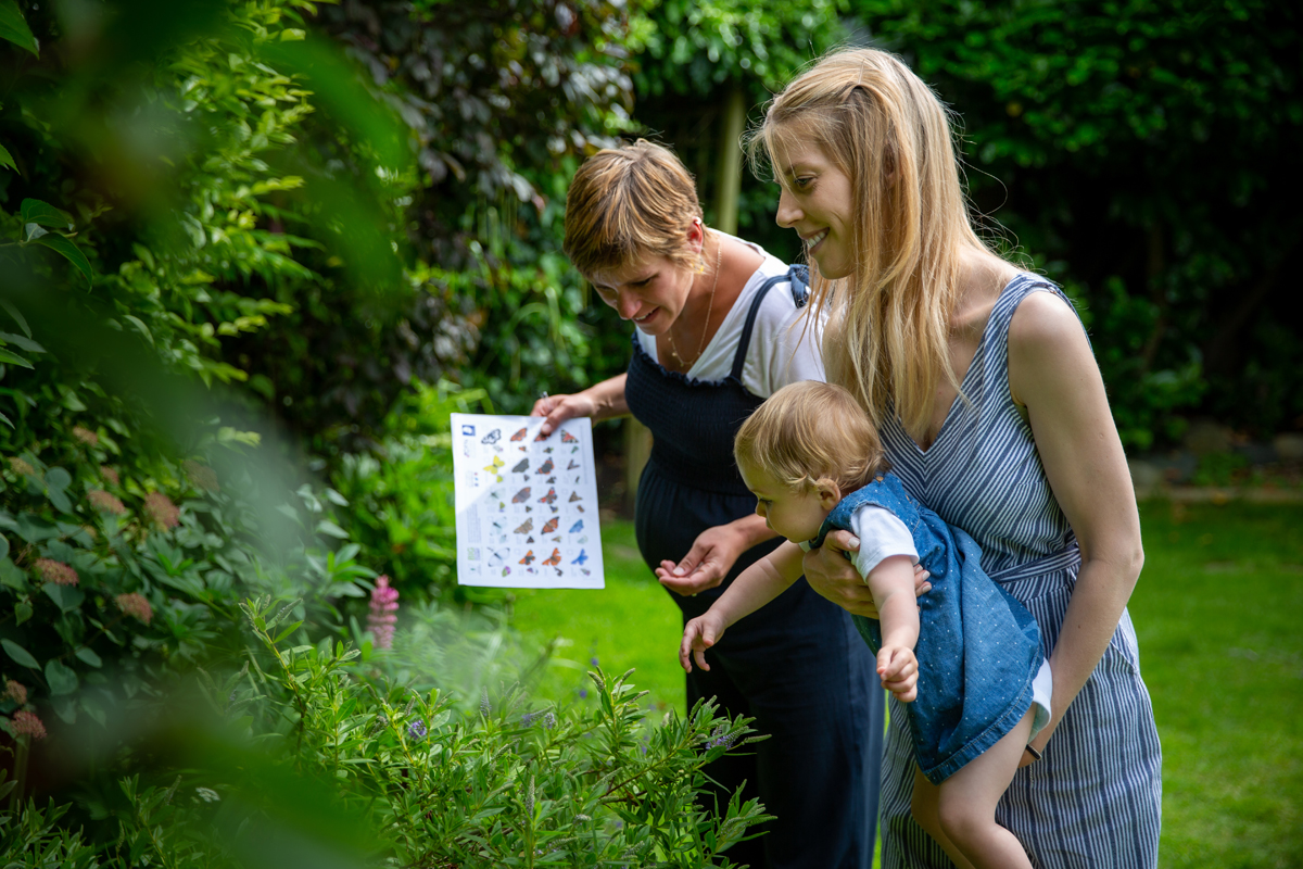
The Big Butterfly Count is back
 The Big Butterfly Count is back this summer and you’re invited to take part! The event is an annual check of nature’s pulse that’s been held since 2010. It’s the world’s largest survey of butterflies, with hundreds of thousands of people taking part since it began. Will you join them this year?
From the marbled white to the speckled wood, there are plenty of beautiful butterflies to spot during the event. The Big Butterfly Count will be held between Friday 15th July and Sunday 7th August, across the UK. All you have to do is find a sunny spot and record the type and number of butterflies (and certain day-flying moths) you encounter over a 15-minute period. It doesn’t matter where you do your count – it could be a garden, park, forest or field.
Before you start, get the free iOS or Android app, where you’ll find a butterfly ID chart to identify the butterflies and moths you see.
You can also use the apps to instantly record what you spot. Don’t worry if you don’t have an app, you can still take part. The butterfly ID chart is available to download from the event’s website. Submit your results online by the end of August – simple!
Why count butterflies and moths?
Butterfly Conservation, the charity behind the cause, focuses on butterflies as they’re an important part of the ecosystem but are under threat, declining notably since the 1970s. Their decline is also an early alert for other wildlife losses, as they respond quickly to environmental changes. Butterfly numbers reflect the health of nature, so keeping track of them, in the Big Butterfly Count, helps our fight to protect nature.

“Taking part in the Bug Butterfly Count is a small but crucial thing everyone can do. This information will not only help us to protect butterflies and moths but also help to inform what effect the changing climate is having on our biodiversity,”
says Dr Zoe Randle, Senior Surveys Officer and Butterfly Conservation at the charity.
Keep up with the count
The Big Butterfly Count has a useful map where you can check out butterfly counts across the UK. You can also follow the event on Facebook, Twitter and Instagram, using #ButterflyCount and #countthemtosavethem.
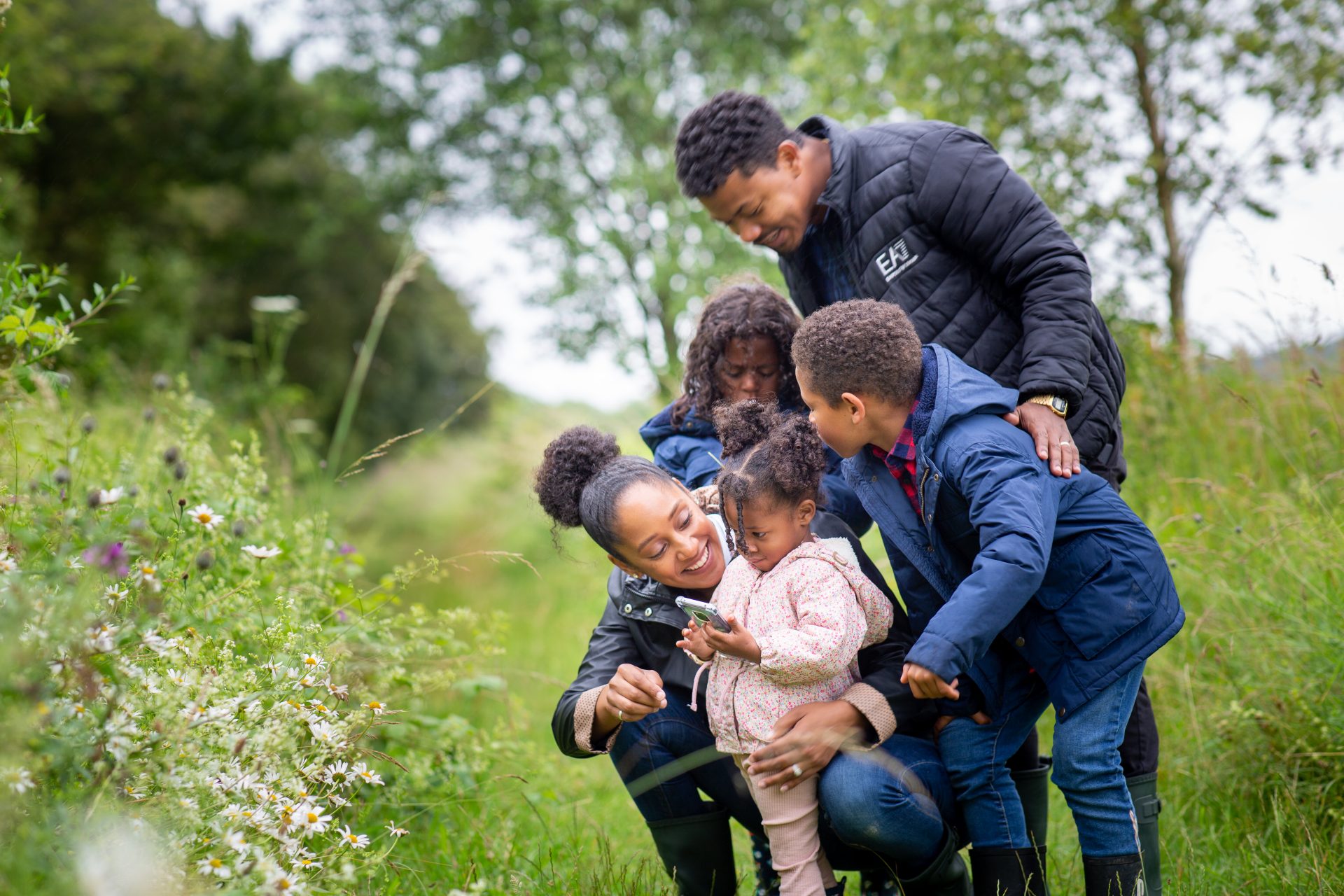
Dennis Maps is one of the leading map printers in the world, producing more than two million maps and charts every year. We offer comprehensive pre-press services, large format print solutions using both large format litho printing and large format digital print technologies, plus specialised map folding and map finishing techniques.

Ten outdoor activities for kids this summer
Looking for ways to keep your kids entertained this summer? We’ve rounded up ten activities from forest schools across the UK, to keep kids busy all summer and beyond! Find inspiration with a range of games and crafts from outdoor experts.
Woodland treasure hunt
Let’s go fishing
Nature pictures
Hapa Zome
Mud painting
Nature crowns
Eagle eyes
Nature weaving
Spider webs
Rush rafts
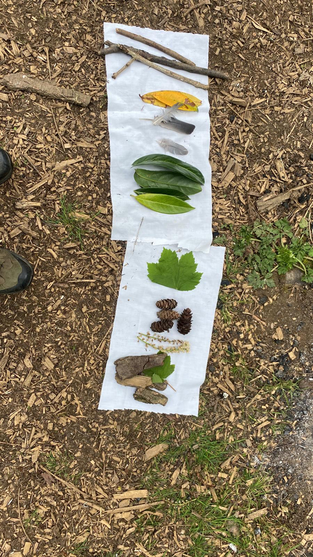 Woodland treasure hunt
What you’ll need
A handkerchief, cloth, tea towel or piece of paper
Instructions
Children often wish to find treasures in the woods, so why not create your own treasure hunt? You can use a bit of cloth, a handkerchief, tea towel or piece of paper for this. Lay it on the ground, then add different objects you spot on the forest floor.
Ask children to look for matching objects and to place them on top of the corresponding ones on the fabric. You can use items of different sizes, textures, colours and shapes for your woodland treasure hunt.
Claire Crowley, Root and Branch Out CIC, Rutland
Let’s go fishing
What you’ll need
Sticky weed, a stick, wool, a hole punch or Sellotape, card, glue, felt tips or crayons.
Instructions
This activity is perfect for late spring and early summer when sticky weed grows in abundance. Find a stick and tie a length of wool to one end, then tie some sticky weed to the other end of your wool. This will be your fishing rod. Cut out a fish shape from your card, decorate it and make two holes in the tail of your fish with a hole punch (if you have one). Attach some wool to the tail, either by threading it through the holes or with Sellotape. Now it’s time to go fishing! Once you’ve perfected your technique you can make more fish. How many can you catch in a minute? How far from your ‘pond’ can you stand and manage to catch your fish?
Alice Tucker, Goblin Combe Adventures, North Somerset
Nature Pictures
What you’ll need
A piece of cardboard, air dry clay (or sticky mud), nature items – e.g., leaves, sticks, feathers or pinecones.
Instructions
Explore the area and see what exciting natural items you can find! Push the clay or mud onto the cardboard (air dry clay and sticky mud act like a glue) and stick your items into it to make your creation. Recently, we made stick men at our forest school, as that was our story for the session. You can adapt it to make anything though.
Emma Webster, Sidcot Forest School, Somerset
Hapa Zome
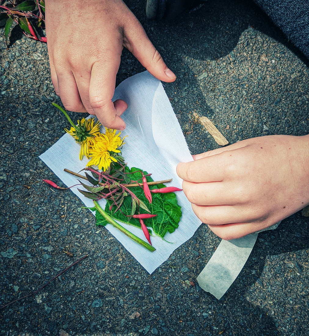

What you’ll need
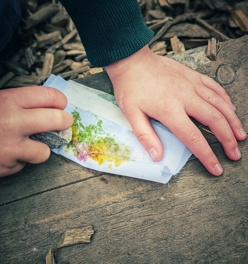
Plain fabric cut into smaller pieces (old pillowcases or bedsheets are ideal), plus flowers, leaves, grass and other colourful nature items – the brighter the better! Dock leaves and dandelions work particularly well, and ferns can make lovely tree shapes. You’ll also need masking tape, plus a hammer, mallet or stone.
Instructions
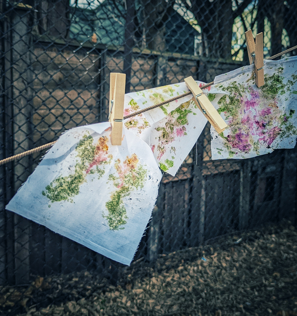
Hapa Zome is the Japanese art of smashing leaves and flowers to release the pigment onto fabric or thick paper. Find a flat, hard surface, then select your flowers, leaves, etc and lay them on your piece of fabric or paper. Lay another piece of material on top, fold your material in half to create a mirror image or simply put tape over the top of your nature items to keep them in place. Using your hammer, mallet or stone, carefully hit the fabric repeatedly to release the colours. This may take some time to do, but it's fun. Peel away the flowers or leaves to reveal your picture. It can be a great technique for making flags or bunting too.
Top tip: dock leaves are easily cut into shapes with scissors – e.g., heart shapes – and the colour comes out well.
Kim Jarvis, Wirral Wildlings CIC, Wirral
Mud Painting
What you’ll need
Mud, water, pots to mix, paper, sticks, leaves, feathers and string
How to
Have a look around you for some sticks, leaves and feathers. Tie the leaves or feathers to the end of a stick with some string. Next find a good patch of mud and use another stick to scrape up some of the mud. Put it in a pot and add some water, then mix it. Use your original stick as a make-shift paintbrush, to make a beautiful nature picture.
Emma Webster, Sidcot Forest School, Somerset
 Nature crowns
What you’ll need
Cardboard or sticky weed, double-sided tape or glue, scissors, scavenged nature items (e.g., grass, flowers, leaves or feathers).
Instructions
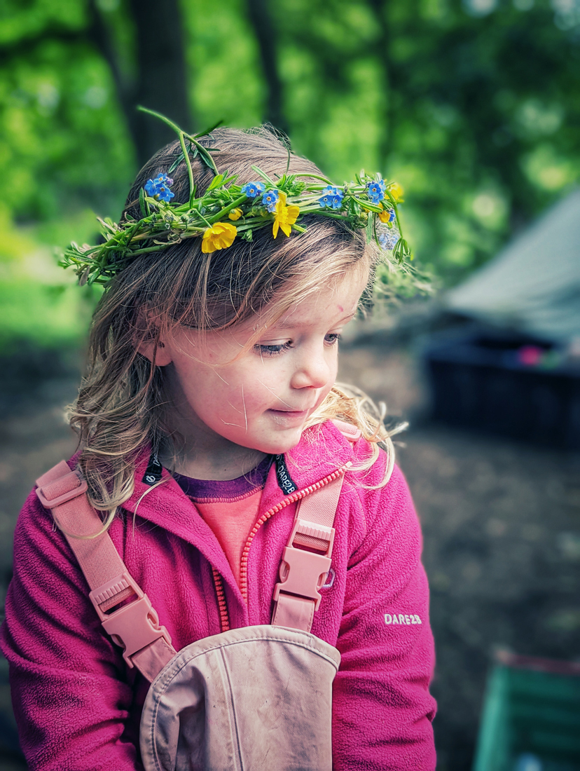
An A4 piece of cardboard will create two crowns, when cut into four long strips. Using a small piece of double-sided tape, attach two strips together end-to-end to make them long enough for a crown. Measure the strips round your head first to make sure they’ll fit. Using a piece of double-sided tape, fix the ends together to make a circular crown shape. Stick a long piece of double-sided tape around the crown. Collect nature items and stick them onto the tape. Make sure the items are dry, so they stick easily. You can also use glue instead of sticky tape.
If using sticky weed, you’ll need to twist a few strands together and shape them into a crown. Wrap the ends round and they should easily stick in place. Then poke your nature items in between the sticky weed strands. They should stick quite easily.
Kim Jarvis, Wirral Wildlings CIC, Wirral
Eagle Eyes
What you’ll need
A space to play in. A wooded area is ideal but anywhere with plenty of hiding spots will work.
Instructions
This game is a classic that our group asks for again and again! Choose someone to be the eagle. Eagles have amazing eyesight that helps them hunt their prey. Everyone else is a rabbit: the eagle’s prey. First, the eagle chooses a nesting spot with a good view of the surrounding area. The eagle then announces that they are closing their eyes for 15 seconds and counts down. When the eagle’s eyes are closed the rabbits must find hiding spots. After 15 seconds the eagle opens their eyes and tries to spot the rabbits. The eagle must stay in their nest and only move their head. If spotted, a rabbit then becomes an eaglet in the nest for one round before returning to the game.
Once the eagle is satisfied it can’t spot any more rabbits it closes its eyes and counts down another 15 seconds, during which the rabbits need to find another hiding space. The aim of the game is for the rabbits to evade detection by the hungry eagle. Want to make the game more challenging? Decrease the time the eagle closes their eyes for. You can change the eagle-rabbit roles to any predator-prey relationship too. The kids always bring their own brilliant ideas.
Lucy Cursham, Braid Hills Forest School, Midlothian
 Nature weaving
What you’ll need
Cardboard or a y-shaped stick, string or wool, scavenged nature items (e.g., leaves, flowers, grass, feathers)
Instructions
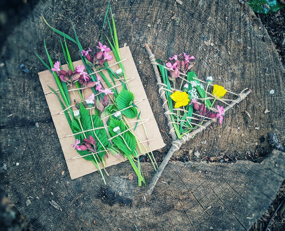
If you’re using cardboard, make little snips round the edges of the cardboard with scissors, then wrap string round and round to stay firm in the little indentations. If using a y-shaped stick, wrap the string back and forth across the 'v' shape and tie each end so it doesn’t unravel. Weave your nature items in, out and underneath the string to make a beautiful piece of art. This can also be done on a large scale by wrapping string between large sticks, branches or tree trunks.
Kim Jarvis, Wirral Wildlings CIC, Wirral
Spider webs
What you’ll need
Some brightly coloured wool (that snaps easily)
How to
Wrap your wool around trees and bushes (this should be done by an adult) to make a web. Then the children have to carefully climb through.
Emma Webster, Sidcot Forest School, Somerset
Rush Rafts
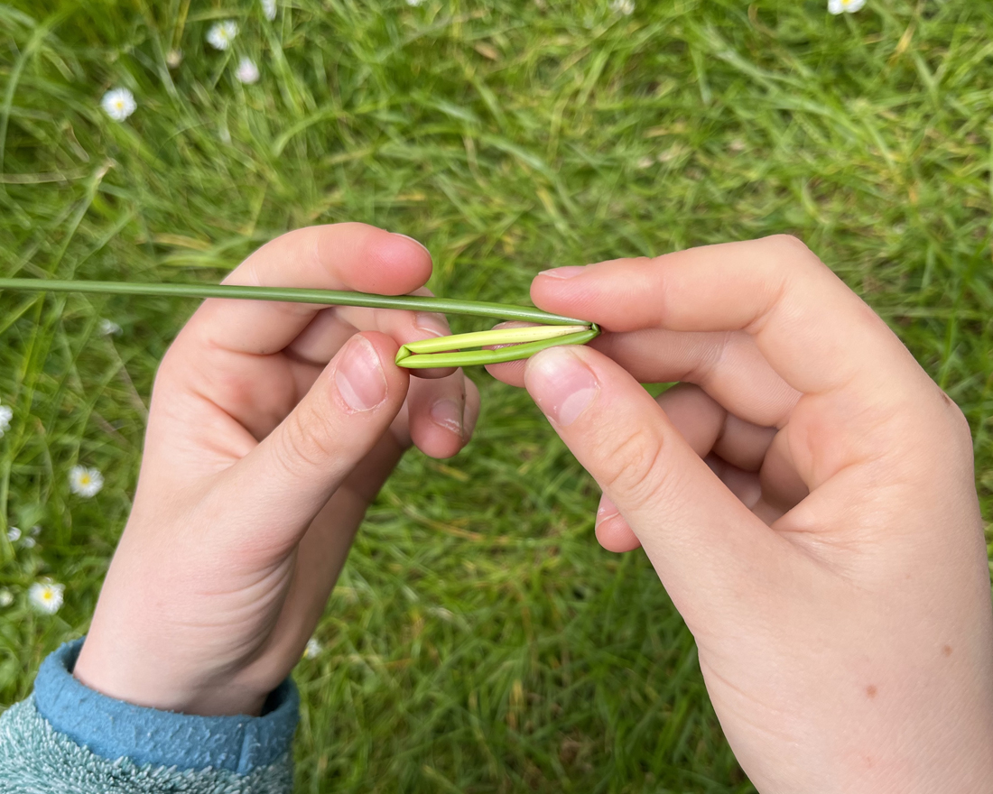
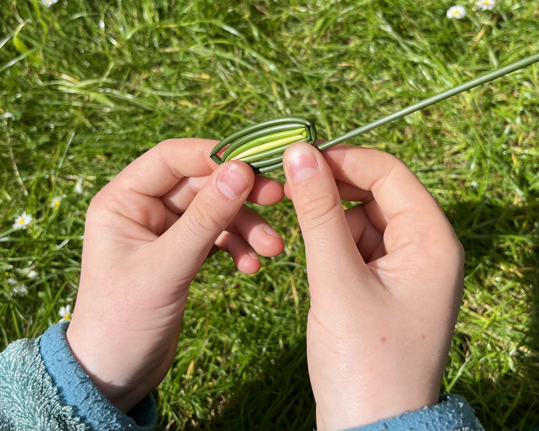
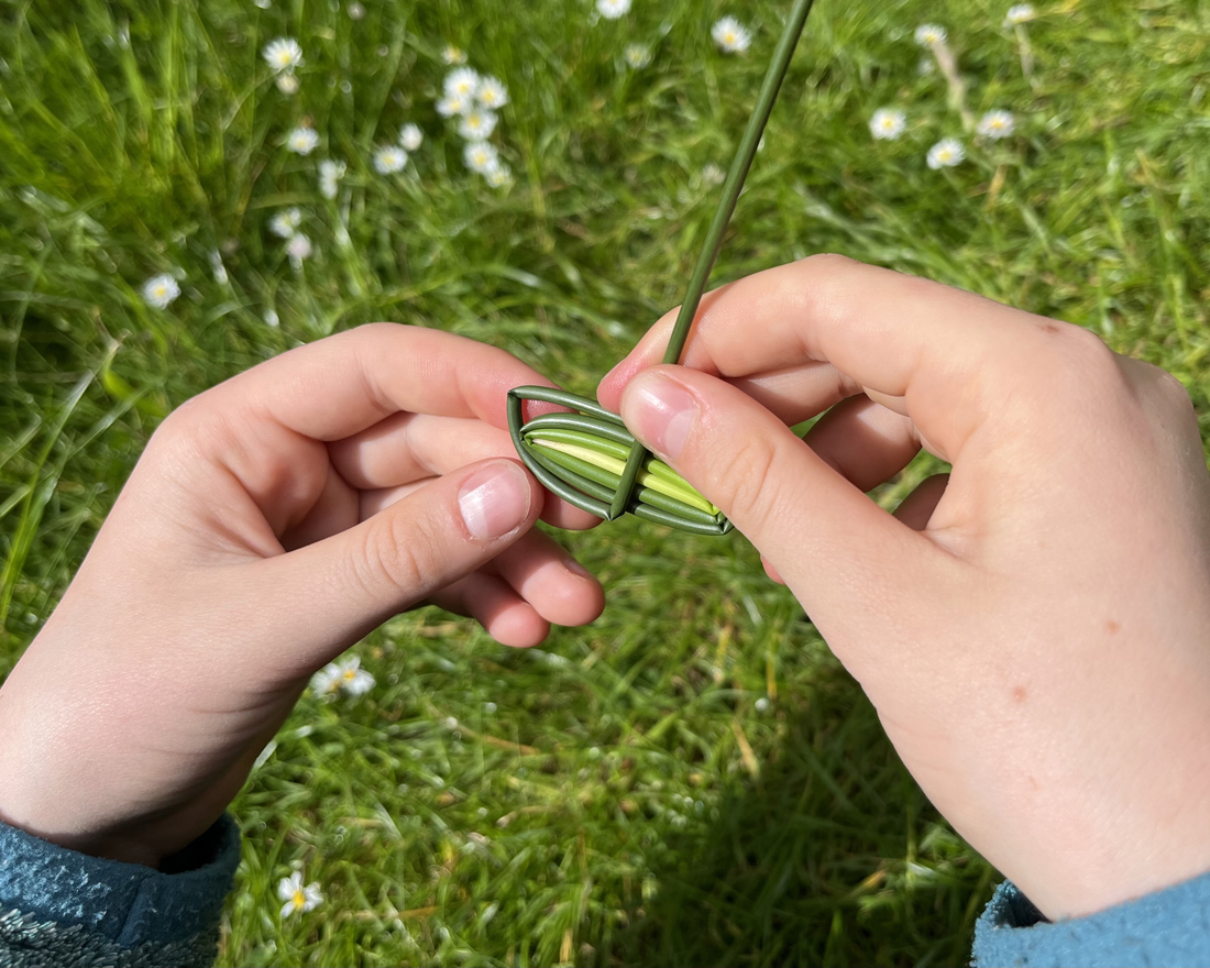
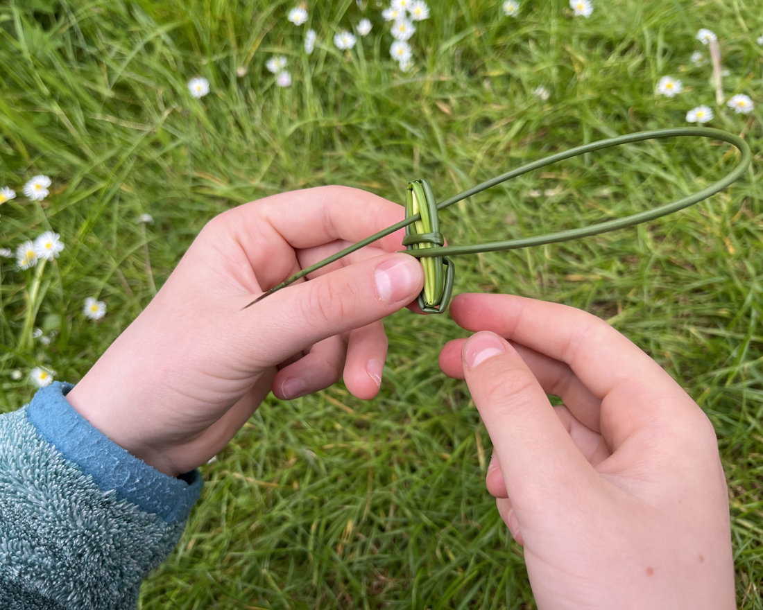
What you’ll need
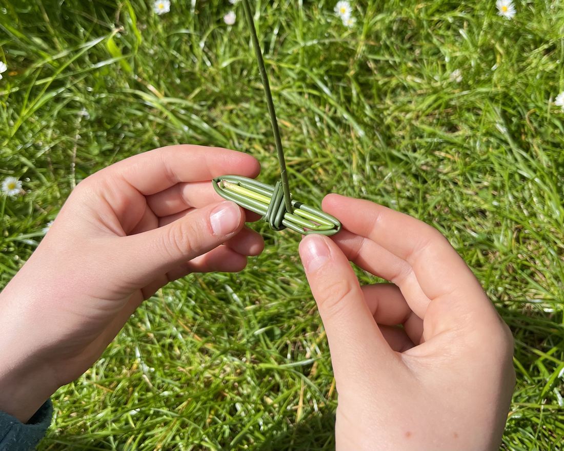
Common, or soft, rush, an easy to identify plant that grows in clumps in grasslands and wet woodlands. It has smooth, green stems that are spiked at the end and can be easily peeled to reveal a spongy centre. This spongy centre makes it buoyant and the ideal material for river faring craft.
Instructions
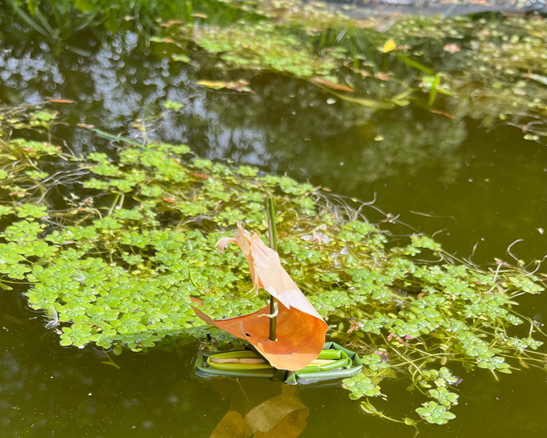
This is a simple but immensely satisfying craft activity that provides a great excuse to safely muck about in the shallows. And who doesn’t enjoy that? Pick a rush. The longer the rush the bigger the boat you can create. Start with the thicker end and wind it around itself in a spiral motion, making an elongated oval shape. Once halfway through the rush, wrap it a few times around the middle of your raft, like a belt, catching the initial wrap so it doesn’t come undone. Then stick the end up through the middle wrappings. You can add a leaf or bark for a sail or whatever else you think your sea faring vessel needs. The final step is the most important: take it to the water for its maiden voyage!
Lucy Cursham, Braid Hills Forest School, Midlothian
Dennis Maps is one of the leading map printers in the world, producing more than two million maps and charts every year. We offer comprehensive pre-press services, large format print solutions using both large format litho printing and large format digital print technologies, plus specialised map folding and map finishing techniques.
Heron Maps – bringing British waterways to life
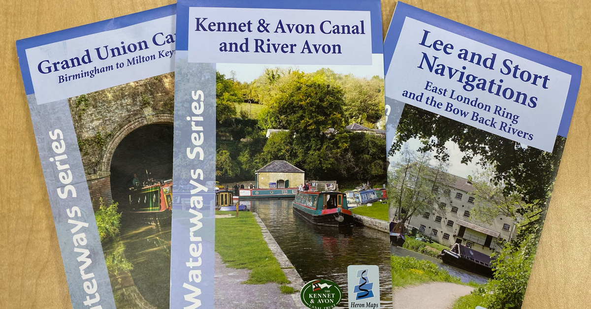
Open a Heron Maps’ product and you’ll notice something a little different – waterways take centre stage on many of its maps, instead of the roads and paths you’d usually see. The company’s Waterways and Greenways products all feature enlarged waterways with corridors of surrounding detail, such as paths, cycle routes and places of interest. They bring British inland waterways to life like never before. We catch up with Nick Holroyd, Director of Heron Maps, to find out more about the company’s unique creations.
What makes your maps so unique, Nick?
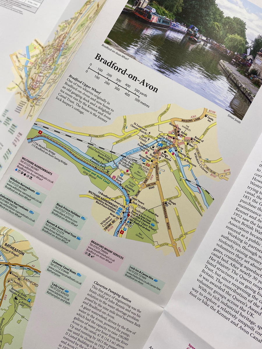
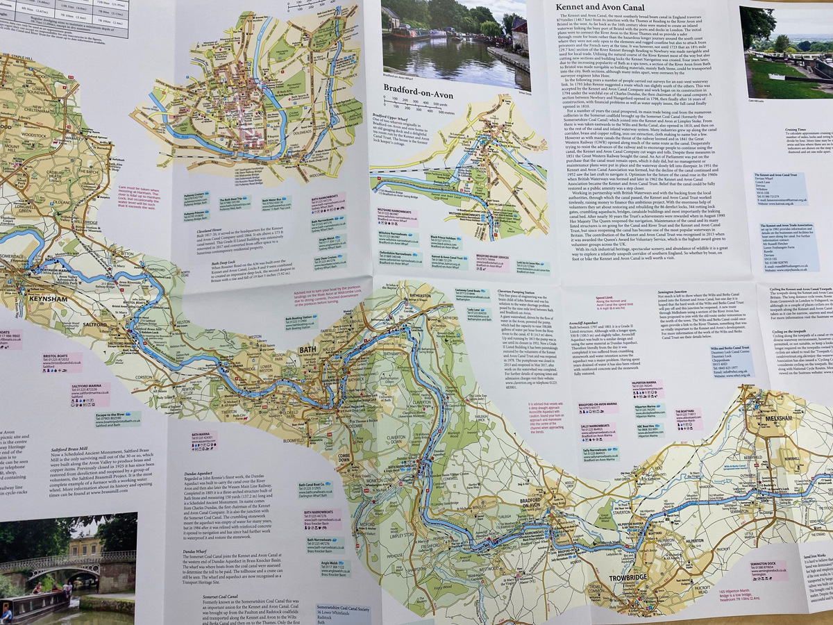
We offer a variety of maps but specialise in plotting Britain’s inland waterways. We’re the only company that offers fold out sheet maps of British inland waterways, usually at 1:50000 scale. You can see the whole map in one view, unlike in a traditional book where you turn pages. We enlarge the canals and waterways too, making them the prominent features of the map. This means you can’t use GPS with our maps, but you can see the canals and waterways in incredible detail.
What are your most popular products?
The Broads map is our most popular product, as well as the Kennet & Avon Canal, and Llangollen & Montgomery Canals, which are all part of our Waterways Series.
Do you personally use Heron Maps’ products?
I’m probably a bit of a map geek and take a paper map wherever I go! My family and I use our maps for cycling and walking along waterways. They’ve all got Sustrans cycle paths plotted on them and footpaths too. Recently we used one to walk a section of the River Thames.
How do you come up with ideas for new maps?
I founded the company in 2010 with my business partners Chris Johnson and Dave Edwards. We’d previously worked together at another waterways mapping company that closed, so we started off making maps that had been popular with its customers. Now we’re filling in the gaps where maps of the British inland waterways system are missing. We’re only five or six maps away from having the whole system covered.
Talk us through the process of creating one of your maps
It takes about six to eight months to create a map from start to finish. A member of staff will visit the waterway, and sometimes work with a local canal society to map it. We look at existing Ordnance Survey maps for reference, but everything gets changed massively. We add in lots of features that are specific to canals, like lock numbers, bridge numbers and lock lengths. The canal line or waterway is enlarged too, as the main point of interest. We use a mapping programme to draw the maps, add all the information in, and layer the map (each feature has a layer, e.g., a layer for roads, another layer for utilities). It’s edited along the way and corrections added in. Once everyone’s happy, the relevant local canal society will have their input, if they’ve been involved. Then we send it to Dennis Maps as a PDF. It takes three to four weeks from sending the files to receiving the printed maps. After that, the printed copies go to mainstream and specialist distributors, then out to customers.
How do you meet the challenge of making your maps environmentally friendly?
There’s very little in our production line that isn’t sustainable. We even cycle along the canal paths to plot them! Further down the production line, Dennis Maps prints all our maps, using sustainable paper and vegetable-based inks.
Does the business face any other challenges?
Utilities along canals can change quickly and we have to keep on top of changes. For example, pubs may close after a map is published. We aim to update maps every two years but it’s still a challenge to keep utilities up to date.
What’s the best part of running Heron Maps?
It’s exciting when we order large quantities of maps as it means lots of people are using them. Other than that, it’s going to the Crick Boat Show. It’s an annual show in Northamptonshire, that anybody and everybody to do with canals goes to. It’s like a festival with camping, stands and live music. You get to meet everyone and keep up to date with everything to do with canals.
Are there any exciting plans for Heron Maps that you’re able to reveal?
We usually produce one or two new maps every year but this year it’ll be three. We’ve just had one delivered – a map of the Forth and Clyde Canal. It’s a route from Edinburgh to Glasgow via the Falkirk Wheel. It’s exciting for us as it’s covering a new area. We’re currently plotting the Basingstoke Canal too – another new area for us. The map should be out next year.
Dennis Maps is one of the leading map printers in the world, producing more than two million maps and charts every year. We offer comprehensive pre-press services, large format print solutions using both large format litho printing and large format digital print technologies, plus specialised map folding and map finishing techniques.